
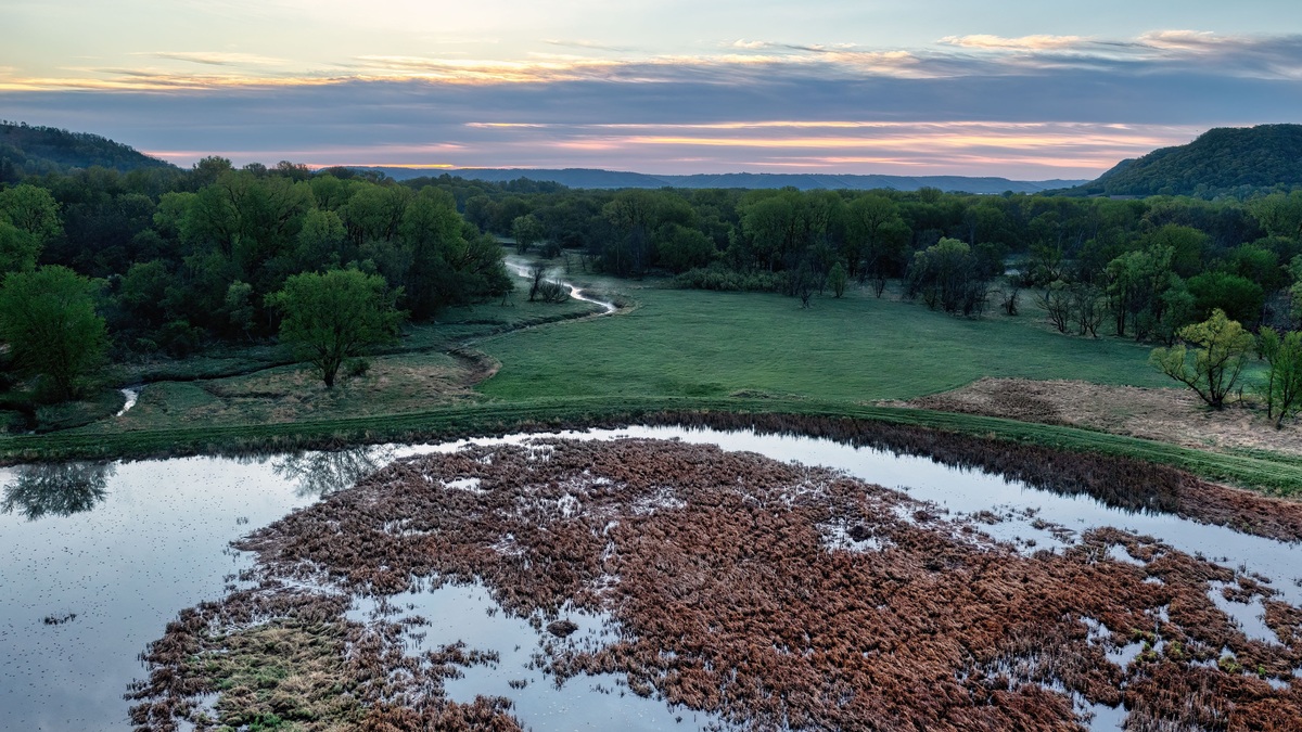
Oklahoma’s natural lakes fall mainly into two categories: oxbow lakes and playa lakes. The state’s famous recreation lakes, including Eufaula, Texoma, Broken Bow and Tenkiller, are reservoirs created by dams.
The Oklahoma Geological Survey states that natural lakes are limited to oxbows along major streams and playas in the western High Plains. An Oklahoma Water Atlas count, repeated in state reports, identifies 62 oxbow lakes of at least 10 acres and 585 seasonal playas. Smaller features and changing wet-season boundaries make any all-size total dependent on definition and mapping method.
The distinction concerns origin rather than appearance. A reservoir may have wooded shores with clear water. An oxbow can be altered by levees or drainage and still retain a natural origin. Geologists ask how the basin formed and whether a dam created the present water body.
Oxbow lakes occupy abandoned river bends
A meandering river erodes its outer banks and deposits sediment on inner bends. The neck between two bends can narrow until floodwater cuts a shorter path. Sediment then blocks the old loop, leaving a curved oxbow lake on the floodplain.
Oklahoma oxbows occur mainly along the Red, Arkansas, Washita, North Canadian and Verdigris rivers. Many lie in central or eastern Oklahoma, where broad floodplains preserve abandoned channels.
An oxbow may reconnect with its river during floods. Groundwater and local runoff can also supply it. Sediment gradually makes the basin shallower. Plant growth follows, eventually replacing open water with wetland unless new floods scour it. Argo’s guide to river-created landforms places oxbows within the larger sequence of channel erosion and deposition.
Oklahoma counts 62 large oxbows
The 2024 Oklahoma water-quality report reproduces Water Atlas figures for 62 oxbow lakes measuring at least 10 acres. Together they cover 2,765 acres.
The size threshold is important. It excludes smaller abandoned channels, so “62” is not the total number of every natural oxbow pool in the state. Later floods may reopen one feature. Another can divide or fill after a map was made.
The largest listed oxbow is the 272-acre 1941 Cut-Off near the Red River in McCurtain County. Oklahoma’s 1995 comprehensive water plan identifies it by name and notes that 26 oxbows occur in that county.
Playas fill shallow High Plains depressions
A playa is a shallow, internally drained basin with no stream outlet. Rain and runoff collect after storms, forming a temporary lake. Water then evaporates or infiltrates into the underlying sediment.
Oklahoma playas cluster in the Panhandle and northwestern High Plains. Their broad, saucer-shaped floors can look like dry flats for much of the year. A wet spring may produce extensive water where an aerial image from a dry season shows little.
The EPA’s overview of High Plains playa lakes explains that most fill after rainstorms. These basins provide seasonal wetland habitat and can contribute water to the underlying aquifer where soils allow infiltration.
The state atlas lists 585 seasonal playas
Oklahoma’s official summary gives 585 playa lakes during wet seasons. The 1995 water plan rounded the number to nearly 600 and estimated that wet-season playas cover almost 10,000 acres.
The figures are compatible because one is a dataset count and the other is an explanatory approximation. Neither means all 585 hold open water simultaneously. Storm tracks and antecedent soil moisture determine which basins fill.
Mapping rules also change totals. A geologist may include every closed depression with playa soil, while a surface-water inventory may require visible water at the image date. Readers should preserve the source year and inclusion threshold.
Most named Oklahoma lakes are reservoirs
The state’s major lakes were built for flood control, municipal supply, hydropower, recreation or combinations of these purposes. Dams transformed river valleys into permanent water bodies far larger than most natural Oklahoma lakes.
The Oklahoma Geological Survey overview explicitly says all major lakes and reservoirs in the state are human-made. The Oklahoma Water Resources Board atlas maps 133 featured lakes, but inclusion in that recreational dataset does not establish natural origin.
Great Salt Plains Lake illustrates why names can confuse. The area contains natural salt-flat and playa processes, yet the present named lake is impounded by a federal dam. “Lake” in a place name is not a geological classification.
Natural and modified can overlap
People can deepen a natural basin or surround part of it with a dike. Drainage structures may alter its connection to nearby water. An oxbow may be cut off partly by natural deposition and later isolated further by a levee. The water body’s origin remains natural even though its modern hydrology has human controls.
Conversely, a reservoir may contain wetlands and natural-looking coves. Those habitats can be ecologically valuable, but the basin owes its modern extent to a dam. Origin answers how it formed. Current condition describes the water body now, while ecological value requires its own assessment.
Argo’s guide to lake and pond differences makes a related point: common names do not enforce one scientific size threshold. For Oklahoma, origin provides the clearest reservoir-versus-natural distinction.
Oxbows and playas support different habitats
Oxbows remain connected to river floodplains through water, sediment and migrating organisms. Fish may enter during floods. Quiet water supports aquatic plants and invertebrates that differ from the main channel community.
Playas support species adapted to irregular flooding. Waterbirds use filled basins, while aquatic invertebrate eggs can persist through dry periods. The wet-dry cycle is part of the ecosystem rather than evidence that a playa has failed as a lake.
Both landforms change naturally. Oxbows accumulate sediment as rivers migrate. Playas alternate between open water and exposed mudflat before becoming dry basins. A map should show date and season before being treated as a permanent shoreline inventory.
Why natural-lake counts can conflict
One source may count only named lakes. Another maps every water polygon, while a third applies a minimum area. The state’s integrated report lists 224,948 combined lakes, reservoirs, playas and ponds, a total dominated by farm ponds. It cannot be cited as the number of natural lakes.
Sixty-two oxbows and 585 playas are the most useful published category counts, with the oxbow total limited to features at least 10 acres. Additional smaller natural basins exist, while the wet-season playa count describes potential basins rather than one date’s water coverage.
Readers comparing statewide lists should also separate area from number. Argo’s 10 largest Oklahoma lakes covers the prominent reservoirs people usually mean in travel searches, not the state’s small natural basins.
The clearest answer
Oklahoma’s natural lakes are real. Most are small and shallow, with boundaries that change through time. Oxbows record old river channels across central and eastern floodplains. Playas occupy closed depressions of the western High Plains.
The state’s large permanent lakes are overwhelmingly reservoirs. A correct map should label both categories instead of repeating the misleading claim that Oklahoma has no natural lakes at all.
Origin and counting rule should accompany every total. With those qualifications, the official record supports 62 large oxbows. It separately lists 585 wet-season playas, together offering the best concise picture of Oklahoma’s natural lakes.
Natural lakes are mapped as moving systems
A river cutoff begins as a recognizable former bend, but floods continue to alter the floodplain. A new channel can reconnect the lake. Deposition may plug one end or divide the water body. Parcel boundaries and levees may later constrain those changes.
Playas respond to a different clock. One storm can fill a dry depression. Evaporation and infiltration then lower the water over subsequent weeks. Satellite images taken in different seasons may assign contrasting water areas to the same basin without either image being wrong.
For long-term inventory, mappers can use soil, topography and wetland vegetation to identify a natural basin even while dry. For a current surface-water map, visible inundation is the relevant measure. The map’s purpose determines which representation is appropriate.
Named examples need source context
The 1941 Cut-Off is the clearest published large-oxbow example because the Oklahoma Comprehensive Water Plan identifies its area and location. Many smaller oxbows carry local names that may not appear in a statewide recreation atlas.
Playa names are even less stable because seasonal basins can be treated as wetlands, ponds or landscape depressions. A list that demands permanent open water will omit most of the category by design.
Oklahoma’s official geology sources classify by origin. That method avoids elevating a reservoir simply because its name contains “lake,” while still recognizing that modified natural basins can retain their original geomorphic history.
For a separate water-quality comparison, see Argo’s cleanest Oklahoma lakes based on state monitoring.





