
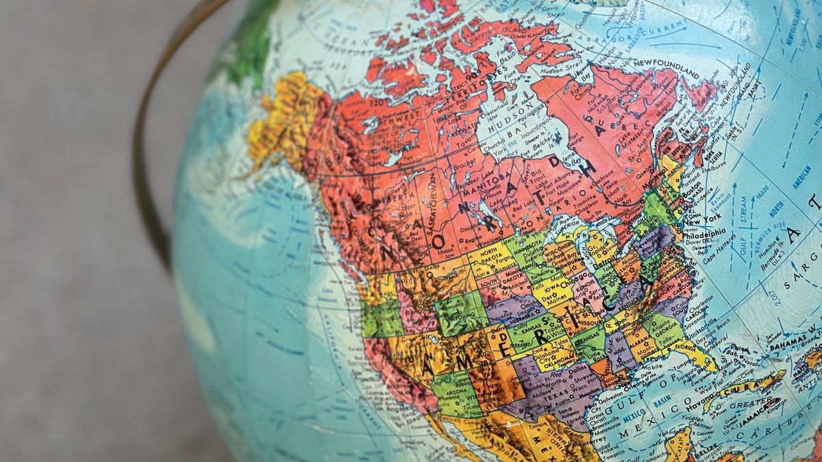
A map of the United States and surrounding oceans must include more than the Atlantic and Pacific. The contiguous states face the Atlantic Ocean to the east and the Pacific to the west. The Gulf coast borders the Gulf of Mexico, while Alaska reaches the Pacific and Arctic Ocean regions. Hawaii lies in the central North Pacific.
The geographic picture changes with the map extent. A contiguous-U.S. map usually omits Alaska and Hawaii or places them in insets. A complete national ocean map must also decide whether it shows coastlines, named seas, territorial limits or the much larger U.S. exclusive economic zone.
Atlantic waters border the East Coast
The Atlantic coast runs from Maine to Florida. Its major indentations include the Gulf of Maine, Long Island Sound, Delaware Bay and Chesapeake Bay. Florida separates the open Atlantic from the Gulf coast.
NOAA divides detailed navigation references among several volumes of the United States Coast Pilot. The sequence shows how one ocean label contains many regional coasts, bays and approaches that require larger-scale charts.
An ocean label does not define a legal maritime boundary. The coast is a physical edge, while jurisdictional zones are measured from an official baseline. A classroom map may show only water names and omit those legal limits entirely.
The Pacific borders three contiguous states
Washington, Oregon and California meet the Pacific Ocean. The coastline includes broad shelves in some areas and narrow margins where deep water lies relatively near shore. Major estuaries include Puget Sound, the Columbia River mouth and San Francisco Bay.
The Pacific map should extend far enough west to include Hawaii if the intent is national rather than contiguous. Hawaii’s position is thousands of kilometers from the mainland, so moving it into a lower-corner inset sacrifices true distance for page layout.
Argo’s guide to ocean-floor topography explains why a simple blue area conceals shelves, slopes, abyssal plains and trenches. Those submerged forms require bathymetric data rather than a political basemap.
Alaska faces Pacific and Arctic regions
Southern Alaska opens toward the Gulf of Alaska and the North Pacific. The Aleutian chain separates the Gulf of Alaska from the Bering Sea. Farther north, the Chukchi and Beaufort seas form parts of the Arctic Ocean margin.
NOAA’s Coast Pilot 9 covers the Pacific and Arctic coasts of Alaska from Cape Spencer to the Beaufort Sea. The coverage demonstrates why calling Alaska simply a Pacific state loses an entire northern coast.
The Bering Sea is a named marginal sea of the Pacific. The Chukchi and Beaufort seas are commonly assigned to the Arctic Ocean. Argo’s map of Arctic Ocean seas explains how classification boundaries can differ among references.
The Gulf coast needs a clear label
Texas, Louisiana, Mississippi, Alabama and Florida border the large gulf between the United States, Mexico and Cuba. Rivers from much of the central United States reach it through the Mississippi drainage.
NOAA’s Coast Pilot 5 covers the coast from Key West to the Rio Grande. The navigation region includes ports, bays and approaches that a national map can only generalize. Readers should follow the terminology used by the map’s issuing authority, especially when official naming conventions change.
The gulf connects with the Atlantic through the Florida Straits and Caribbean passages. It is therefore part of the wider Atlantic basin even though maps label it separately.
Hawaii sits entirely within the Pacific
The Hawaiian Islands form an archipelago in the central North Pacific. Their coastlines face different local channels and open-ocean sectors, but no second ocean borders the state.
Map insets often enlarge the islands and place them closer to the mainland. An inset must carry its own scale and orientation. Otherwise viewers may incorrectly infer the distance from California or the spacing between islands.
U.S. Pacific territories lie farther west and south. Whether Guam, American Samoa and the Northern Mariana Islands appear depends on whether “United States” means the 50 states or all territories and possessions.
What NOAA’s maritime-boundary map adds
NOAA’s interactive U.S. maritime limits and boundaries map shows the baseline and several seaward zones. It also provides downloadable GIS data for mapping applications.
The territorial sea generally extends 12 nautical miles from the baseline, while the contiguous zone reaches 24 nautical miles. The U.S. exclusive economic zone commonly extends to 200 nautical miles where not limited by an agreed boundary with another country.
These distances are measured from a legal baseline, not from a state border drawn on land. Bays, river mouths and complex coastlines require specific baseline rules. NOAA notes that the normal baseline follows the low-water line shown on recognized nautical charts.
Ocean names and legal zones serve different purposes
A physical map labels the Atlantic, Pacific and Arctic oceans along with marginal seas and gulfs. A legal map emphasizes baselines, territorial waters and negotiated boundaries. A marine forecast map divides water into operational zones that can change with agency needs.
NOAA’s Integrated Ocean Observing System map uses regional associations for observation and data delivery. Its boundaries are not ocean basins or maritime claims. The purpose printed in the legend determines how the lines should be read.
Argo’s overview of ocean zones uses a vertical ecological framework, another meaning of “zone.” Reusing one map for all three concepts creates confusion.
Projection and insets can distort the picture
A flat map cannot preserve area, shape, direction and distance everywhere. Common projections enlarge high latitudes, making Alaska look disproportionate to the contiguous states. An equal-area map improves area comparison but alters shapes.
Insets solve the page-space problem at the cost of geographic continuity. The scale bar for Alaska may differ from the one for Hawaii or the mainland. A map should clearly frame each inset and avoid drawing ocean labels across relocated geography.
Map extent also controls which ocean appears dominant. A mainland-centered frame emphasizes the Atlantic and Pacific. A polar view makes Alaska’s Arctic relationship much clearer, while a Pacific-centered frame restores Hawaii’s true regional position.
How to choose a reliable U.S. ocean map
Use a general reference map to learn ocean names and coast locations. Use NOAA nautical charts for navigation, the Coast Pilot for regional descriptions and the maritime-boundary viewer for legal-zone context.
Check the title, legend, projection and date before interpreting a line. Dynamic boundaries and official names can be updated, while a printed atlas preserves the conventions of its publication date.
The complete geographic answer is simple but qualified. The United States reaches the Atlantic, Pacific and Arctic ocean regions, with the Gulf coast and several named marginal seas shown separately on many maps. Alaska and Hawaii must remain in their true ocean settings even when page design uses insets.
Choosing an official ocean map
Use the map that matches the boundary question. NOAA’s maritime-limits data is appropriate for territorial sea and exclusive economic zone lines. Coast Pilot volumes supply regional navigation context, while the IOOS regional map shows the observing organizations working around U.S. coasts.
Inset maps require special care. Alaska and Hawaii are often moved and resized to fit a page, which breaks their true distance and direction from the contiguous states. A locator box should disclose that treatment. A globe or continuous digital map is better for comparing their actual ocean positions.
NOAA’s ocean basins overview helps distinguish a named basin from a marginal sea or gulf. Map labels can represent overlapping geographic levels, so the Gulf of Mexico can be named while remaining connected with the wider Atlantic system.
A complete U.S. view also includes island territories whose ocean settings fall beyond the usual fifty-state classroom map. The map title and coverage statement reveal whether those areas are included.





