
A useful map of Texas lakes begins with the state’s river basins. Most prominent inland waters are reservoirs built across rivers, so their names, shorelines and operating purposes make more sense when viewed inside the basin that supplies them. The Texas Water Development Board provides an official major-reservoir map that labels existing water-supply reservoirs against rivers and basin boundaries.
The word “major” has a precise planning meaning here. TWDB defines a major reservoir as an impoundment with at least 5,000 acre-feet of conservation storage at its normal operating level. Smaller city lakes, farm ponds and many flood-control impoundments can be important locally without appearing on a statewide major-reservoir map.
How to read the Texas lakes map
Start with the basin lines rather than the nearest highway. Texas recognizes 15 major river basins and eight coastal basins and the agency’s river-basin overview reports roughly 191,000 miles of streams. A reservoir belongs to the drainage network feeding it, even when its shoreline crosses county lines or its everyday name omits the river.
The map is a statewide locator, not a navigation chart. Reservoir outlines and labels show where large water bodies sit relative to rivers, cities and basin divides. Boaters still need current access information and detailed charts, while water-supply research often requires the reservoir’s latest elevation-area-capacity table.
Texas is mainly a reservoir landscape
Texas has few large natural lakes compared with the number of impoundments created by dams. The distinction is explored in Argo’s account of natural lakes in Texas. Caddo Lake is the best-known natural example, although human modifications have also affected its water level. Most blue shapes that dominate a modern statewide map, including Lake Texoma, Lake Travis and Sam Rayburn Reservoir, are impounded waters.
Reservoir construction accelerated during the middle decades of the twentieth century. TWDB says many early projects emphasized flood control, while water supply became increasingly important after the severe 1950s drought. More than half of Texas’s available surface-water supply comes from reservoirs, which store high flows for later use when rivers decline.
The inventory is larger than one fixed number may suggest because different programs count different things. TWDB’s basin page separates major water-supply reservoirs from additional major impoundments without a water-supply function. Its Hydrographic Survey Program uses the same 5,000-acre-foot threshold, yet concentrates surveys on reservoirs that dominate conservation storage.
Major basins and recognizable lakes
The Trinity River Basin contains a dense cluster around the Dallas – Fort Worth region, including Lavon Lake, Grapevine Lake, Joe Pool Lake and Lake Ray Hubbard. Farther southeast, Lake Livingston stores Trinity River water before the river reaches the coastal plain. Similar names can conceal different projects, so the basin label is a useful check when searching an agency database.
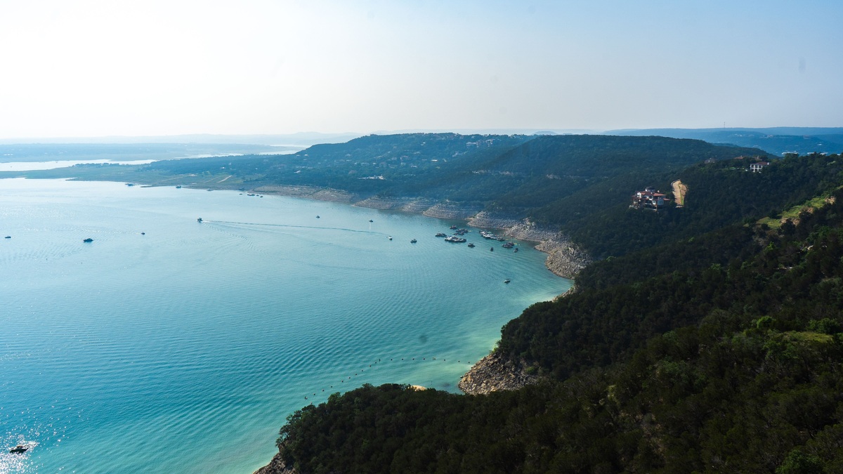
The Colorado River Basin of Texas includes the Highland Lakes chain northwest of Austin. Lake Buchanan is the largest storage reservoir in that chain, while Lake Travis, Lake LBJ, Lake Marble Falls, Lake Austin and Lady Bird Lake step downstream. This Texas Colorado River is separate from the interstate system covered by Argo’s Colorado River reservoir tracker.
In East Texas, the Sabine and Neches basins contain broad, humid watersheds. Toledo Bend Reservoir lies on the Texas-Louisiana boundary and has the greatest conservation storage listed by TWDB when both states’ portions are included. Sam Rayburn Reservoir, entirely in Texas, is another immense impoundment. Readers comparing superlatives should see what counts as Texas’s largest lake, because surface area and storage capacity produce different answers.
Border lakes and coastal waters need separate labels
Lake Texoma straddles Texas and Oklahoma on the Red River, while Toledo Bend spans the Louisiana line. Amistad International Reservoir and Falcon International Reservoir occupy the Rio Grande boundary with Mexico. State totals may include an entire reservoir’s storage, only the Texas share or a jointly managed capacity, depending on the table. The map legend and source notes determine which interpretation applies.
Coastal bays are not lakes. Galveston Bay, Matagorda Bay and Laguna Madre are saline or brackish coastal systems connected to the Gulf, while a coastal-basin label describes land drainage between major rivers. Mixing bays into a lake list makes the map look more complete but combines water bodies formed and managed in fundamentally different ways.
Use live data for conditions, not a static map
A map answers where a reservoir is; it does not show how full it is today. TWDB’s Water Data for Texas reservoir dashboard provides current storage information. Levels can change during drought, flood releases or seasonal demand and the exposed shoreline may differ markedly from the polygon on a planning map.
Bathymetry changes more slowly but still needs dates. Sediment gradually reduces storage, which is why TWDB surveys reservoirs with sonar and sediment cores. Its reports include a bathymetric contour map, updated capacity tables and, for sedimentation studies, estimates of the former reservoir bottom. Those products are better than a general state map for depth questions.
For a practical workflow, use the statewide PDF to locate the basin and reservoir, open the TWDB listing for project information, then consult live storage or survey data for the question at hand. That sequence keeps location, legal definition, current level and measured capacity from being treated as interchangeable map facts.
Names, ownership and access require another check
A reservoir may have an official project name, a familiar lake name and a dam name. Eagle Mountain Lake, for example, appears in some records with its dam, while International Amistad Reservoir is often shortened to Lake Amistad. Search both forms when a map label produces no result. The GNIS name used in federal mapping may also differ from the name used by a water supplier or park operator.
Ownership does not follow one statewide pattern. The US Army Corps of Engineers operates many flood-control reservoirs. River authorities manage connected supply systems, while cities own other projects. The Texas Parks and Wildlife lake directory is useful for fishing and access information, but inclusion there does not mean TPWD owns the water body. Boat ramps can close when levels fall even though the lake remains visible on every map.
Some reservoirs share a name across basins or resemble a nearby town. Cedar Creek Reservoir appears in both Colorado- and Trinity-basin listings on the TWDB lake page, reflecting different water bodies. Pairing the name with its river basin prevents a route planner, fishing report or storage value from being assigned to the wrong lake.
Map dates deserve attention. A new reservoir may be missing from an older PDF, while a proposed reservoir footprint is not an existing lake. Bois d’Arc Lake began impoundment long after many widely circulated state maps were drawn. The 2022 State Water Plan carefully labels proposed sites as planning concepts, so readers should verify construction status before treating a blue outline as present-day water.
Storage and hazard maps answer other questions
Acre-feet measure volume rather than surface area. One acre-foot is the amount needed to cover one acre one foot deep, about 326,000 US gallons. Conservation storage is the usable volume assigned between specified elevations; flood-control space may sit above it. A map cannot show these operating zones and two reservoirs with similar outlines may store very different amounts because their basin depths differ.
Dam-safety and flood maps serve another purpose. They can show inundation zones below a dam or land exposed to a design flood, neither of which is the lake’s ordinary shoreline. Keeping the title, legend and issuing agency attached prevents a hazard scenario from being confused with the Texas lakes inventory.
Reservoir depth is likewise absent from a locator map. TWDB’s measured bathymetry is a better source than estimating depth from surface size or shoreline shape.





