
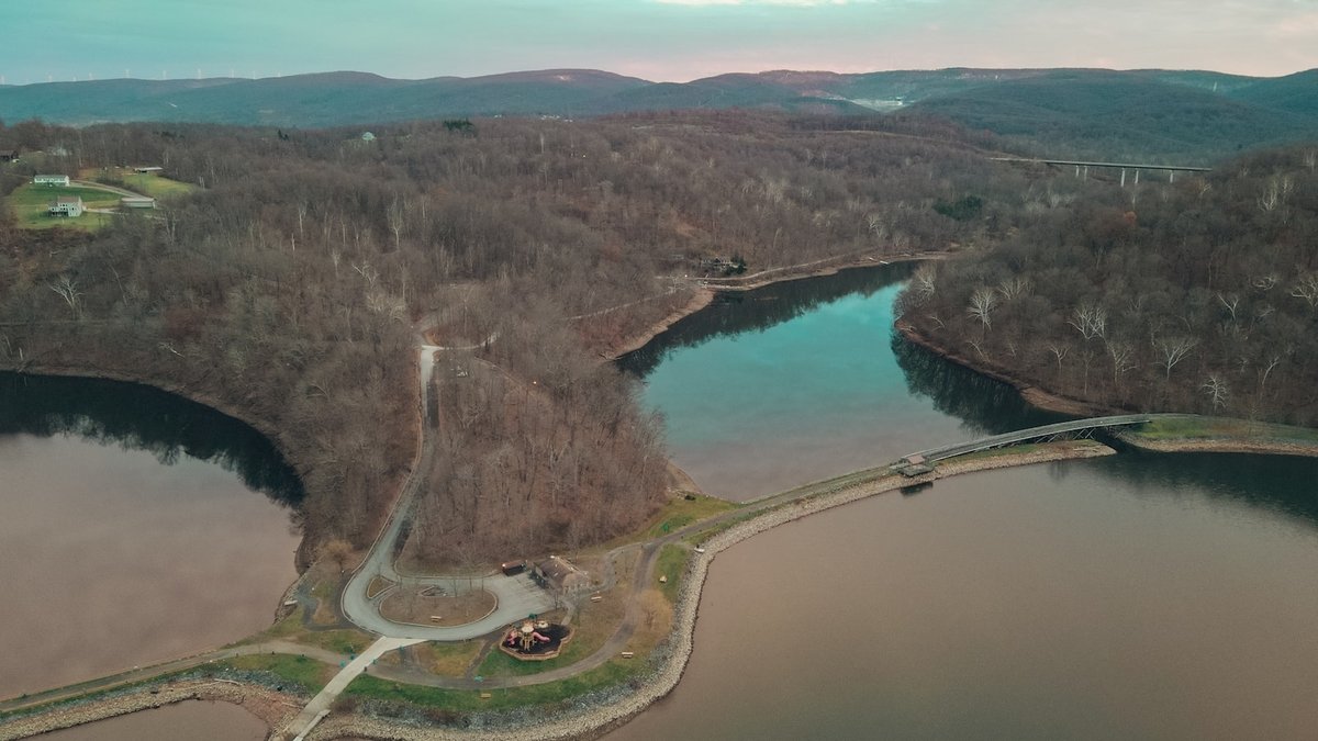
Built across the Sabine River, Toledo Bend Reservoir spreads across 181,600 acres at its conservation pool. That is about 284 square miles, making it the largest reservoir in or shared with Texas when size means surface area at the normal conservation level. The answer comes with one important boundary: Toledo Bend lies on the Texas-Louisiana line, so part of the water is in each state.
The official reservoir record from the Texas Water Development Board gives Toledo Bend a shared storage capacity of 4,477,000 acre-feet at an elevation of 172 feet above mean sea level. An acre-foot is the amount of water needed to cover one acre to a depth of one foot. It equals about 326,000 gallons, which makes the reservoir’s stated capacity roughly 1.46 trillion gallons.
Readers who mean the largest lake located completely inside Texas get a different answer. The Texas Water Development Board identifies Sam Rayburn Reservoir as the state’s largest wholly contained reservoir by total storage capacity. Natural lakes form another category, with Caddo Lake usually carrying Texas’s natural-lake distinction even though it also crosses into Louisiana and has been modified by dams.
Toledo Bend wins by surface area
Surface area measures the water’s horizontal footprint. Using conservation-pool area as the comparison, Toledo Bend leads Texas reservoirs with 181,600 acres. Its long, branching shoreline follows the flooded Sabine River valley for well over 100 river miles. The dam stands about 80 miles northeast of Beaumont, while the reservoir reaches north through several East Texas counties.
The measurement applies to the entire reservoir, including the Louisiana side. Texas shares the lake and its stored water with Louisiana through the two states’ Sabine River authorities. The state line follows the river corridor beneath the reservoir, so describing Toledo Bend simply as a Texas lake can hide a substantial geographic fact. A precise ranking says it is the largest reservoir in or shared with Texas by conservation-pool surface area.
Area also offers the most intuitive way to compare what people see on a map. One square mile contains 640 acres, so Toledo Bend’s conservation area converts to 283.75 square miles. Shoreline length would be a poor substitute because the result changes with map detail. Fine mapping traces far more small coves than a coarse survey does, even when both maps represent the same water level.
The state line changes the answer
Toledo Bend’s western shore is in Texas, while its eastern shore is in Louisiana. The reservoir occupies parts of four Texas counties and two Louisiana parishes. Both states helped pay for the project and their river authorities jointly own it. They also share its water and the electricity produced at the dam.
Geographic wording decides which record applies. A question about the largest lake “in Texas” may include any lake partly within the state. Under that broad boundary, Toledo Bend is the clear surface-area answer. A question limited to a lake “entirely within Texas” excludes every interstate reservoir, including Toledo Bend and Lake Texoma. The wholly contained category points to Sam Rayburn.
Shared location does not mean Texas receives half of every acre-foot at all times. Water rights and operating agreements govern how the project is managed, while the state line answers the geographic question. Keeping those ideas separate prevents an area ranking from being mistaken for a statement about ownership or each state’s usable supply.
Sam Rayburn is largest entirely in Texas
Sam Rayburn sits on the Angelina River in the Neches River Basin, about 10 miles northwest of Jasper. The state’s reservoir profile calls it the largest reservoir within Texas by total storage capacity. A 2004 volumetric survey measured 112,590 surface acres and 2,876,033 acre-feet at the power-pool elevation of 164.4 feet.
Higher operating levels produce larger figures. At the top of its flood-control pool, Sam Rayburn covers about 142,700 acres and holds 3,997,600 acre-feet. At the crest of the emergency spillway, its possible footprint reaches 153,800 acres with storage of 4,442,400 acre-feet. Even that upper figure remains below Toledo Bend’s 181,600-acre conservation-pool area, while Sam Rayburn keeps the title tied to a boundary wholly inside Texas.
Sam Rayburn’s history also overlaps Toledo Bend’s construction era. Work on the federal project began in 1956. Deliberate filling started in March 1965, followed by the full conservation pool in 1966. Congress originally authorized it as McGee Bend Dam and Reservoir. The name changed in 1963 to honor former U.S. House Speaker Sam Rayburn, a Texas advocate for water conservation.
Water level changes lake size
A reservoir has no single fixed shoreline. Rain can raise the surface, while releases through the dam and water withdrawals lower it. Evaporation also removes water. When the elevation rises, water spreads over low ground around coves and tributaries. During dry periods, exposed banks widen and the measured area shrinks. Any reliable size figure therefore needs the elevation or operating pool attached to it.
The conservation pool is the level used to store water for regular project purposes. Flood-control space lies above it and is kept available to capture high flows. An emergency-spillway figure describes a much higher condition, rather than the everyday lake. Comparing Toledo Bend at conservation pool with Sam Rayburn at its emergency limit would mix two unlike measurements. The ranking is clearest when the metric, pool level and state boundary are stated together.
Storage capacity changes with elevation for the same reason. Engineers estimate the volume between the lake bottom and the water surface, then express it in acre-feet. Sediment gradually occupies some of that space, so later volumetric surveys can revise an older capacity estimate. A date attached to a survey helps readers distinguish a fresh measurement from the reservoir’s original design figure.
Caddo Lake holds the natural-lake distinction
Caddo Lake began as a natural lake in the cypress country of East Texas and western Louisiana. Later dams altered its water level, so its modern condition combines a natural origin with human control. A Texas Parks and Wildlife survey described it as a 27,472-acre lake, with 12,712 acres on the Texas side. More recent agency descriptions use slightly different totals as lake levels shift. Survey methods and mapped boundaries can also change the result.
Caddo’s total area is far smaller than Toledo Bend’s, yet origin gives it a separate place in Texas geography. Calling it the state’s largest natural lake refers to how the basin formed, rather than an overall surface-area record among all waters commonly called lakes. Caddo also straddles the state line, which is another reason to attach a clear definition to the claim.
Why Toledo Bend was built
Construction of Toledo Bend Dam began on May 11, 1964. Deliberate filling started on October 3, 1966. The dam was completed in 1969. The project blocked the Sabine River with a rolled-earth embankment. Unlike many large federal reservoir projects, Toledo Bend was financed by Texas and Louisiana through their river authorities.
The reservoir stores raw water for communities and industry. It also supports irrigation and recreation, while two generating units produce hydroelectric power. The Sabine River Authority lists water supply and recreation as primary reservoir uses and identifies Toledo Bend’s added hydropower role. Those functions depend on managed releases, especially when downstream needs compete with lake levels.
Toledo Bend’s drainage area covers 7,178 square miles, so rainfall far beyond the shoreline can affect the reservoir. Water arriving through the Sabine River and its tributaries raises the lake, while controlled releases send water downstream. The dam’s managers balance storage with operating limits as conditions change. For the original question, the durable answer remains precise: Toledo Bend is Texas’s largest associated lake by conservation-pool surface area, Sam Rayburn is the largest reservoir wholly within Texas by total storage capacity and Caddo Lake represents the natural-lake category.





