
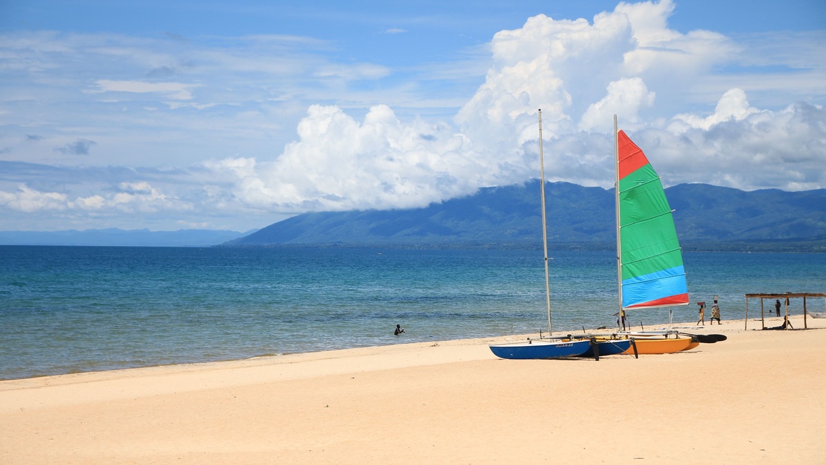
Lake Malawi stretches along the borders of Malawi, Mozambique and Tanzania in Africa’s western Rift Valley. It covers about 30,800 square kilometers, equivalent to roughly 11,900 square miles. From north to south, the lake extends approximately 560 kilometers. Most of the shoreline and water lie beside Malawi, where the lake occupies a large share of the country’s eastern edge.
Its maximum depth is less settled than its general size. Technical and official sources publish figures ranging from about 695 to 758 meters, or 2,280 to 2,487 feet. Survey coverage can produce different results, while chart revisions may change the stated value again. Sources may also select a different sounding as the deepest point. Reporting the range is more accurate than silently choosing the largest value.
An older FAO fisheries review gives 560 kilometers in length, 50 kilometers in width and a 695-meter maximum. A separate FAO country account reports 758 meters while retaining the same 30,800-square-kilometer area.
Where Lake Malawi is on the map
The lake forms a long, narrow strip between highlands. Malawi occupies most of its western and southern shore. Mozambique controls much of the eastern shore. Tanzania reaches the northeastern section, where the water is called Lake Nyasa.
The international boundaries have political complexity. Malawi and Tanzania hold different positions on their lake border. A geographic map should distinguish the physical shoreline from disputed legal interpretations rather than present a single boundary line as uncontested.
Names also change across the map. “Lake Malawi” is standard in Malawi and much international literature, while “Lake Nyasa” remains common in Tanzania and appears in older technical sources. Both names refer to the same water body.
The Shire River leaves the southern end and flows toward the Zambezi River in Mozambique. Lake Malawi therefore belongs to the Indian Ocean drainage. Its outlet makes it part of a river network, while the deep basin still stores water for a long time compared with a channel.
Size, length and volume
At approximately 30,800 square kilometers, Lake Malawi ranks among the world’s largest freshwater lakes by area. Its narrow form means length is more striking than width: many references use about 560 kilometers long and roughly 50 to 80 kilometers across depending on the section measured.
A technical FAO lake profile assigns 24,400 square kilometers to Malawi and another 6,400 to Mozambique. The same profile gives 1,500 kilometers of total shoreline. Its division does not capture every contemporary boundary interpretation, so those national shares should be read as the source’s accounting.
The lake also holds an immense volume because much of the basin is deep. Area and volume rankings are not interchangeable. Argo’s overview of the largest freshwater lakes explains why surface area can produce a different order from stored water.
The World Lake Database profile uses an intermediate maximum of about 706 meters and places that point near the western shore north of Nkhata Bay. Its 560-kilometer length and 75-kilometer greatest width illustrate how measurement sources can agree on general form while differing at the deepest sounding.
Why maximum-depth figures disagree
The 695-meter figure appears in FAO fisheries literature, while 758 meters appears in another FAO country assessment and technical profile. Other modern summaries use values near 700 or 706 meters. All place Lake Malawi among Africa’s deepest lakes.
Depth surveys depend on instrument coverage and the water-level reference used to convert soundings. A newly measured trench can revise the maximum without changing the rest of the basin. Rounding from feet to meters can introduce smaller discrepancies.
For a general reference page, about 700 meters deep, with published maxima from 695 to 758 meters, is the defensible answer. The mean depth is often reported near 264 to 292 meters, again with differences among datasets.
A separate ILEC Lake Malawi basin brief uses 29,500 square kilometers, 700 meters maximum and 264 meters mean. Its values likely reflect a particular lake boundary and dataset. The comparison reinforces the need to state a source instead of merging dimensions from several tables.
A lake formed by continental rifting
Lake Malawi occupies a fault-bounded depression in the East African Rift. Earth’s crust is stretching and movement along faults has lowered the lake basin relative to neighboring highlands. Sediment accumulating on the bottom records the basin’s environmental history.
The steep sides and great depth differ from broad glacial lakes of northern North America. Rivers deliver sediment around the margins, but the main trough remains deep. Earthquakes in the region reflect the active tectonic setting.
Lake Malawi shares a rift origin with Tanganyika. Their dimensions differ, as does the chemistry of their water. Malawi’s long axis follows the structural direction of the rift, making the tectonic control visible on a regional map.
Deep water lacks oxygen
The lake’s upper water supports abundant life, while deep layers remain isolated from the atmosphere for long periods. FAO’s fisheries review reports anoxic water below about 250 meters and says complete vertical mixing has not been observed.
Warm surface water is less dense than the cooler water below, maintaining stratification. Wind mixes the upper zone but usually cannot overturn the full depth. Microbial decomposition consumes oxygen in the isolated lower layer.
The deep anoxic volume limits fish habitat despite the lake’s enormous depth. Most productive fisheries occur in surface or shelf waters where light and oxygen support food webs. Maximum depth therefore does not translate into usable habitat from top to bottom.
Exceptional cichlid diversity
Lake Malawi is renowned for its cichlid fishes, which diversified into many ecological forms. Some species occupy rocky shores. Others live over sandy bottoms or move through open water. Closely related fish can feed in different ways. They may also display different coloration or favor separate depth ranges.
The UNESCO Lake Malawi National Park protects a small but important part of the southern lake and was recognized for outstanding fish diversity and evolutionary value. The park does not encompass the whole lake, so protected status should not be generalized to every shore.
Species totals change as researchers describe new taxa and revise classifications. Claims often range from several hundred to more than 1,000 fish species, depending on what is counted and current taxonomy. The stable conclusion is that the lake holds an exceptional concentration of endemic cichlids.
Three countries depend on the lake
Fishing supports food security and livelihoods along the shore. Small pelagic fish and diverse cichlids enter local fisheries, while larger commercial operations work particular zones. Pressure varies by region and target species.
The lake also supplies water and supports transport. Outflow through the Shire contributes to hydropower and downstream ecosystems. Pollution can therefore affect communities beyond a single national boundary. Sediment from land use moves through the same shared water, while overfishing can alter stocks that cross jurisdictional lines.
Shared management is complicated by different laws and monitoring capacity. Fish move across the open water even where governments disagree over jurisdiction. Scientific cooperation provides a common basis for understanding changes in stocks and water quality.
How Lake Malawi compares with Lake Victoria
Lake Victoria covers a much larger surface area but is far shallower. Malawi’s rift basin descends hundreds of meters, while Victoria occupies a broad depression between rift branches. Their different forms influence circulation and habitat.
Argo’s guides to Lake Victoria’s location and borders and animals of Lake Victoria offer a useful comparison. Both are international African lakes with diverse fisheries, but their geological origins and deep-water conditions are not the same.
Lake Malawi’s map is ultimately a map of a rift: a narrow international lake aligned between steep highlands. Its area is about 30,800 square kilometers. Published values place the maximum depth between 695 and 758 meters. The deepest-point numbers differ, but the lake’s continental scale is beyond dispute. So is its extraordinary biodiversity.





