
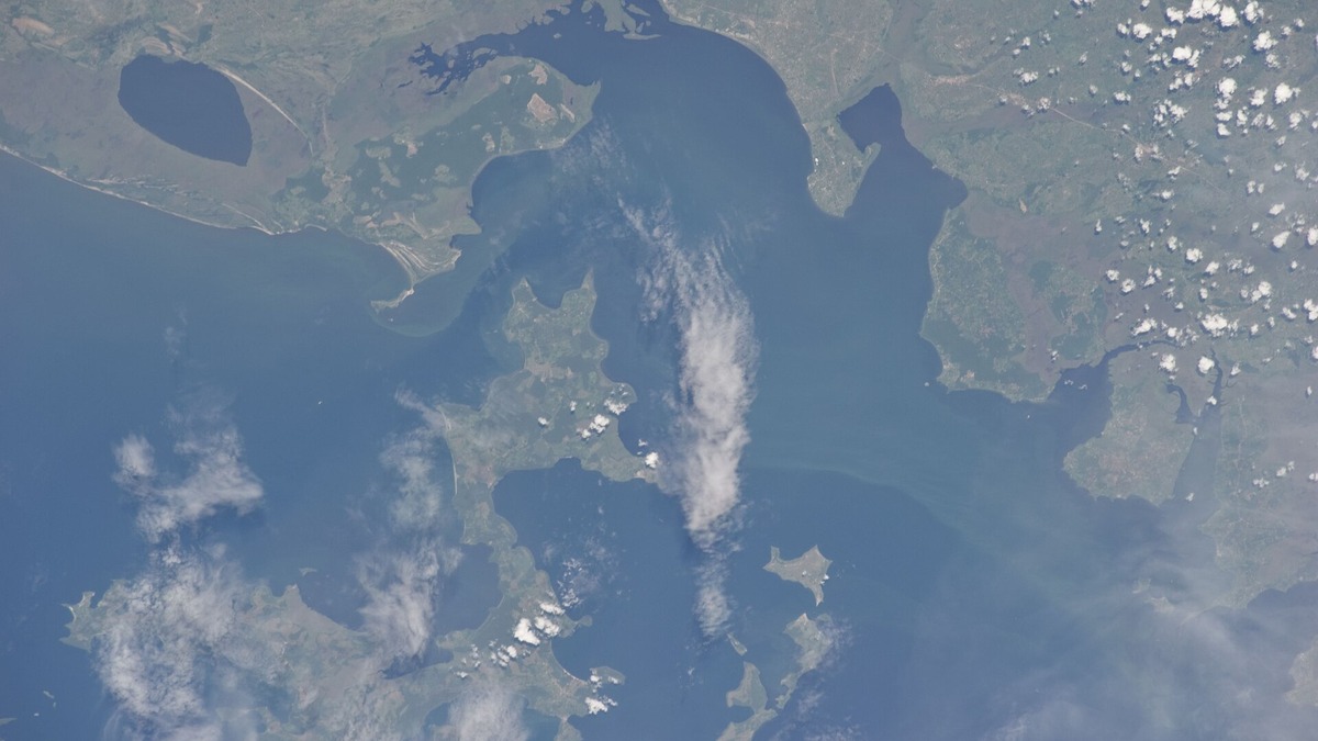
Lake Victoria contains large inhabited islands, forested archipelagos, fishing settlements and tiny rocky islets divided among Uganda, Tanzania and Kenya. Major groups include Uganda’s Ssese and Buvuma islands, Tanzania’s Ukerewe group and Kenya’s Mfangano, Rusinga and smaller Suba islands.
There is no single stable, well-supported total for every island in the lake. Counts change with water level, map scale and the minimum size used to separate an island from a rock or seasonally exposed shoal. Administrative totals also cover only a district or archipelago. The soundest approach is to identify the major groups and state exactly what each official count describes.
Why the island total varies
A lake-wide count needs a definition. Cartographers may include a named rock that sits above water all year, while local government records may count only land assigned to an administrative unit. A narrow channel can separate two islands during high water and disappear during low water. Shoreline vegetation can conceal the boundary in satellite imagery.
Uganda’s Kalangala District reports 84 islands, Buvuma District describes an archipelago of 52 and Tanzania’s Ukerewe District reports about 38 within its jurisdiction. Adding those numbers would still omit other parts of the lake and could double-count features where administrative descriptions overlap or use different criteria.
Claims that Lake Victoria has a precise total such as 3,000 islands often circulate without a reproducible inventory. Official district records alone document well over one hundred islands in separate named groups, with additional islands and rocks elsewhere. A lake-wide number still needs a map scale, date and inclusion rule.
The Ssese Islands of Uganda
The Ssese Islands occupy the northwestern part of Lake Victoria and are largely administered as Kalangala District. The district government’s profile says it is composed of 84 widely scattered islands. Its stated total area includes far more open water than land, a reminder that an island district is also an aquatic territory.
Bugala is the largest Ssese island and the location of Kalangala, the district’s main town. Ferries connect it with the mainland, while smaller islands rely on boats for people, supplies and fish. Fishing and farming are central activities, with oil-palm cultivation becoming a major land use on Bugala.
Forests and wetlands remain ecologically important across the archipelago. The district profile records central forest reserves, but it also documents substantial forest reduction. Island habitats are especially sensitive because clearing on a limited land area can quickly reach streams, wetlands and the lake shore.
Buvuma Islands near Napoleon Gulf
East of the Ssese group, the Buvuma archipelago lies near Napoleon Gulf in Uganda. The Buvuma District government describes 52 islands. Buvuma Island is the largest and the group sits near the outlet region where Lake Victoria feeds the Victoria Nile.
Fishing shapes transport, work and settlement. Forests cover parts of the islands, while farms and villages occupy cleared land. Elevation varies enough to produce hills rather than a uniformly flat landscape. Small landing sites act as road junctions would on the mainland.
Buvuma’s official numbers can differ across sections of government documents because land area, total district area and inhabited area are separate measures. Such differences reinforce the need to label any statistic rather than present it as a complete measurement of all islands in Lake Victoria.
Other Ugandan island groups
Uganda’s portion of the lake includes islands outside Kalangala and Buvuma districts. The Bukooli islands lie farther east near the Kenyan border. Namayingo District identifies island sub-counties including Sigulu, Bukana and Lolwe, with fishing communities distributed among them.
Jaguzi and neighboring islands fall within Mayuge District. The district profile describes six islands in Jaguzi Subcounty and notes extensive deforestation along shores and hills. The figure belongs to that administrative unit rather than the national total.
Many smaller Ugandan islands are densely connected to mainland markets through fish trade. Their names may have multiple spellings when Luganda or other local names are rendered in English. A map and local administrative usage offer firmer identification than an informal tourist list.
Ukerewe, Tanzania’s largest lake island
Ukerewe lies in the southern part of Lake Victoria and is the lake’s largest island by land area. Nansio serves as the district headquarters and a transport hub. Ferry routes link residents with Mwanza and neighboring shores, supporting movement of fish, crops and passengers.
An official Ukerewe District plan gives Ukerewe Island an area of about 494 square kilometers. It describes about 38 islands in the district, with 15 permanently inhabited at the time of the plan. Ukara, at about 80 square kilometers, is the second-largest named island in the district table.
Other listed islands include Irugwa, Bwiro or Busumba, Kamasi, Sizu and Kweru. Their populations and services vary. As elsewhere on Lake Victoria, inhabited status can change over time, so a district planning figure should retain its date and context.
Rubondo and the southwestern islands
Rubondo Island lies in Tanzanian waters toward the southwest and forms the center of Rubondo Island National Park. Forest covers much of the island, producing a very different landscape from heavily farmed and densely settled islands. Wetlands and sheltered bays add habitat for birds and aquatic animals.
The park also contains animals introduced during twentieth-century conservation experiments, so every mammal seen there is not necessarily native to the island. Chimpanzees released on Rubondo established a free-ranging population. Conservation descriptions should distinguish such introduced populations from species that reached the island without human help.
Smaller islands around Rubondo contribute nesting and resting habitat. Park boundaries may include surrounding water as well as land, meaning a protected-area figure is not automatically an island-area figure.
Mfangano and Kenya’s Suba islands
Mfangano is one of Kenya’s largest Lake Victoria islands. The island has permanent settlements, a ring road and cultural sites associated with the Abasuba community. Boats connect it to Mbita and nearby fishing islands, while local roads now connect more villages around its steep terrain.
Kenya’s government created Suba Central subcounty to bring services closer to residents of Mfangano and nearby islands. A Kenya News Agency report names Ringiti, Remba and Takawiri within the new unit. Administrative grouping explains why these islands often appear together even though they differ greatly in area and population.
Mfangano is also known for rock-art sites and the preservation of Suba cultural traditions. Fisheries remain economically central. Small islands such as Ringiti and Remba can support dense settlements because their locations provide access to fishing grounds, despite limited land and freshwater.
Rusinga and the bridge question
Rusinga lies near Mbita on the Kenyan shore. It is famous for fossil discoveries, including early ape material from Miocene deposits and for the tomb of Kenyan political leader Tom Mboya. The island is also closely associated with Suba culture.
A causeway and bridge now connect Rusinga to the mainland. A Kenyan parliamentary debate even described it as annexed to the mainland, while geographic and cultural references continue to call it Rusinga Island. An engineered connection can alter how inventories classify the landform.
The example shows why counting is not purely physical. Tides are negligible in Lake Victoria compared with an ocean coast, yet water levels, culverts, bridges and causeways still affect whether maps show uninterrupted water around a feature.
Smaller Kenyan islands
Takawiri is known for pale sandy beaches and lies near Mfangano. Remba and Ringiti are smaller fishing islands with compact settlements. Migingo, a tiny rocky island near the Kenya-Uganda boundary, became internationally famous because of fishing access and a long-running boundary dispute.
Ndere Island lies closer to Kisumu and is protected as a national park. It offers grassland and shoreline habitat rather than the dense settlement found on some fishing islands. Birds, reptiles and antelope use the island or its surrounding shallows.
Maps may also label Pyramid, Maboko and other small islands in Kenyan waters. Maboko is scientifically important for Miocene fossils. Fame, population and land area therefore identify different sets of “major” islands, depending on whether the question concerns culture, biology or geography.
Island settlements and transport
Water transport is part of ordinary life. Ferries serve the largest routes, while wooden boats and motorized craft connect smaller landing sites. Weather can change rapidly over the broad tropical lake and nighttime storms create serious hazards for fishers and passengers.
Island settlements depend on mainland links for fuel, medicine, construction materials and education. Large islands may have roads and health centers, but referrals from remote communities still require a boat crossing. Kalangala’s district profile explicitly describes the complexity created by poor roads and extensive water.
Fishing provides income, yet intense dependence on one resource can make communities vulnerable to stock changes and enforcement restrictions. Farming, tourism and trade broaden local economies where land and access permit.
Forests, wetlands and wildlife
Lake Victoria’s islands support forest birds, bats, primates, reptiles and shoreline invertebrates. Papyrus fringes shelter fish nurseries and wetland specialists. Rocky shores provide spawning habitat for cichlids, while sheltered bays trap sediment and host aquatic plants.
Isolation can encourage local genetic differences, especially among fish tied to short stretches of rocky habitat. It can also leave wildlife vulnerable to forest clearing, invasive plants and introduced terrestrial animals. A small habitat fragment has little room for species to move when conditions change.
The companion page on Lake Victoria wildlife covers fish, birds and other animals in greater detail. Readers can also compare the archipelagos with the islands of North America’s Great Lakes, where glaciation and a cooler climate created a different island landscape.
A transboundary lake
Lake Victoria’s water surface is shared approximately 51 percent by Tanzania, 43 percent by Uganda and 6 percent by Kenya, according to the Lake Victoria Basin Commission. Those water shares do not translate directly into the same proportions of islands, people or shoreline.
National borders cross a continuous ecosystem and active fishing grounds. Pollution, invasive plants and unsafe navigation do not stop at jurisdictional lines. The commission coordinates areas including water resources, fisheries, wetland management and maritime safety across the East African Community.
For geographic context, the Lake Victoria location overview explains the three shoreline countries and the wider basin, which also reaches Rwanda and Burundi. Within that shared system, island counts remain most reliable when tied to a named district, archipelago and date.





