
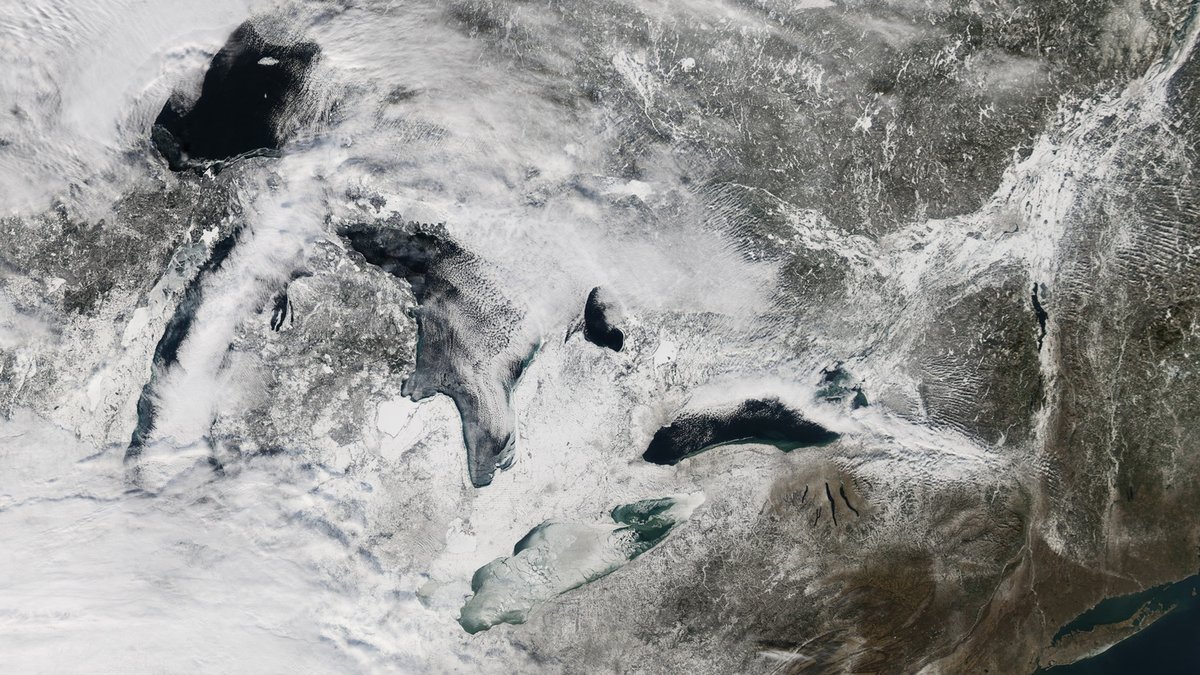
A lake can develop its first surface ice after several cold, calm days, but complete freeze-over often takes days to weeks once the lake has cooled enough. Large lakes may need much longer when their basins are deep or exposed to wind. Some never become fully covered during a mild winter. The calendar alone cannot predict the result because the lake must release heat stored from summer before a stable sheet can spread across it.
Scientists call the whole seasonal process freeze-up. It begins when surface water reaches its freezing point and ice crystals appear. It ends at the lake’s maximum ice coverage, according to Natural Resources Canada. A lake that looks frozen from shore may still have open water elsewhere and a continuous sheet can remain too thin or uneven to support a person.
The safest direct answer is therefore a range with conditions attached: a small, shallow, sheltered freshwater lake may close during a sustained cold spell, while a deep or broad lake can remain partly open for weeks or all winter. Freeze-over is not a measure of ice safety. Anyone planning to step onto ice needs current local information and repeated thickness checks along the intended route.
How a lake reaches the freezing point
Freshwater usually begins freezing at about 32 degrees Fahrenheit (0 degrees Celsius), yet the lake does not simply cool straight down from top to bottom. As autumn air removes heat, surface water becomes denser and sinks. Warmer water rises to replace it, which keeps the lake mixing while the water column loses more of its stored heat.
Fresh water reaches its greatest density near 39.2 degrees Fahrenheit (4 degrees Celsius). Below that temperature, colder water becomes slightly less dense, so it stays near the surface instead of sinking. The U.S. Geological Survey explains that this unusual density behavior allows a cold surface layer to reach the freezing point while deeper water remains near 4 degrees Celsius.
Ice is less dense than liquid water, so new crystals float and collect at the surface. Under calm conditions, they can join into a thin, continuous skin. More water then freezes onto the underside. The existing ice slows heat loss as it thickens, which is one reason early growth can be quick while later growth proceeds more slowly.
Cold air starts the clock, but it does not set a deadline
Air temperature is the strongest broad control on freeze-up. A slightly subfreezing night may create ice along a quiet shoreline, then daytime warmth can remove it. Sustained cold produces a larger heat loss. Ice specialists often summarize the accumulated cold with freezing degree-days, calculated from daily mean temperatures below 0 degrees Celsius.
The measure is useful, although it is not a universal countdown. Canada’s guidance for navigation notes that air temperature can provide a reasonable estimate of ice thickening when snow is absent. Local models still require coefficients suited to local conditions. Weather before the cold spell also counts because a warm lake must shed more energy before surface ice can persist.
A real freeze-up can advance unevenly. In a National Weather Service example, ice spread across Lake Winnebago and southern Green Bay during a cold period from roughly December 9 to December 18. Officials still warned that thickness varied because streams, springs and other moving water produced weak areas. The episode illustrates why a visible change over several days cannot establish a general rule for every lake.
Depth, area and wind change the timing
Deep lakes store more heat in their water columns than shallow lakes with otherwise similar conditions. They usually need a longer cooling period before the surface can remain at the freezing point. A broad lake also presents long stretches of open water where waves can break fragile new ice. Sheltered bays often close before the exposed center.
Wind has more than one effect. Before freeze-over, it can increase heat loss to cold air, but it also stirs warmer water upward and keeps the surface moving. Strong wind can fracture newly formed ice and pile fragments against a shore. Once a continuous sheet forms, the response changes because the water is no longer exposed directly to waves across the same distance.
Lake shape influences where the first stable ice survives. Narrow coves and protected shorelines may freeze while the main basin remains open. Large lakes can preserve substantial open water even during severe cold. Canadian satellite monitoring therefore tracks percent ice coverage as well as freeze-up dates, ice type and thickness, rather than treating each lake as simply frozen or unfrozen.
Currents can keep patches of water open
Moving water continually carries heat toward the surface and disrupts crystal growth. Inlets and outlets deserve particular caution, as do constricted channels. Groundwater springs can create another local source of comparatively warm moving water. Ice near these features may be slow to form. It can remain thin or reopen while nearby ice looks solid.
Currents also explain why rivers generally freeze later and clear earlier than lakes in the same region. A lake can contain river-like flow near a tributary or outlet even when most of its basin is quiet. Pressure ridges and cracks add further variation after a sheet develops.
Persistent open patches do not necessarily mean the air has been too warm everywhere. Wind-driven circulation may keep a small area moving. Water entering from a stream can have the same effect, as can heat released from deeper water. Local agencies often know recurring trouble spots, but conditions can change through the season.
Snow slows growth and can hide weak ice
Snow acts as insulation. A deep blanket limits the rate at which heat moves from the ice into colder air, so the sheet beneath it can thicken more slowly than clear ice exposed to the same weather. Early snowfall may also conceal thin spots before they are easy to recognize.
Weight from snow can press ice downward and bring water onto its surface. If the mixture freezes, it forms cloudy or white ice containing more air than clear ice grown directly from lake water. The Minnesota Department of Natural Resources says white ice is about half as strong as new clear ice and advises doubling its published thickness guidelines when traveling on it.
Sunlight and warm spells complicate the picture further. Ice can lose strength before it appears dramatically thinner, especially late in the season. A cold night after a thaw may refreeze the surface without restoring the strength of the older ice below.
Salt lowers the freezing point
Most lakes contain fresh water, but dissolved salts still vary from one lake to another. Added salt lowers the freezing point, so a saline lake requires colder water before ice can form. The effect is pronounced in the ocean, where average seawater freezes near 28.4 degrees Fahrenheit (-1.9 degrees Celsius), according to NOAA.
Salinity also changes how cold water mixes. Fresh water is densest near 4 degrees Celsius, while seawater continues becoming denser as it cools toward its lower freezing point. Argo’s explanation of how the ocean freezes describes how salt is largely excluded from growing sea ice. A freshwater lake follows the 4-degree density cycle unless its dissolved mineral content is unusually high.
Freeze-over and safe ice are separate questions
A complete skin of ice records a stage in freeze-up. Whether ice can bear a load depends on its thickness and quality. Local support conditions also count. It may be much thinner near a current than it is a short distance away. Snow ice can reduce strength even where a measurement looks reassuring. Cracks or recent warming can weaken it further.
The Minnesota DNR states that ice is never 100 percent safe. Its guidance for new, clear ice says to stay off when thickness is under 4 inches and to wait for at least 4 inches before considering travel on foot. Those figures are recommendations for a specific ice type, rather than a promise. The agency warns that ice can be two feet thick in one location and only one inch thick a few yards away.
Check current reports from a local natural-resource agency or experienced local authority before going out. Thickness must be measured repeatedly along the route with suitable safety equipment and extra caution is needed near shore, vegetation, moving water or pressure ridges. Neither a date nor a run of cold nights can substitute for direct checks. The appearance of a frozen surface cannot do so either.
Water clarity is not an ice-strength measurement. Several lakes in Argo’s guide to the clearest lakes in Minnesota have deep Secchi visibility, yet each still requires current local ice checks.
Argo’s explanation of why lakes freeze from the top down covers the density change that controls the order of ice formation.





