
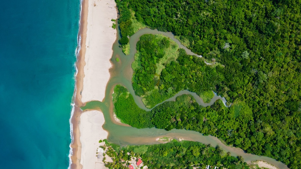
Estuarine circulation is the repeated exchange of river water and seawater where a river meets the coast. Fresh water tends to move seaward near the surface, while denser saltwater can move landward below. Tides reverse the instantaneous current, yet the average flow over many tidal cycles often preserves this two-layer pattern.
The real motion is more complicated than two smooth arrows. Tides generate turbulence throughout the channel. Wind pushes surface water, while bends redistribute the current across the estuary. River discharge changes after rain or snowmelt. The salt front therefore travels through the estuary rather than remaining at one fixed point.
A 2024 U.S. Geological Survey Taunton River assessment illustrates the movement. Incoming tides carry saltwater about 12 miles into the estuary, while the upstream limit shifts roughly 2.5 miles as tide and freshwater flow change.
The density-driven exchange
River water contains less dissolved salt than ocean water and is usually less dense. When the two meet, the fresh water tends to spread over the salty water. Gravity maintains the vertical arrangement while pressure differences produce opposing flows.
Near the surface, the river adds water that must eventually leave toward the sea. Salt mixed upward joins this outflow. To replace the lost salt, a net landward current develops near the bottom. The paired motion is called gravitational circulation.
The strength depends on the horizontal salinity gradient. A larger difference between the head and mouth creates a stronger baroclinic pressure gradient. Channel depth also matters because deep channels can support greater separation between upper and lower currents.
Earth’s rotation can shift the two flows toward opposite sides of a broad estuary. Friction at the bed and shoreline then changes their speed. The resulting lateral circulation is one reason measurements along a single centerline may miss important transport.
Cross-channel surveys expose that hidden structure directly.
What tides do
Flood tide drives water landward and ebb tide drives it seaward. These alternating currents can be much faster than the average estuarine exchange. Scientists separate the tidal motion from the residual flow by averaging observations over complete cycles.
Tides also mix fresh water with saltwater. Current shear generates turbulence near the bed, with narrow channels concentrating the effect. Strong tidal energy weakens vertical salinity differences and can create a well-mixed estuary.
Mixing is not equal throughout the month. Spring tides, which occur near new and full moons, have a larger range and often generate stronger turbulence. Neap tides have a smaller range, allowing stratification to rebuild in some estuaries.
The tide changes as it travels upstream. In the Taunton River system, USGS reports a high-tide delay of about 40 minutes between the mouth and upstream end, while the low-tide lag is about two hours. Friction and channel storage distort the incoming wave.
River flow moves the salt front
The salt front is the transition between nearly fresh water and the brackish estuary. High river discharge pushes it toward the ocean. Low discharge gives the tide and density-driven bottom flow more opportunity to carry salt upstream.
Heavy rain can change the position over days. Seasonal snowmelt may freshen an estuary for weeks, while drought allows prolonged intrusion. The response is not instantaneous because water already stored in side embayments and deep channels must also be exchanged.
In the Taunton River, the length of saltwater intrusion is inversely related to river discharge. USGS emphasizes that no tidal cycle is identical to the one before it. A water intake or habitat boundary therefore needs continuous context rather than a single mapped line.
Wind changes the surface flow
Wind stress can reinforce or oppose the usual surface current. Wind blowing seaward helps move fresh surface water toward the mouth. A persistent landward wind may hold water inside and raise the local water level. The accumulated water drives a compensating flow at depth.
Because Earth’s rotation deflects moving water, wind can create differences between opposite sides of a broad estuary. Shoreline orientation and basin shape determine the exact response. Narrow systems behave differently from wide bays.
Strong wind also adds turbulence through waves. Mixing may erode a surface fresh layer and carry oxygen downward. After the wind relaxes, buoyancy can restore vertical stratification as river water spreads over the saltier layer.
How channel shape controls circulation
Deep channels guide dense saline water inland, while shallow shoals mix more thoroughly. Curves shift the fastest current from one bank to the other. Bed roughness slows the flow and produces turbulence near the bottom.
A sill can restrict deep exchange, as in many fjords. Narrow inlets accelerate tidal currents and may enhance mixing. Broad side embayments store water that returns to the main channel later, increasing residence time.
Dredging can deepen a route for salty bottom water. Causeways or inlet modifications may reduce exchange elsewhere. Predicting the result requires the full geometry because a change that improves flushing in one area can increase retention in another.
USGS identifies estuary geometry as one control on salt movement in the Taunton. Channel curvature redistributes the flow, while bathymetry gives dense saline water a route inland. These physical constraints modify the effects of wind and tides under the river discharge present at the time.
Salt wedges and partial mixing
A fast river combined with weak tides can create a salt wedge. Fresh water flows over a sharply bounded tongue of seawater. The wedge tip moves as river flow and water level change, while limited turbulence entrains salt across the interface.
Moderate tides produce a partially mixed structure. Salinity still increases toward the bottom, but the transition is broad. The two-layer residual circulation remains even though each tidal current moves water through the full depth.
Strong tidal turbulence produces nearly uniform salinity from top to bottom. Horizontal salinity still rises toward the ocean, so density-driven effects can persist in subtler forms. NOAA’s circulation tutorial uses these mixing states to classify estuaries.
Why circulation matters
Circulation determines how long dissolved substances and suspended particles remain in an estuary. Plankton respond to the same residence time, while contaminants follow their own physical and chemical pathways. A short residence time carries material to the coast quickly. Retention can support productive food webs, but excess nutrients may also fuel algal blooms that consume oxygen.
The landward bottom flow can import larvae and marine particles. Seaward surface flow exports river-borne sediment and organic matter. Many organisms time movement with the tide or occupy a preferred salinity zone within this exchange.
Managers measure current speed at several depths while recording salinity. Water-level gauges supply the tidal reference. Dye studies can reveal a pathway directly, while drifting instruments follow moving water through the channel. Numerical models extend those observations beyond a single station. Model tests compare predicted tides and salinity with observations before exploring future scenarios. A mismatch sends researchers back to boundary conditions or channel geometry before the model informs a decision.
Estuarine circulation works through a changing balance of buoyancy and mixing. River water supplies the light upper flow above dense water supplied by the sea. Tides repeatedly rearrange the two layers. Wind and channel shape determine how clearly that basic exchange appears in any real estuary.
Observation networks need enough depth coverage to capture flow reversals. A surface current meter alone may record water moving out while denser water enters below. Instruments placed across the channel reveal lateral differences that a centerline station can overlook. Forecasts can then test practical questions, such as how a drought changes the salt front or how quickly a spill could leave a side embayment. The predictions carry uncertainty from future river flow and winds, but a validated hydrodynamic model makes the assumptions visible and measurable. New observations can update those estimates as conditions change through droughts, floods and strong coastal storms.
Related reading: the difference between an ocean and a sea and how saltwater lakes form. Authoritative background: NOAA explains what defines an estuary, while the EPA outlines estuary habitats and functions.





