
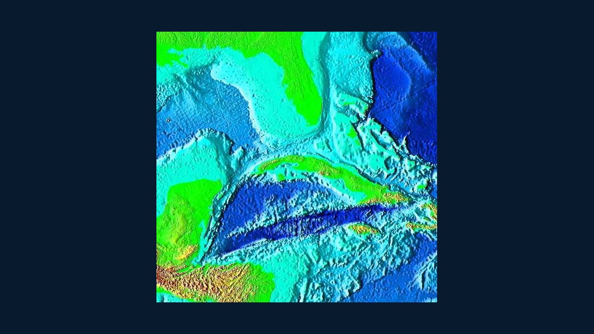
The Cayman Trench reaches approximately 25,216 feet, or 7,686 meters, below sea level. The Cayman Islands Department of Environment uses that figure for the deepest part of the Caribbean Sea. It is deep enough to place the trench floor more than 4.7 miles beneath the surface.
Also called the Cayman Trough and historically the Bartlett Deep, the feature runs through the western Caribbean south of Cuba and the Cayman Islands. It is not a classic subduction trench. It is a pull-apart basin along the boundary between the North American and Caribbean tectonic plates.
Maximum depth should not be confused with the depth immediately offshore from Grand Cayman. The island stands on the Cayman Ridge and its shelf drops steeply, but the trough’s deepest depression lies farther south within a much larger tectonic system.
Pressure increases by about one atmosphere for every 10 meters of seawater. Near the maximum depth, an object experiences roughly 770 atmospheres before small corrections for seawater density and local conditions. Human divers cannot approach such depth, so mapping and sampling require sonar, robotic vehicles or instruments lowered from ships.
Names can create another misunderstanding. “Trench” is common in public descriptions, while geologists often prefer “trough” because the basin’s tectonic origin differs from a subduction trench. Both labels refer to the same broad Caribbean feature.
Bathymetric charts report negative elevation or positive depth depending on convention. A value of 7,686 meters below sea level and a depth of 7,686 meters describe the same approximate vertical distance when the sea surface is the reference.
The deepest point is about 7,686 meters
The Cayman Islands government’s marine environment overview places the maximum depth at 25,216 feet, equivalent to 7,686 meters. Rounded descriptions often say more than 25,000 feet. The precision of a depth estimate depends on the bathymetric survey and the vertical reference used.
That maximum applies to the trough’s deepest depression, not its entire floor. Broad areas are shallower and the Mid-Cayman spreading center has an axial depth greater than 6,000 meters in places. Underwater ridges and fault scarps create strong relief across the basin.
The trench is the Caribbean’s deepest area, but the nearby Puerto Rico Trench is deeper. Its Milwaukee Deep exceeds 8,000 meters. The Cayman feature is remarkable for combining great depth with an active seafloor-spreading center.
For scale, the Cayman maximum is more than six times the height of the Empire State Building. It is still shallower than Challenger Deep in the Pacific, which approaches 11,000 meters. These comparisons describe vertical relief rather than the distance a research vehicle travels along a sloping route.
A transform boundary pulled the basin apart
The North American Plate moves relative to the Caribbean Plate along a left-lateral transform system. Sections of the fault boundary are offset, creating space for the crust to stretch and subside. Geologists describe the result as a pull-apart basin.
The trough extends roughly east-northeast to west-southwest. Instead of one narrow groove, it contains ridges and multiple deep sections. Fault motion continues, so earthquakes occur along the boundary and its connected fault zones.
This origin differs from trenches formed where one tectonic plate bends beneath another. Argo’s explanation of how subduction trenches form describes the more familiar mechanism. The Cayman Trough gains depth through extension and transform motion rather than a descending slab.
The basin began opening tens of millions of years ago as motion displaced the Caribbean Plate relative to North America. Magnetic patterns on the seafloor record stages of spreading. Modern rates remain slow enough that centimeters of plate movement accumulate over years, while the basin records the result across geological time.
The Mid-Cayman Rise creates new seafloor
Near the center lies the Mid-Cayman Spreading Centre, a roughly north-south ridge where plates separate and new oceanic crust forms. Its full spreading rate is less than 20 millimeters per year, qualifying it as ultraslow.
Peer-reviewed seismic work describes the ridge as the deepest known seafloor spreading center, with its axis below 6,000 meters in places. Slow spreading produces rugged terrain because tectonic extension can dominate over the supply of magma.
Oceanic core complexes occur along the ridge flanks. Faulting exposes rocks that formed deeper in the crust or upper mantle. These structures give researchers access to geological material usually hidden beneath younger volcanic rock.
Spreading does not proceed at a constant balance between faulting and volcanism. Some ridge sections receive more magma, while others stretch through large faults. That alternation helps explain why crustal thickness and seafloor shape vary over relatively short distances.
The crust is unusually thin
USGS researchers modeled gravity measurements to infer major differences in crustal thickness along the trough. Within about 50 kilometers of the spreading center, the crust may be only 2 to 3 kilometers thick. Typical oceanic crust is often closer to 6 or 7 kilometers.
The USGS gravity study found apparent thickness increasing away from the center. Some of that signal is interpreted as serpentinized mantle rather than a larger volume of true oceanic crust.
Serpentinization occurs when seawater reacts with mantle rock. The reaction changes minerals and lowers rock density, affecting seismic speeds and gravity. Samples of serpentinized peridotite dredged from the trough support the interpretation.
The reaction can also release hydrogen, a potential chemical energy source for microbes. Geologists therefore study serpentinized systems for both crustal structure and habitability. The Cayman Trough places those processes under an unusually tall column of seawater.
Deep hydrothermal vents occupy the ridge
Seawater can enter fractures, warm near hot rock and return carrying dissolved chemicals. At the Mid-Cayman Rise, this circulation supports hydrothermal vents at exceptional depth. The Beebe, or Piccard, vent field lies nearly 5,000 meters down.
Pressure at that depth is roughly 500 times atmospheric pressure at sea level. Vent fluids remain liquid at temperatures far above the normal boiling point because pressure raises the boiling threshold. Microbes use chemical energy, supporting communities beyond the reach of sunlight.
The vent field is shallower than the trough’s deepest point, so “deepest vent” and “deepest trench” are separate records. Argo’s guide to deep-sea hydrothermal vents explains how chemosynthesis supports life in such places.
Vent chemistry differs between sites because the circulating water reacts with different rocks. At the Von Damm field on an oceanic core complex, fluids interact with exposed deep-crust material. At Beebe, very hot fluids rise from the axial rift. Comparing them helps scientists separate the effects of rock type, heat supply and subsurface circulation.
Sonar turns travel time into a depth map
Ships map the seafloor by sending sound pulses downward and measuring their return. Sound speed through seawater varies with temperature, salinity and pressure, so survey teams correct the travel times before converting them into depth.
Multibeam sonar sends many beams across a wide swath, producing a three-dimensional bathymetric map. NOAA’s 2011 Mid-Cayman Rise expedition mapped nearly 11,000 square kilometers during 11 days of work. Remotely operated vehicles then examined selected areas at close range.
Maps remain incomplete at the finest resolution because survey ships cover limited swaths. Argo’s report that only 28 percent of the global seafloor had been mapped to modern standards places the challenge in perspective. Focused expeditions can resolve a ridge or vent field far better than the surrounding ocean.
Depth figures can improve as surveys gain better coverage and positioning. The most useful plain-language answer remains approximately 25,216 feet deep. That number describes the deepest known point in a complex tectonic basin whose scientific importance extends from thin crust to ultraslow spreading and hydrothermal life.





