
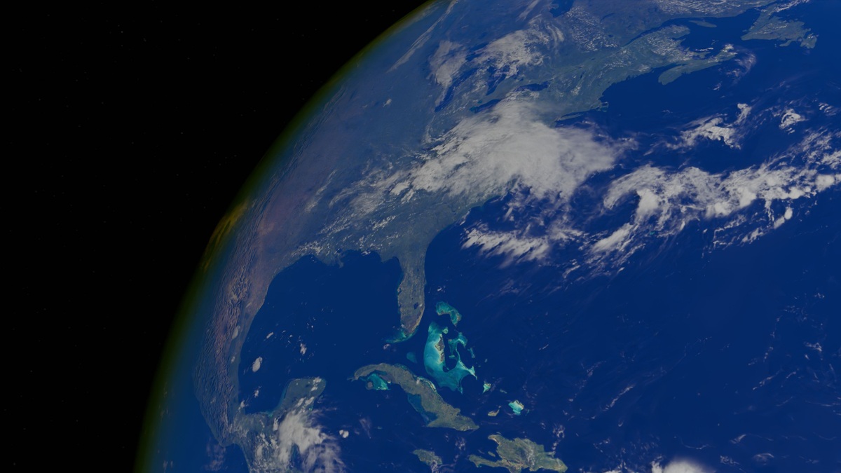
The Atlantic Ocean covers about 106.5 million square kilometers, or 41.1 million square miles, when its connected seas are included. It occupies roughly one-fifth of Earth’s surface and separates the Americas from Europe and Africa.
NOAA’s estimate of the Atlantic Ocean’s size makes it the world’s second-largest ocean basin after the Pacific. The figure can vary among references because geographic boundaries and the treatment of marginal seas are not always identical.
Area alone barely conveys its scale. The Atlantic spans both hemispheres from Arctic waters to the Southern Ocean. Important shipping routes cross the basin, whose waters also support major fisheries and climate currents.
How large is the Atlantic Ocean?
At its widest, the Atlantic stretches thousands of miles between continental coasts. Its outline resembles an elongated S that narrows near the equator, then opens broadly across the North and South Atlantic. The equator provides the usual boundary between those two named regions.
The basin’s surface area includes deep open water plus shallower continental shelves. Broad Atlantic statistics often count major adjacent seas, including the Caribbean and Mediterranean. Excluding them produces a smaller number, which explains some differences between atlases.
NOAA places the Atlantic at about 20 percent of Earth’s total surface. Oceans collectively cover more than 70 percent, so the Atlantic represents a large share of the planet’s water-covered area even though it is only a little more than half the Pacific’s size.
Where the Atlantic begins and ends
North and South America form the western boundary. Europe and Africa form the eastern side. The ocean connects with the Arctic in the north and meets the Southern Ocean around Antarctica in the south.
Ocean boundaries are scientific conventions rather than walls in the water. The International Hydrographic Organization publishes standards used to name and describe seas. Different datasets may select slightly different lines for statistical purposes.
The Caribbean Sea and Gulf of Mexico connect through narrow passages and feed water toward the Gulf Stream. The Mediterranean exchanges water with the Atlantic at the Strait of Gibraltar. In the far north, channels around Greenland link the Atlantic with Arctic basins.
Scientists also describe the Atlantic through water masses rather than map lines. Salinity and temperature determine density, helping identify water that formed in a particular region even after currents carry it far from its origin.
A deep basin with a mountain chain
Average depth is another way to describe ocean scale. Much of the Atlantic lies several kilometers below sea level, while continental shelves form broad, shallow margins. Trenches provide the deepest points and submarine canyons cut across some slopes.
The Mid-Atlantic Ridge runs down the basin like an underwater seam. The U.S. Geological Survey describes it as a divergent plate boundary where tectonic plates move apart and new oceanic crust forms.
Parts of the ridge rise above sea level in Iceland and on other volcanic islands. Most remains hidden beneath the ocean, dividing eastern and western deep basins. Transform faults offset the ridge into many segments.
Bathymetric maps reveal abyssal plains and seamounts beyond the ridge, with fracture zones cutting across parts of the basin. The international GEBCO project assembles seafloor data into a global grid by combining ship soundings with other measurements.
Large areas remain mapped less precisely than coastlines on land. Satellite gravity can infer broad seafloor shape, while ships using multibeam sonar collect much finer tracks. The contrast in resolution is visible in many ocean maps.
The Atlantic is still widening
The modern Atlantic began opening as the supercontinent Pangaea broke apart. Rifting separated land that would become the Americas from Africa and Europe, allowing seawater to enter the growing basin.
New crust continues to form along the Mid-Atlantic Ridge. The USGS plate-motion explanation gives an average spreading rate of about 2.5 centimeters per year. Rates vary along the ridge and motion is divided between plates on either side.
Two and a half centimeters sounds trivial, roughly comparable to annual fingernail growth. Sustained for millions of years, the movement shifts continents by enormous distances. Rocks nearest the ridge are generally younger than oceanic crust closer to the continental margins.
The Atlantic does not expand without changes elsewhere. Oceanic crust is recycled into Earth’s mantle at subduction zones, especially around the Pacific. Plate tectonics reorganizes all ocean basins over geological time rather than increasing Earth’s surface indefinitely.
Water moves through the basin
The Atlantic’s dimensions influence how heat travels between the tropics and high latitudes. Wind-driven gyres circulate through the North and South Atlantic. Along the western boundaries, currents become narrow and fast.
The Gulf Stream carries warm water northward from the Florida Straits before turning east across the ocean. Farther north, cooling helps form deep water as mixing carries surface properties downward. That deep water returns south as part of the Atlantic’s role in global climate.
Rivers also leave a continental signal. The Amazon delivers freshwater and sediment far into the tropical Atlantic. African dust crosses the basin through the atmosphere and supplies minerals to ocean waters. Some of it reaches the Caribbean or Americas.
Hurricanes draw energy from warm surface water and can cross much of the tropical basin. Their tracks connect conditions near Africa with hazards in the Caribbean and North America, another reminder that distances on a map are joined by moving air and water.
The NOAA currents tutorial explains how winds, tides, density differences and Earth’s rotation drive circulation at different scales. The Atlantic contains all of these processes at once.
People have crossed it for centuries
Coastal communities used Atlantic waters long before written records and ocean crossings linked societies over time. Modern routes carry containers alongside energy products. Bulk cargo also moves between some of the world’s largest ports.
Submarine cables follow surveyed paths across the seabed, carrying most intercontinental digital communications. Fishing fleets work productive shelf seas and upwelling regions. The same basin supports tourism and offshore energy, while scientific observatories record its changing conditions.
Scale creates management challenges. Pollution can cross borders while fish stocks move among jurisdictions. Greenhouse gases alter the entire ocean. International observation networks are essential because no country can monitor the full Atlantic alone.
Measurements from ships, moorings, satellites and autonomous floats give the basin a changing set of vital signs. Surface temperature is only one layer; scientists also track salinity, oxygen, carbon, currents and sea level.
Why size estimates need context
A single area figure is useful for comparison, yet it depends on a definition. Some sources include the Atlantic’s marginal seas, while others focus on the main basin. Map projections can also make northern waters appear larger than they are.
Digital calculations use coastlines and boundary polygons at a chosen resolution. Including small bays and detailed shorelines can alter totals slightly. Sea level adds another complication at fine scales, especially where ice cover or coastlines change.
The robust conclusion remains clear across reasonable methods: the Atlantic is Earth’s second-largest ocean and covers about one-fifth of the planet. Depth and circulation give its size physical context, while geological history explains how the basin grew. A boundary number alone misses that motion.
The number 106.5 million square kilometers describes the surface. Beneath it lies a basin still opening at its central ridge, crossed by currents that affect weather and climate on neighboring continents. The ocean also stores heat and carbon across a huge volume, so depth changes its environmental scale. Observation networks follow conditions through that volume and connect changes near one shore with processes far offshore. Geography and volume give the statistic meaning within an ocean that remains in motion.
Related reading: how the Atlantic basin moves heat and countries with Atlantic and Pacific coasts.





