
The Atlantic Ocean is still growing. Along its long central ridge, pieces of Earth’s crust slowly pull apart and fresh seafloor forms between them. That hidden process began after the supercontinent Pangaea broke up, then built the broad S-shaped basin between the Americas and Europe and Africa. Today the Atlantic is a living part of Earth’s climate system, trade routes, food webs and coastal weather.
Its immense scale can disguise its moving parts. NOAA puts the Atlantic basin at about 106.46 million square kilometers, or 41.105 million square miles, making it Earth’s second-largest ocean basin. That figure comes from a NOAA basin estimate that includes the Atlantic’s connected marginal seas. The ocean’s familiar map shape also links very different environments, from icy northern waters to tropical reefs and stormy Southern Ocean latitudes.
A basin between four continents
North and South America form the Atlantic’s western side. Europe and Africa lie to the east. It opens northward toward the Arctic Ocean and southward toward the Southern Ocean. Oceanographers commonly describe a North Atlantic and a South Atlantic. The equatorial region forms a broad transition between them.
Several major seas are tied to the basin. The Caribbean Sea and Gulf of Mexico connect through the Americas. The Mediterranean communicates with the Atlantic through the Strait of Gibraltar. Far offshore, the Sargasso Sea has no coastline at all. It is defined by currents that circle a large area of the North Atlantic and gather floating Sargassum seaweed.
Coasts make the Atlantic especially important to people. Its bays, estuaries, shelves, islands and enclosed seas have supported ports and fisheries for centuries. The same geography can also focus danger. Tropical cyclones draw energy from warm water, while storm surge and rising sea level can push water into low-lying communities. Conditions vary widely from one shore to another because winds, currents, tides, seafloor shape and local landforms all matter.
Why measurements differ
A single number rarely captures the Atlantic’s size. Area totals depend on the boundary a source chooses. Some references count the Mediterranean, Caribbean, Gulf of Mexico, Baltic and other marginal seas within the Atlantic system. Others measure the open Atlantic basin separately. The 106.46-million-square-kilometer NOAA figure uses the wider ocean-basin convention. Comparing totals requires checking that convention first.
Depth figures need the same care. An average depth is a mean across a selected area, including shallower continental margins when they are included. A maximum depth identifies one small place. The deepest part of the Atlantic is in the Puerto Rico Trench, north of Puerto Rico. Modern seafloor maps improve these estimates over time, so rounded values and labels are more useful than pretending every source uses identical survey coverage.
Volume combines area and depth, so it changes with the boundary definition too. It describes the water held in a chosen basin. Surface area is a separate measurement. Those distinctions explain why an atlas, an oceanographic data set and a general reference can all give different Atlantic area, average-depth, or volume values while describing the same connected ocean.
Survey technology adds another layer of change. NOAA’s National Centers for Environmental Information released ETOPO 2022, a global relief model that combines bathymetry, topography and shoreline data at 15-arc-second resolution. A data product such as this can refine a map while leaving the basic boundary question unresolved. A published area, volume, or mean-depth figure should therefore identify both the chosen ocean limits and the underlying seafloor data when precise comparison matters.
A seafloor made at a ridge
Deep beneath Atlantic waves, the Mid-Atlantic Ridge runs roughly down the basin’s middle. It is part of the worldwide chain of mid-ocean ridges. Here, tectonic plates move apart. Hot material rises from below, cools and becomes new oceanic crust. The ridge’s high terrain divides many deep basins on either side.
USGS describes the ridge as a classic divergent plate boundary and estimates its average spreading rate at about 2.5 centimeters per year. Over millions of years, that small yearly motion has widened the Atlantic enormously. The agency’s account of the plate motion also explains why its volcanic ridge extends from the Arctic region toward the far South Atlantic.
Magnetic minerals locked into cooling lava preserve the direction of Earth’s magnetic field at the time the rock formed. Symmetrical bands on both sides of the ridge became powerful evidence for seafloor spreading. Iceland offers an unusual view of this process because part of the ridge rises above sea level there. Most of the system remains far below the surface, where earthquakes, volcanoes and hydrothermal activity continue to reshape the seafloor.
Currents that carry heat and salt
Water in the Atlantic moves at the surface and through the deep ocean. Winds drive broad surface currents, including the clockwise subtropical circulation in the North Atlantic and the counterclockwise circulation in the South Atlantic. Earth’s rotation bends moving water, helping organize these large loops. Coastlines and seafloor features steer them further.
In the North Atlantic, warm salty surface water moves toward higher latitudes. As it loses heat to the air, some becomes denser and sinks. That deep water flows southward and is part of the Atlantic meridional overturning circulation. NOAA calls the wider connected pattern the global ocean conveyor. Its circulation overview explains how temperature and salinity together help power deep-water movement.
This circulation influences climate because water stores and transports heat. The Gulf Stream and its extensions help carry warm water northeastward. That transport interacts with the atmosphere, sea ice, freshwater input and changing winds. Scientists monitor the system because its strength naturally varies and because changes can affect regional weather, rainfall patterns, fisheries and sea level along some coasts.
Salt is central to the story. Evaporation removes water while leaving dissolved salts behind. Rainfall, river water, melting ice and exchanges with neighboring seas can freshen the surface. The Atlantic contains some of the world ocean’s saltiest broad surface waters, especially in dry subtropical regions. Differences in heat and salt change density, which helps connect local conditions at the surface to slow circulation at depth.
Life, coasts and pressure
Sunlit surface waters support phytoplankton, tiny drifting organisms that form the base of many marine food webs. Their growth depends on light, nutrients, temperature and mixing. Zooplankton, fish, seabirds, turtles, sharks and whales depend on these food chains in different ways. Far below the lighted zone, deep-sea animals live under cold, dark, high-pressure conditions.
Human activity reaches every part of this ocean. Fishing feeds communities and supports jobs, yet depleted stocks and bycatch can strain wildlife. Plastics, chemicals, excess nutrients and wastewater travel from land through rivers and coasts. Carbon dioxide absorbed by seawater also changes ocean chemistry. NOAA explains that ocean acidification reduces seawater’s pH and can make it harder for some organisms to build shells or skeletons.
Some Atlantic habitats need special attention because they form slowly or gather species in small areas. Coral reefs, seagrass beds, salt marshes, mangroves and deep-sea communities each provide shelter or nursery space. The Sargasso Sea supports drifting life in open water. Deep ridge environments can host organisms that use chemical energy associated with hydrothermal fluids. Protection strategies must fit the ecology and the place, from a coastal wetland to waters beyond national jurisdiction.
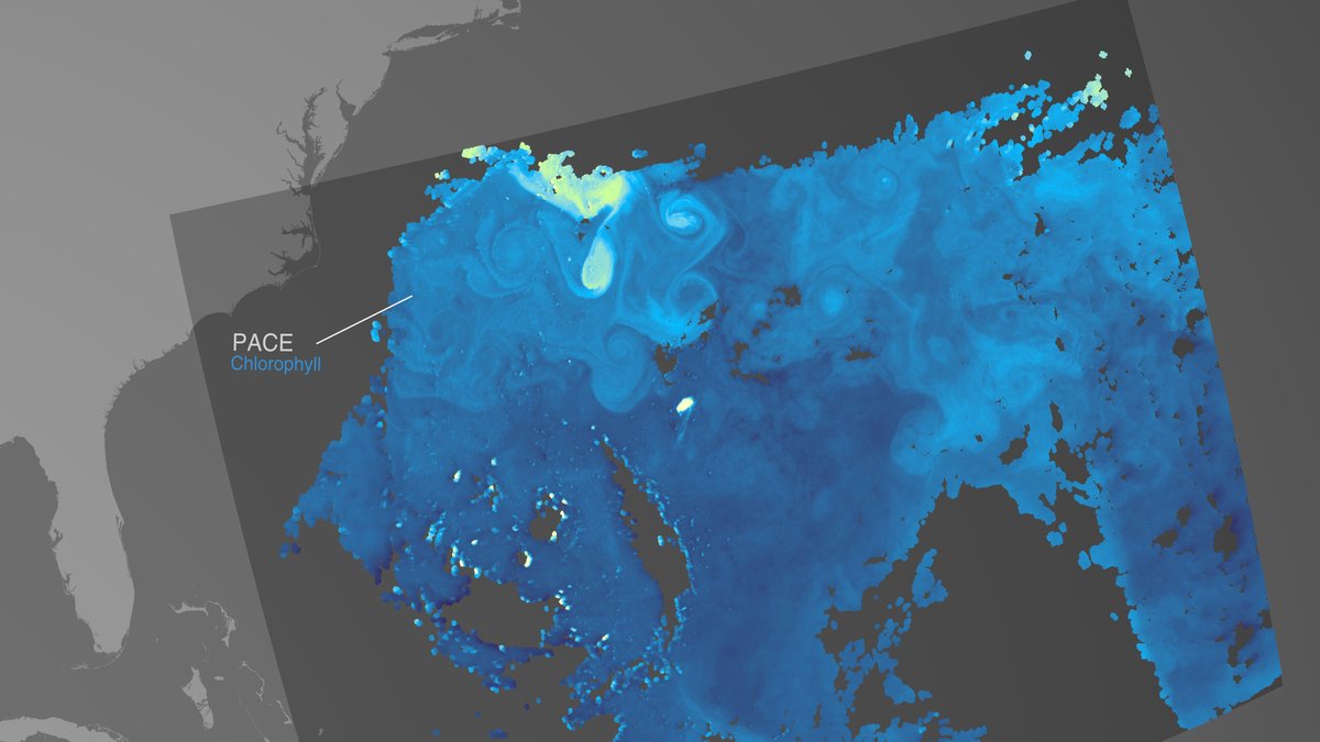
Protecting Atlantic ecosystems depends on observations as much as rules. Satellites track sea-surface temperature and color. Buoys, floats, research ships, tide gauges and seafloor instruments add measurements that satellites cannot collect alone. Together, those records help scientists follow warming, oxygen changes, currents, storms and marine habitats across a basin that is both ancient in origin and actively changing today.





