
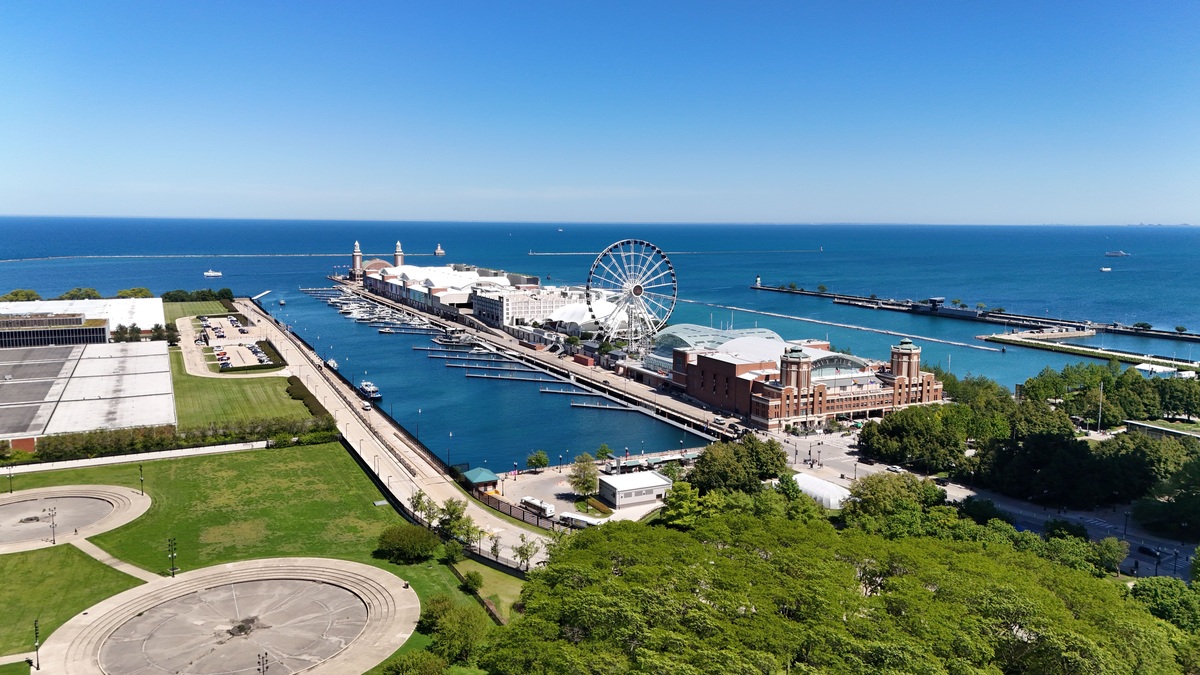
Lake Michigan is an inland freshwater sea with dimensions that are easier to grasp one fact at a time. The measurements below use basin-wide figures from the U.S. Environmental Protection Agency and Michigan’s environmental agency. Shoreline length and elevation can vary by method and water level, so each number is best read with its definition.
1. Lake Michigan lies entirely within the United States
Lake Michigan is the only Great Lake located wholly within one country. Its shores belong to Michigan, Wisconsin, Illinois and Indiana. The other four Great Lakes cross the international boundary between the United States and Canada.
The lake still belongs to a binational water system. Water flows through the Straits of Mackinac into Lake Huron, then continues through the lower Great Lakes and the St. Lawrence River. Political borders do not isolate its currents or migrating organisms.
2. It covers about 22,300 square miles
Lake Michigan’s surface area is approximately 22,300 square miles, or 57,800 square kilometers. It ranks third among the five Great Lakes by surface area, after Superior and Huron when the traditional lake names are counted separately.
Surface area is not volume. Lake Michigan holds more water than Lake Huron despite covering slightly less area because Michigan is deeper on average. It contains far more water than shallow Lake Erie.
3. Its deepest point is 925 feet
The lake reaches a maximum depth of 925 feet, or 282 meters. That deepest spot is a small part of a complex basin, so it does not describe ordinary nearshore conditions.
The average depth is about 279 feet. Argo’s article on how much water Lake Michigan contains explains how depth and basin shape combine to produce its enormous volume.
4. Lake Michigan holds about 1,180 cubic miles of water
The EPA lists a volume of 1,180 cubic miles, equivalent to roughly 4,920 cubic kilometers. By volume, Michigan is the second-largest Great Lake after Superior.
Volume affects how slowly the lake responds to persistent pollution and climate shifts. A large lake can dilute a contaminant, yet its enormous storage also means water and dissolved substances may remain for decades.
5. Water remains for about 99 years
Lake Michigan has an estimated retention time of 99 years. Retention time is a basin-scale average calculated from volume and outflow, not a timer for an individual drop of water.
Nearshore currents can move water rapidly along the coast, while some material circulates within the basin. The long average helps explain why preventing pollution is usually easier than removing it after it has dispersed.
The estimate also helps researchers compare lakes. Erie replaces its water much faster, while Superior retains water longer. The EPA’s Great Lakes figures place those measurements within one consistent reference set.
6. Michigan and Huron share the same water level
The Straits of Mackinac form a deep, wide connection between Lakes Michigan and Huron. Water moves in both directions through the straits and the two lakes maintain essentially the same surface elevation.
Hydrologists can treat them as Lake Michigan-Huron, a single water body with two large lobes. Traditional geography retains the separate names. Argo examines the connection in Are the Great Lakes connected?
The shared level means neither lake sits upstream of the other in the simple way Superior sits upstream of the St. Marys River. Wind and atmospheric pressure can drive temporary back-and-forth flow through the straits.
7. Four states border the lake
Wisconsin lies along the western shore and Michigan wraps around much of the north and east. Illinois and Indiana meet the southern end. Chicago and Milwaukee place large metropolitan populations directly on the basin.
The northern coast is generally less urbanized than the south. That contrast influences shoreline development, runoff and habitat. State boundaries also mean fishing and boating rules can change across the lake.
8. It is about 307 miles long
Lake Michigan extends roughly 307 miles, or 494 kilometers, from north to south. Its maximum breadth is about 118 miles. The scale allows strong winds to build waves over long stretches of open water.
Its length also spans a substantial climatic gradient. The northern basin freezes more extensively and remains cooler, while the southern basin is influenced by dense urban development and warmer seasonal conditions.
9. The lake has about 1,600 miles of shoreline
Official summaries give shoreline lengths around 1,638 to 1,659 miles, depending on dataset and method. Coastline measurements change with map scale because a detailed tracing captures more curves than a coarse one.
Beaches, bluffs, wetlands and engineered waterfronts all occur along that edge. The shoreline is dynamic: waves erode some sections and deposit sand elsewhere. Water level changes shift the position where land and lake meet.
10. Its watershed is larger than the lake
The land drainage area covers about 45,600 square miles. Rain and melting snow flow through tributaries, wetlands and groundwater before reaching the lake. What happens inland can therefore affect coastal water quality.
The full basin, including the lake surface, covers about 67,900 square miles. Argo’s Lake Michigan watershed article follows those connections in more detail.
11. Glaciers excavated and reshaped the basin
Repeated continental glaciation deepened lowlands and rearranged drainage across the region. Retreating ice left sediment ridges and meltwater routes that helped establish the modern lake.
The present shoreline developed as ice disappeared and outlets changed. Glacial history also explains many surrounding dunes, buried valleys and inland lakes. The broader sequence appears in Argo’s account of how the Great Lakes formed.
12. Lake Michigan has the world’s largest freshwater dune system
Large coastal dunes line portions of the eastern and southern shore. Sand supplied by glacial deposits is moved by waves, then carried inland by wind. Plants stabilize some dunes while exposed areas continue to migrate.
The National Park Service protects major examples at Sleeping Bear Dunes and Indiana Dunes. The Indiana Dunes explanation describes how Lake Michigan, wind and changing shorelines formed the park’s dune complexes.
13. More than 80 fish species use Great Lakes coastal wetlands
Great Lakes coastal wetlands provide feeding, spawning or nursery habitat for more than 80 fish species across the system. Lake Michigan’s wetlands are part of that network, although no single marsh contains every species.
Open-water fish live alongside nearshore communities adapted to vegetation and warmer shallows. Argo’s guide to fish in Lake Michigan explains the mix of native species, stocked salmonids and established invaders.
14. The lake supplies drinking water to major cities
Chicago, Milwaukee and many smaller communities draw drinking water from Lake Michigan. Treatment plants remove particles and disinfect the water before distribution. Source-water protection remains essential because treatment has limits and failures can be costly.
Withdrawals are governed within the wider Great Lakes legal framework. Most water use is returned to the basin after treatment, while diversions receive special scrutiny. Chicago’s historic diversion sends some Lake Michigan water toward the Mississippi watershed.
15. Dangerous currents can form near shore
Lake Michigan can produce rip currents and structural currents near piers. Waves breaking at an angle generate alongshore flow, while gaps in sandbars can concentrate water moving away from the beach. Cold water adds another hazard even on sunny days.
Beach flags and local forecasts reflect current conditions. The National Weather Service advises swimmers to stay away from piers during high waves and to follow lifeguard instructions. Argo’s Lake Michigan swimming guide covers those risks and practical precautions.
The National Weather Service beach-hazard program provides forecasts for dangerous waves and currents. Conditions can differ between nearby beaches because shoreline shape, piers and wind direction influence local flow.
Together, these 15 facts show why Lake Michigan functions as both a lake and an inland sea. Its water connects four states, supports cities and wildlife and responds slowly to lasting changes. The strongest figures come with clear units and definitions rather than isolated superlatives.
Measurements can be revised as mapping improves, but the governing distinctions remain stable: surface area differs from volume, maximum depth differs from average depth and Lake Michigan remains connected to Huron through the Straits of Mackinac.





