
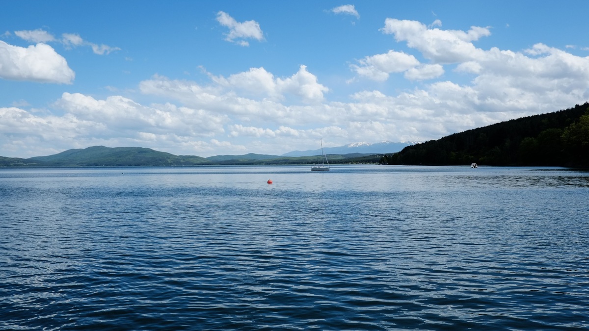
Lake Champlain is the deepest lake touching New England. It reaches 400 feet between Charlotte, Vermont and Essex, New York. Because the state line runs through the lake, part of that deepest water belongs to Vermont, though the lake also extends through New York and into Quebec.
If the question is restricted to lakes located entirely within New England, Maine’s Sebago Lake is the leading answer in current state data at 316 feet. The wording changes the result, so both definitions deserve to be stated clearly.
Lake depth is measured from the water surface to the bottom, not from sea level. Champlain’s surface sits roughly 96 feet above sea level on average, so its deepest bed lies below sea level. Sebago and Willoughby occupy higher terrain, making their bottom elevations different even when their water columns are compared directly.
Maximum-depth rankings also depend on whether reservoirs are admitted. The answer here compares named natural lakes and uses figures published by basin or state authorities. Small private pits and unverified local claims are excluded.
New England consists of Maine, Vermont, New Hampshire, Massachusetts, Connecticut and Rhode Island. New York is outside the region, which is why Lake Champlain’s cross-border position requires a qualifier even though its Vermont shore is extensive.
In ordinary regional usage, Lake Champlain is therefore the strongest concise answer. A careful reference article should preserve the qualifier so readers using the stricter boundary rule also receive the correct Sebago result.
Lake Champlain reaches 400 feet
The Lake Champlain Basin Program lists a greatest depth of 400 feet, or 122 meters. The deepest point lies in the broad main lake between Charlotte on the Vermont shore and Essex on the New York shore. Average depth is much lower at 64 feet.
The official Lake Champlain facts also give a length of 120 miles and a maximum width of 12 miles. Water flows north into Quebec’s Richelieu River and eventually reaches the St. Lawrence River.
Lake Champlain crosses political boundaries, but Vermont is one of the six New England states. A lake need not lie wholly within a region to touch it. Under that ordinary geographic reading, its 400-foot maximum makes it New England’s deepest lake.
Its size also makes the comparison useful beyond depth. Lake Champlain covers about 455 square miles and contains more than 70 islands. Argo’s ranking of the largest lakes in North America uses surface area instead, illustrating why different metrics produce different lists.
The state boundary passes through the lake
Most of Lake Champlain separates Vermont from New York. Its northern waters enter Quebec, while the southern reach narrows toward Whitehall, New York. The international and state boundaries complicate simple regional superlatives.
The deepest area is close to the line between Vermont and New York. Charts and boundary descriptions are required to assign a precise patch of water to one jurisdiction, but the basin as a whole clearly includes New England.
Regional rankings often include border features. Lake Champlain is commonly discussed as both a Vermont lake and a New York lake, just as rivers can belong to two states. Readers who require every shoreline to fall within New England are using a narrower rule.
Quebec’s small share adds an international dimension. Management therefore involves agencies and communities on both sides of the border. The Lake Champlain Basin Program coordinates work across jurisdictions because water quality and invasive species follow the watershed rather than state lines.
Sebago is deepest wholly within New England
Sebago Lake lies entirely in Maine. The Maine Natural Areas Program lists a maximum depth of 316 feet and an average depth of 107 feet. On the narrower all-shorelines-within-New-England definition, that current official figure puts Sebago first.
Lake Willoughby lies entirely in Westmore, Vermont. The Vermont Lake Score Card gives a maximum depth of 308 feet. Older references vary by a few feet because surveys and chart datums differ, but current state data support 308 feet.
Glacial ice cut the lake’s steep, narrow basin between Mount Pisgah and Mount Hor. The surrounding cliffs make it appear fjord-like, although it is a freshwater glacial lake with no direct marine connection.
Older tourism references sometimes give Willoughby depths above 320 feet, which would reverse the order. The state scorecard’s 308-foot maximum and Maine’s 316-foot Sebago figure provide the most consistent current official comparison. A cautious ranking should identify its sources because small revisions can change the result.
Sebago and Moosehead are Maine’s deep lakes
Maine’s natural-resources assessment identifies Sebago Lake as the state’s deepest at a maximum of 316 feet. Sebago is shallower than Lake Champlain’s 400-foot basin but may exceed Vermont’s current 308-foot Lake Willoughby listing.
Moosehead Lake, Maine’s largest lake by surface area, reaches 246 feet according to the Maine Department of Inland Fisheries and Wildlife. Its broad open water makes it visually immense, yet surface area and depth measure different properties.
These official figures expose a common problem with lake rankings. One agency may update a depth chart while older tourism pages continue to repeat another value. Water level, sounding methods and chart datum can also produce small differences.
A sonar sounding measures the water column at a point, while a bathymetric map interpolates between many soundings. Modern GPS improves horizontal position and surveyors correct depth for lake level. A deeper pocket can be missed when old survey lines are widely spaced, which is one reason updated figures deserve preference.
New England’s best-known lakes are not necessarily its deepest. Surface area, shoreline length and volume each answer a separate question. Argo’s survey of famous lakes in the United States offers a broader geographic comparison rather than a depth ranking.
Glaciers produced the region’s deepest basins
New England’s deep lakes occupy landscapes modified by the Laurentide Ice Sheet. Moving ice followed weak rock and existing valleys, widening them and excavating basins. Glacial debris later blocked outlets in some places as the ice retreated.
Lake Champlain’s history also includes the Champlain Sea, a temporary marine inlet that flooded the depressed region after deglaciation. Land rose as the crust recovered from the ice load, cutting the basin off from the ocean and leaving the modern freshwater lake.
Lake Willoughby’s U-shaped trough offers a more compact example of glacial scouring. The same general process produced many New England lakes, though local bedrock and drainage determined their final depth.
Sebago occupies another glacially modified basin. Ice erosion, meltwater and deposited sediment combined to define its shoreline and outlet. The region’s lake depths therefore record local geology as well as the broad passage of continental ice.
Depth affects temperature and oxygen
Deep water allows lakes to stratify in summer. Warm surface water forms an upper layer, while colder dense water remains below. The transition between them limits mixing and can create different habitats within one basin.
Lake Champlain’s main lake has a warm surface layer that commonly extends about 33 feet down in summer. Below it, temperature changes rapidly through the thermocline. Cold-water fish depend on deeper habitat retaining enough dissolved oxygen.
The direct answer therefore needs one qualifier: Lake Champlain is deepest among lakes that extend into New England, at 400 feet. For lakes completely enclosed by the region, current state datasets put Maine’s Sebago first at 316 feet, narrowly ahead of Vermont’s Lake Willoughby at 308 feet.
Neither maximum depth describes the experience of the whole lake. Champlain averages only 64 feet despite its 400-foot pocket. Sebago’s official average of 107 feet is deeper, even though its maximum is smaller. Maximum and mean depth should never be substituted for each other.





