
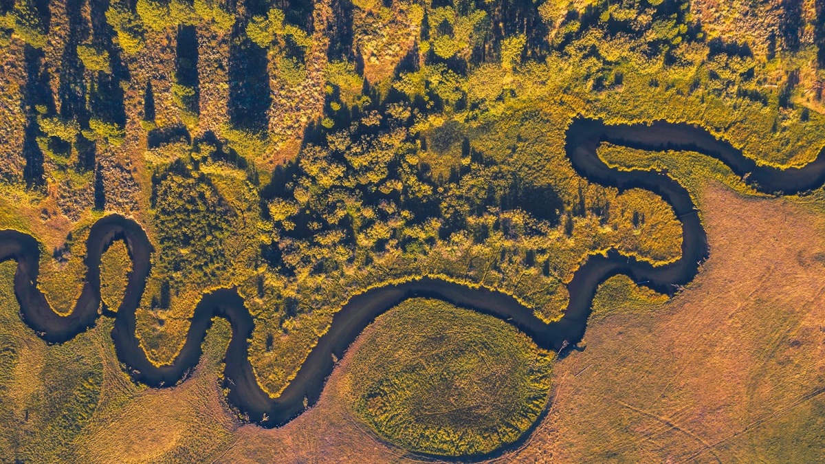
Watershed, drainage basin and catchment usually describe the same core feature: an area of land whose surface water drains to a common outlet. The preferred word changes by country, profession and mapping system. Scale and the chosen outlet matter more than the label.
In some older geographic usage, “watershed” means the high boundary separating basins. Modern U.S. water agencies generally use watershed for the drainage area itself and call the boundary a drainage divide.
The shared definition begins with an outlet
Choose a point on a stream, lake outlet or coast. The contributing land upstream of that point is its drainage area. Rain or snowmelt moving downhill within the boundary can eventually reach the selected outlet.
The USGS treats watershed, drainage basin and catchment as interchangeable in common use. Its definition includes all land draining streams and rainfall to a shared outlet.
The outlet controls the boundary. Moving the point downstream enlarges the basin by adding tributary areas. Moving upstream isolates a smaller contributing area.
Watershed is common in the United States
U.S. environmental programs often use watershed for an area surrounding a river, lake or estuary. The word appears in restoration plans, water-quality assessments and community projects.
The EPA defines a watershed as land that drains to a stream, lake or river. It emphasizes that conditions on the land affect the receiving water.
Watershed can refer to almost any scale in ordinary discussion. A neighborhood creek has one and so does the Mississippi River. A speaker should identify the outlet or named water body to remove ambiguity.
Drainage basin emphasizes the river system
Drainage basin is widely used in geography and hydrology. It often suggests the full area drained by a named river and its tributaries, although it can also describe a small study area.
A river-basin map shows branching channels inside a topographic boundary. Argo’s maps of the major rivers and watersheds of Nebraska illustrate how several basin areas organize a state’s surface drainage.
Basin can be confusing because geology also uses the word for structural depressions that may contain sediment. A groundwater basin can cross a surface drainage divide. The phrase drainage basin makes the surface-water meaning explicit.
Catchment is widely used outside North America
Catchment is standard in Britain, Australia and many international technical publications. A water-supply catchment commonly means the land contributing runoff to a reservoir or intake.
The word highlights collection: precipitation falling within the boundary is routed toward a shared point. Losses to evaporation, plant use and infiltration mean only part of that precipitation becomes streamflow.
Researchers sometimes use catchment for a relatively small experimental basin, but no universal size threshold separates it from a watershed. The study’s defined outlet and mapped boundary remain decisive.
Subwatersheds nest inside larger basins
Every tributary has its own contributing area. Those smaller units combine into progressively larger basins downstream. This nested structure lets scientists analyze a pollution source or flood contribution at a useful scale.
The United States organizes hydrologic units in a hierarchy of codes. The USGS drainage-area program notes that calculations of runoff and flood statistics depend on the chosen contributing area.
Administrative hydrologic units are designed for consistent mapping and may not match every colloquial basin name. A code should not be assumed to represent the precise drainage area above any arbitrary point.
A drainage divide forms the surface boundary
Ridges and local high ground usually separate neighboring basins. Water falling on opposite sides follows different downhill routes. The line connecting those high points is a drainage divide.
Flat land makes divides difficult to see. Wetlands, artificial ditches and storm drains can redirect flow. Digital elevation models help delineate boundaries, but culverts and engineered channels require corrections.
Continental divides separate drainage toward different oceans or major terminal basins. Smaller divides occur between neighboring creeks and may cross an ordinary field.
Groundwater may ignore the surface line
A topographic watershed follows surface flow. Underground water responds to hydraulic head and geology, so a groundwater catchment can extend across the mapped surface divide.
Karst aquifers provide clear examples. Water entering a sinkhole may travel through conduits beneath a ridge and emerge in another surface basin. Dye tracing can reveal connections that contours alone miss.
The USGS report on groundwater and surface water explains how flow paths connect recharge areas with streams. Watershed studies that involve wells or springs may need both surface and subsurface boundaries.
Why the terminology matters in practice
Water-quality rules often assign responsibility by contributing area. Runoff from farms, streets or construction sites can reach the same receiving channel even when the sources lie in different jurisdictions.
Flood forecasts use basin rainfall and soil conditions. Reservoir operators track the catchment that supplies an intake. Ecologists examine how upstream land cover influences habitat downstream.
Argo’s Lake Michigan watershed explanation demonstrates the value of naming the receiving water and geographic extent rather than relying on terminology alone.
For most readers, the comparison has a straightforward answer: watershed, drainage basin and catchment are synonyms for land draining to one outlet. Technical work should define the outlet, scale and whether the boundary represents surface flow only. Those details prevent a vocabulary difference from becoming a mapping error.
Maps need scale and purpose
A watershed boundary derived from a fine-resolution elevation model can capture small gullies that disappear on a national map. Neither boundary is automatically wrong. Each supports a different question, from designing a culvert to comparing regional river systems.
Topographic delineation follows high ground around the upstream channel network. Geographic information systems automate much of the process by assigning flow direction to elevation-grid cells. Analysts still correct roads, bridges and culverts that confuse the digital terrain.
A lake watershed may be delineated to the lake shore, its outlet or a monitoring station on an inlet. The choice changes the contributing area. Reports should state the pour point so another analyst can reproduce the boundary.
Noncontributing areas add another complication. Water in a closed depression may evaporate or infiltrate instead of reaching the mapped outlet under ordinary conditions. Exceptional floods can create temporary connections that a simple boundary does not convey.
The most useful map pairs the vocabulary with a defined purpose. “Catchment above Station A” is more precise than “the river watershed” when several nested units share the same name. Clear labeling keeps data about rainfall, pollution and streamflow attached to the correct land area.
Legal boundaries do not always follow the basin
Terminology can also carry a policy meaning. A watershed council may organize residents around an entire river system, while a drainage district is a legal body whose boundary follows infrastructure or property decisions. Similar words do not guarantee identical jurisdictions.
International projects should record local equivalents in their metadata. A dataset labeled “catchment area” can be compared with a U.S. watershed dataset when both use the same outlet and delineation method. Translation alone is less reliable than those spatial definitions.
Area values need the same care. Coastlines, reservoirs and map projection can alter a calculated figure. Stating the dataset and scale makes small differences understandable rather than presenting one area as universally exact.
Definitions make different datasets comparable
The shared physical idea remains stable across languages: precipitation is routed through a bounded landscape toward a common receiving point. Clear technical definitions preserve that idea while allowing watershed, basin and catchment to remain natural regional choices.
Readers comparing maps should first locate the outlet marker. If two maps choose different points, their boundaries and area totals will differ even when both use accurate elevation data. The discrepancy reflects basin scale rather than competing definitions.
Dates also matter where reservoirs, diversions or drainage works have changed flow. A historical catchment may describe the natural network, while a current operational watershed follows engineered transfers.





