
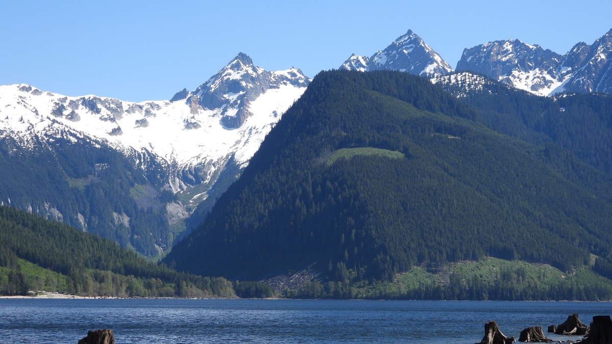
Murtle Lake lies inside Wells Gray Provincial Park in east-central British Columbia, about 27 kilometers from the community of Blue River. BC Parks describes it as North America’s largest canoe-only lake. Its north and west arms are each about 20 kilometers long and the lake averages roughly 3 kilometers wide.
A provincial bathymetric survey gives Murtle Lake a surface area of 76.3 square kilometers and a maximum depth of 333 meters, or 1,093 feet. The same chart reports an average depth of 107 meters. Those numbers make this remote paddling lake far deeper than its quiet beaches initially suggest.
Visitors reach a parking area by an approximately 27-kilometer gravel access road from Blue River, then carry boats and gear about 2.5 kilometers to the lagoon. Motorboats are generally excluded from the lake, which preserves the experience behind its canoe-only description. Current access information and advisories belong on the official BC Parks page.
Where Murtle Lake is located
The lake occupies the southeastern side of Wells Gray Provincial Park, a large protected landscape in British Columbia’s Cariboo Mountains. Its approximate center is 52°08′17″N, 119°38′12″W, according to the BC Geographical Names Office. Blue River is the nearest community with regular highway services.
The provincial geographical-names record says the name was adopted in 1914 and traces it to surveyor Joseph Hunter, who is said to have chosen the name after his Scottish birthplace. The official record also fixes the lake’s mapped location, avoiding confusion with similarly named features.
Murtle’s two long arms spread west and north from the area near its outlet. Central Mountain rises between them, giving the lake a broad V-shaped plan. Forested slopes descend to bays, gravel points and sandy beaches. Several small islands break the open water near the junction of the arms.
The Murtle River drains the lake to the southwest and eventually joins the Clearwater River. From there, the water enters the North Thompson River and the larger Fraser River system, which reaches the Pacific near Vancouver.
Size, depth and shoreline
The British Columbia Ministry of Environment’s 1985 bathymetric chart lists a surface area of 76,300,000 square meters. That is 76.3 square kilometers, or about 29.5 square miles. The chart gives a main-shore perimeter of 101 kilometers, plus another 6.5 kilometers around islands.
Its recorded maximum of 333 meters places the bottom far below the elevation of many surrounding valleys. Mean depth is listed as 107 meters, showing that substantial deep water occupies more than one isolated hole. The map warns that it was not prepared for navigation and that uncharted rocks or shoals may exist.
Water levels and modern measurements can differ from a decades-old survey, so paddlers should never treat the chart as a substitute for local knowledge. Nearshore hazards, submerged timber and rapidly changing weather matter more to a canoe than the maximum number printed at the center of the lake.
How the lake formed
Murtle Lake sits in terrain heavily modified by ice. Glaciers widened valleys and scoured bedrock during the Pleistocene. After the ice retreated, volcanic activity within the Wells Gray area affected drainage and lava associated with the region helped dam the lake’s outlet.
The park is known for a concentration of volcanic landforms and waterfalls. Murtle Lake’s basin records both the older work of glaciers and later changes to river routes. The result is a deep mountain lake held within steep topography rather than a shallow pond spread across a broad plain.
Water leaving through the Murtle River drops toward McDougall Falls before continuing to the Clearwater. Trails reached from the lake lead paddlers to the falls and to smaller inland lakes, but every trailhead around Murtle is water-access only.
Why it is called a canoe-only lake
BC Parks manages Murtle for nonmotorized travel. Canoes and kayaks can be rented near the lagoon and paddlers distribute themselves among backcountry campsites along both arms. The absence of regular motorboat traffic reduces noise and wake, allowing people to travel at the speed of weather and water.
“Canoe-only” does not mean easy. The open reaches are long enough for wind to build steep waves, especially during the afternoon. Park guidance recommends moving camp in the morning when possible. If a storm approaches, the safe response is to land at the first usable shore rather than trying to outrun it.
Cold water adds risk even on a warm day. A capsize far from shore can quickly become life-threatening. Paddlers need properly fitted personal flotation devices, spare clothing kept dry and a route that matches their skill. The park operator has emergency communication at the ranger cabin, but much of the shoreline remains remote.
Camping and trails around Murtle Lake
Backcountry campsites are spread along the north and west arms. Facilities are simple and visitors must pack out everything they bring. Food and scented items should be managed for bear country. BC Parks posts current fees, reservation rules and advisories because conditions can change between seasons.
Shorter trails lead to Henrietta Lake and Anderson Lake. The McDougall Falls route begins across Diamond Lagoon, where paddlers must stay clear of the strong current near the outlet. Longer climbs reach Central Mountain or the Wavy Alpine area, gaining close to 1,000 meters above the lake.
The combination of water travel and hiking demands conservative planning. A trail that looks short on a map may begin only after several hours of paddling. Wind on the return trip can delay a group, so time and food reserves should account for an unplanned night at camp.
Fish and wildlife
Rainbow trout and kokanee are among the fish associated with Murtle Lake. Anglers need a valid British Columbia freshwater fishing licence and should check the current provincial regulations before a trip. Regulations can change by water body and season, so an old trip report is not sufficient.
Moose, black bears and other forest wildlife inhabit Wells Gray Park. Birdlife changes with habitat, from open-water species near the shore to forest birds along the trails. Wildlife should be observed at a distance, with camps kept clean enough that animals find no food reward.
The lake’s ecological value comes partly from its intact setting. Motors, dense road access and shoreline development that alter many recreational lakes are largely absent. Visitors still create impacts through camp use, waste and disturbance, which is why designated sites and Leave No Trace practices remain important.
A deep lake built for careful paddling
Murtle Lake’s essential figures are unusually dramatic: two arms about 20 kilometers long, 76.3 square kilometers of surface and a surveyed depth of 333 meters. Yet its defining experience comes from access. Reaching most of the shore requires human-powered travel.
The geography rewards that effort with long mountain views and beaches backed by forest. It also exposes paddlers to real wind, cold water and distance from help. The largest canoe-only lake in North America deserves the same respect as a coastal route.
Anyone comparing Canada’s deep lakes can place Murtle beside broader profiles such as the depth of Great Bear Lake or Lake Tanganyika’s depth and wildlife. Murtle is much smaller by area, but its deep glacial basin and protected canoe access give it a distinct geographic identity.
A first trip works best when the route remains modest. A nearby campsite and a morning departure leave room for wind delays, while an ambitious crossing can force a group to move when conditions are poor. Murtle’s protected status keeps the shore comparatively undeveloped, so preparation remains the paddler’s main safety system.





