
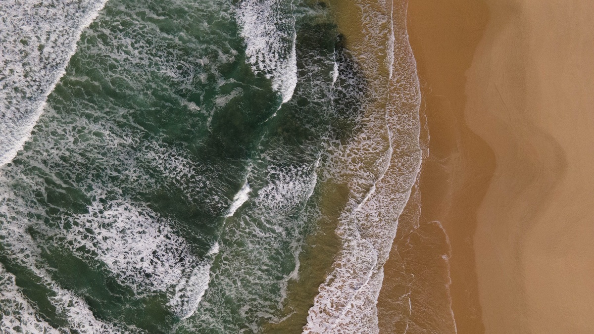
A longshore current is water moving roughly parallel to the beach within the surf zone. Longshore drift is the resulting transport of sand or other sediment along the coast. Waves approaching at an angle drive both, but the terms describe different things: one is moving water and the other is sediment movement.
The process can carry beach material for kilometers over time. Its direction and strength change with wave approach, storms and shoreline shape. Coastal structures that interrupt the transport often build a wider beach on one side while leaving the down-drift shore short of sand.
Angled waves create a longshore current
Waves rarely reach every beach straight on. As they enter shallow water, one part of a wave crest may slow before another, bending the crest through refraction. The remaining angle between the breaking wave and shoreline gives the released momentum a component parallel to the coast.
NOAA’s longshore current tutorial explains that breaking waves deliver bursts of energy that generate the shore-parallel flow. Steeper approach angles and larger waves generally produce faster currents, although beach slope and nearshore bars modify the response.
The current occupies a zone rather than a single narrow line. Its maximum speed can lie near the breaker line, then shift as water depth and wave conditions change. Headlands, inlets and engineered structures interrupt the otherwise along-coast path.
Longshore drift moves sediment
Breaking waves lift sand from the bed and push water up the beach at an angle. Gravity pulls the backwash downslope. Repeated motion gives individual grains a zigzag path while the current carries suspended and rolling sediment alongshore.
Longshore drift is therefore a transport rate and direction, not another name for the current. The amount moved depends on available sediment as well as water velocity. A strong current crossing a rocky shore may carry little sand because the supply is limited.
Grain size affects transport. Fine sand is suspended more easily than gravel, while cobbles move mainly during energetic waves. Sediment may travel in short steps, resting on the beach between storms before another event moves it farther.
Beaches belong to sediment cells
Coasts can be divided into sediment cells with sources, transport paths and sinks. Rivers, eroding cliffs and offshore deposits supply material. Longshore drift redistributes it, while submarine canyons, tidal inlets or deep water can remove it from the active beach system.
A beach may erode even when longshore transport is large if more sand leaves the reach than enters. Another section grows where transport converges or slows. The shoreline response depends on the difference between incoming and outgoing sediment rather than the current direction alone.
Argo’s article on shoreline erosion and natural controls focuses on lakes, but the same accounting principle applies: waves move sediment and stability depends on the local budget.
Spits and barrier features record the drift
Where the coastline changes direction or reaches an estuary mouth, transported sand may extend beyond the former shoreline as a spit. Waves continue adding material to the tip, while changing directions can curve the end. Sheltered water behind the spit may develop mudflats or marsh.
Barrier islands also exchange sediment alongshore, across the beach and through tidal inlets. Their form reflects more than longshore drift because storms can carry sand over the island and sea-level change alters the available accommodation space.
Coastal landforms should be read as active records, not permanent fixtures. Argo’s marine geography overview places beaches, barriers and inlets within the wider structure of ocean margins.
Groins interrupt sediment transport
A groin projects from the beach and traps some sand moving alongshore. The up-drift beach commonly widens because transport slows at the structure. The down-drift side may erode because the current continues but receives less replacement sediment.
A series of groins can move the deficit farther along the coast rather than eliminate it. Nourishment may add sand to the system, yet the material will still follow the prevailing transport path unless structures or wave conditions retain it.
Jetties built at inlets stabilize a navigation channel and can produce a similar interruption. They also change tidal flow and wave patterns, so the shoreline response may extend beyond the simple up-drift and down-drift contrast.
Storms can reverse the usual pattern
Seasonal winds and distant storms change the direction from which waves arrive. A coast with a dominant annual drift may experience days of transport in the opposite direction. Large storm waves can move more sand during a short event than ordinary waves move over many calm weeks.
Storm surge raises the water level and lets waves attack higher parts of the beach. Sand may move offshore into bars, alongshore toward another reach or landward across a barrier. Measuring only the final shoreline position cannot separate those pathways.
Researchers compare wave buoys, current observations and repeated beach profiles. Colored sediment tracers or mineral signatures can show where sand originated. Aerial surveys reveal how the beach volume changes along long sections of coast.
Longshore currents are different from rip currents
A longshore current flows along the beach. A rip current is a concentrated flow moving away from shore, often through a break in sandbars. Longshore flow can feed a rip, but the immediate hazard and direction are different.
Swimmers caught in a rip should follow official safety advice rather than trying to use sediment patterns as a prediction. The National Weather Service’s rip-current safety guidance recommends staying calm and moving parallel to the shore when able, then returning at an angle away from the current.
How coastal scientists estimate drift
Wave height, period and approach angle provide the energy available for longshore transport. Models combine those measurements with beach slope and sediment size. Because formulas simplify complex surf-zone motion, field surveys are used to calibrate the results.
Changes beside a groin can reveal direction but may not represent the natural rate after the structure alters waves and flow. Dredging records at an inlet offer another estimate of sediment arriving at a trap. Each method covers a particular time and segment of coast.
The clearest distinction remains practical: the longshore current moves water, while longshore drift tracks the sediment carried by that moving water and by angled swash. Separating them helps explain why a current can exist without much beach change and why a modest current can reshape a coast when sand is abundant.
Sea-level rise changes the transport setting
Rising mean water level lets ordinary waves act farther landward where the shore can move naturally. Cliffs, seawalls or buildings may restrict that retreat, narrowing the beach as sand remains trapped between deeper water and a fixed boundary.
The USGS National Assessment of Coastal Change Hazards combines storms, shoreline change and sea-level rise to evaluate future exposure. Longshore transport remains one part of the response, but the available sediment and room for the beach to migrate determine whether it can maintain its form.
Management at one property can affect the shared sediment system. Hard protection may reduce local erosion while altering sand delivery beyond the structure. Planning across an entire sediment cell is more likely to recognize those transfers than a series of isolated shoreline projects.
Beach nourishment adds sediment without stopping the current that redistributes it. Grain size should resemble the native beach closely enough to remain stable and support habitat. Monitoring tracks how quickly the placed material moves alongshore or offshore, which guides the volume and timing of later projects.
Public expectations also need a realistic time scale. A nourished beach is a reservoir of movable sand rather than a permanent construction. Its movement can protect land by absorbing wave energy even when the visible shoreline retreats after a storm.





