
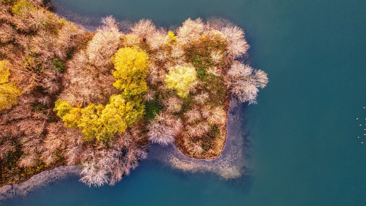
Lake of the Woods covers about 950,400 acres, or roughly 3,850 square kilometers, across Minnesota, Ontario and Manitoba. About one-third of the international lake lies in Minnesota. The Canadian share is larger and contains much of the rocky island country that gives the northern basin its intricate map.
The whole lake reaches a reported maximum depth of about 216 feet in Whitefish Bay. Minnesota’s broad Big Traverse basin averages roughly 24 to 26 feet. Even its deepest point is only about 39 feet. Mixing those regional figures can produce the mistaken claim that the entire lake is shallow from shore to shore.
The Minnesota Department of Natural Resources lists 950,400 acres for the whole lake and 307,010 acres in Minnesota. Another DNR management document uses 951,337 acres, with approximately 317,000 of them in Minnesota. The modest difference reflects the dataset and mapped boundary used.
Where Lake of the Woods is on the map
The lake occupies the international border at Minnesota’s northern edge. Ontario surrounds most of the north and east, while Manitoba reaches the northwestern shore. The Northwest Angle of Minnesota projects into the Canadian side, making it the northernmost part of the contiguous United States.
The Rainy River enters at the south after flowing west from Rainy Lake. Water leaves near Kenora through outlets that feed the Winnipeg River. The route continues into Lake Winnipeg before the Nelson River system carries the water to Hudson Bay.
The International Joint Commission’s watershed map and description traces water about 600 kilometers from the Great Lakes basin divide through Namakan Lake, Rainy Lake and Lake of the Woods. The planned Namakan Lake profile covers one upstream part of that chain.
Whole-lake area versus Minnesota’s share
Lake of the Woods is one of Minnesota’s largest border waters, but it does not rank among lakes entirely inside the state. The DNR’s 307,010-acre figure represents roughly 32 percent of the whole. Canadian sources round their national portion to about 3,300 square kilometers.
Environment and Climate Change Canada’s largest-lakes graphic specifically labels 3,300 square kilometers as the Canadian portion and notes that its area convention includes islands. Adding figures from different conventions without checking whether islands are included can distort the total.
The whole-lake area is roughly 1,485 square miles. For scale, it is smaller than any individual Great Lake but far larger than Leech Lake. The freshwater-lake comparison in the world’s largest freshwater lakes places truly continental basins in context.
Water level changes the surface slightly from year to year and survey conventions change the edge that cartographers trace. Wetlands complicate the boundary, especially where narrow channels meet rock that floods only during part of the year. Acreage rounded to the nearest hundred or thousand is more honest than a claim of exact permanence.
A shallow south and deep northeast
The Big Traverse dominates Minnesota’s open water. It occupies a broad basin left by glacial Lake Agassiz and has relatively little island relief. Historic Minnesota research describes a mean depth near 24 feet and a maximum around 39 feet for this southern region.
Whitefish Bay in Ontario differs sharply. Its bedrock basin descends to a reported 216 feet, or about 66 meters. Island-studded Little Traverse and northern waters contain reefs and abrupt underwater structure absent from much of the muddy southern basin.
A Minnesota legislative archive’s binational fishery description preserves both facts: an average whole-lake depth estimate near 26 feet and a 216-foot recorded maximum in Whitefish Bay. A second Minnesota fisheries report makes clear that its 39-foot maximum applies to Big Traverse rather than the entire lake.
Why the map contains so many islands
Glacial history created two contrasting landscapes. Fine sediment from glacial Lake Agassiz underlies the broad southern water. Farther north, moving ice scoured ancient Canadian Shield bedrock. The resulting maze includes water channels between islands whose shores project into countless rocky points.
Popular descriptions often assign Lake of the Woods more than 14,000 islands. Shoreline totals can also reach tens of thousands of miles when island coasts are included. Such numbers depend on mapping scale and on the minimum size used to define an island. Results change again if tiny rocks or seasonal features qualify.
The coastline paradox explains part of the variation. A finer measuring line follows more small bends and produces a longer total. Island inventories also change when higher-resolution imagery separates a cluster into multiple pieces. It is more reliable to describe the northern basin as containing thousands of islands than to present one count as permanent and exact.
A USGS Quaternary geologic map of the Lake of the Woods region shows the wider terrain across the international boundary. Bedrock and glacial deposits do not follow state or provincial lines, which is why the lake’s physical regions make more sense when the whole basin is mapped together.
Rainy River inflow and Winnipeg River outflow
The Rainy River supplies more than three-quarters of the lake’s inflow in published fisheries descriptions. It brings water from the chain of boundary lakes to the east. Smaller rivers and local runoff enter elsewhere, but no other single tributary approaches its importance.
At Kenora, water exits through channels into the Winnipeg River. Dams regulate discharge for water management and hydropower. Under normal levels, the Canadian Lake of the Woods Control Board manages the system; international oversight applies at prescribed extremes.
The International Lake of the Woods Control Board mandate identifies threshold elevations of 1,056 and 1,061 feet above sea level under the 1925 convention. Regulation influences seasonal level but cannot eliminate wind setup, floods or drought.
An international watershed under shared management
Water and fish cross the political boundaries drawn through the lake. Minnesota and Canadian agencies therefore coordinate monitoring and management. Different fishing regulations still apply by jurisdiction, so crossing an invisible line can change what an angler may keep.
The lake’s outlet rules operate separately from the Rainy and Namakan rule curves upstream. The IJC’s monitoring program explains how dams and minimum releases manage those connected waters. Extremely high inflow can exceed outlet capacity even when gates are fully open.
The connectivity resembles the Great Lakes only in the broad sense that lakes exchange water through rivers and channels. How the Great Lakes are connected explains a different system whose final outlet reaches the Atlantic rather than Hudson Bay.
How to read Lake of the Woods figures
Every measurement should name its geographic scope. A 39-foot maximum belongs to Minnesota’s Big Traverse, while 216 feet describes the deepest reported point of the international lake. Minnesota acreage is one share, not the whole.
Map scale should accompany any precise island or shoreline count. A navigation chart may omit features that appear in a satellite inventory. A tourism brochure may use still another convention, so different totals do not imply that one source is fraudulent. Each may count a different minimum feature or trace the coast at a different resolution.
The stable geographic picture is clear. Lake of the Woods spans three jurisdictions, covers about 950,400 acres and drains toward Hudson Bay. Its shallow southern basin opens northward into deep, rocky water containing thousands of islands.
The lake is best read as several connected geographic settings rather than one uniform bowl. Muddy open water in the south gives way to reef-filled Shield country farther north. Regulated outlets complete the same named lake. A map that preserves those contrasts explains more than a single center-point depth or island total.
Season also changes the practical map. Ice routes may cross water that boats navigate in summer, but pressure ridges and currents make winter travel a separate safety problem. Neither a road map nor an open-water chart establishes safe ice and current local charts remain essential for navigation.





