
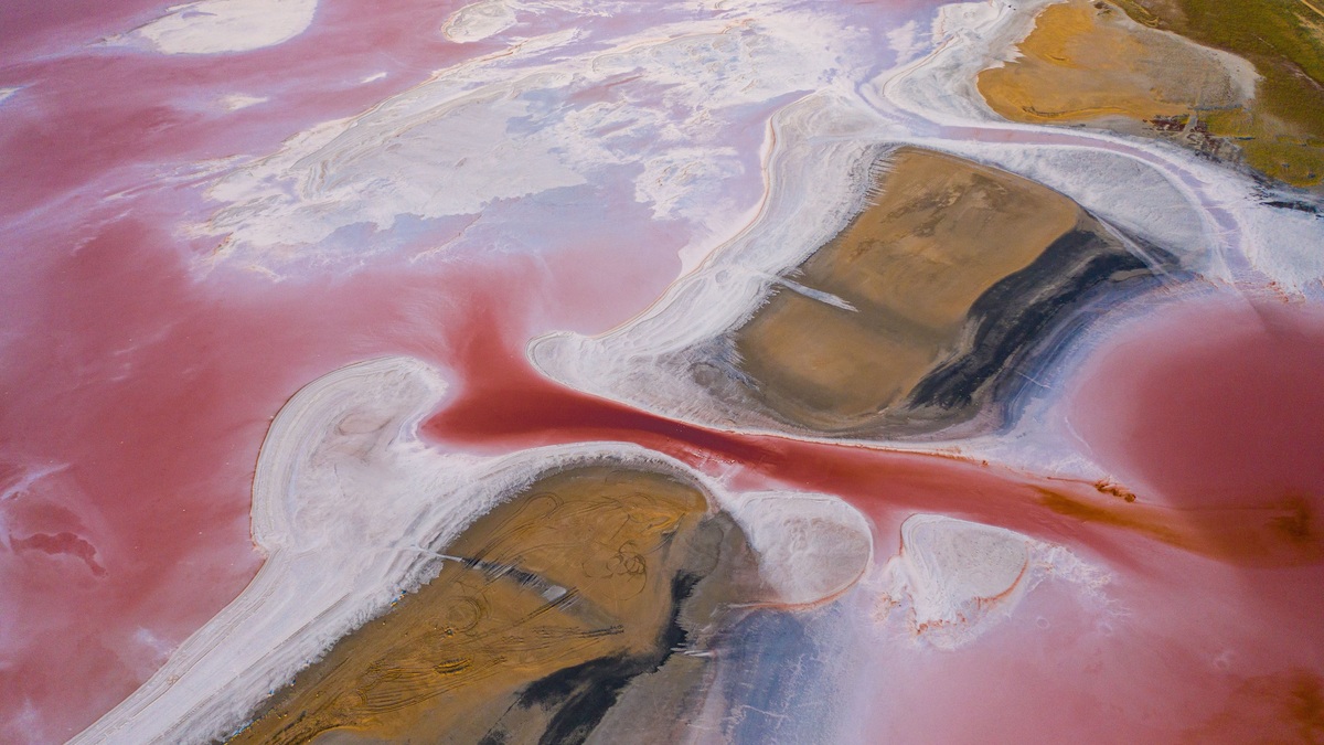
Kati Thanda-Lake Eyre is Australia’s largest lake when full and the lowest natural point on the continent. The salt lake covers about 9,500 to 9,700 square kilometers, depending on the shoreline definition, while its lowest bed lies 15.2 meters below sea level. Most years reveal a very different landscape: a vast saltpan with little water.
The lake sits in northern South Australia within an immense inland drainage system. Rivers flow toward it rather than toward the sea and only a fraction of rain falling across the basin completes the long trip. Rare major inflows can spread shallow water across the salt and draw birds into the desert.
Its North and South basins are separated by low terrain and linked when inflow is sufficient. Satellite images can show water in one section while another remains dry. Any description of current conditions must therefore identify the date and part of the lake being observed.
The lake’s changing colors come from water depth, suspended sediment, algae and the salt surface beneath. A red or green patch does not describe the entire basin and visual color alone cannot establish salinity.
Size depends on the shoreline and the water
The Australian Government describes Kati Thanda-Lake Eyre as a terminal lake of about 9,700 square kilometers. Other national and state sources use approximately 9,500 square kilometers. The difference reflects mapping and shoreline definitions around a flat, irregular saltpan rather than a rapid change in the lake’s underlying basin.
The federal Lake Eyre Basin overview calls it the world’s fourth-largest terminal lake. At full coverage, it is Australia’s largest lake. The main system includes Lake Eyre North and the smaller Lake Eyre South, joined by the Goyder Channel when water levels permit.
Area does not translate into great water volume because much of the lake is extremely shallow. Water may spread over broad sections at depths of only a few centimeters. Wind can also push shallow water across the bed, changing the wet outline over short periods.
Terminal lakes elsewhere share the same basic water-balance problem: inflow ends in evaporation rather than an outgoing river. Argo’s explanation of how saltwater lakes form shows why salts accumulate in closed basins. Kati Thanda is an extreme case because its inflow is so irregular.
The lake bed is Australia’s lowest point
Halligan Bay on Lake Eyre North reaches 15.2 meters below sea level. This elevation describes the land surface, not a normal water depth. A visitor looking across the dry salt is already standing within a depression below the level of the surrounding oceans.
Evaporation dominates the water balance. The region receives little rain, while annual evaporation can reach roughly 2.5 meters. Water has no outlet to the sea, so dissolved minerals remain as the lake dries. The exposed surface becomes a bright crust over mud and sediment.
When the lake holds water, salinity changes through time. Australian environmental reporting notes that a full lake can be similar in salinity to seawater. Continued evaporation concentrates the salts, eventually producing hypersaline water that many freshwater organisms cannot tolerate.
The lake’s greatest water depth during a rare full phase is still modest compared with its area. Because the floor has such a slight gradient, a small vertical change can expose or inundate a large horizontal expanse. Measurements of “percent full” may refer to surface coverage rather than stored volume.
A 1.2-million-square-kilometer basin feeds it
The Lake Eyre Basin spans about 1.2 million square kilometers, almost one-sixth of Australia. It reaches across South Australia and large parts of Queensland and the Northern Territory, with a small portion in New South Wales. The system is endorheic, meaning its streams drain inward.
Major pathways include the Georgina-Diamantina system and Cooper Creek. Rain falling hundreds of kilometers away can move through braided channels and floodplains for months before reaching the lake. Much of it evaporates or remains in waterholes along the route.
Full capacity is uncommon. South Australia’s park authority says the lake filled to capacity only three times in 160 years before the major 2025 inflow. Smaller or partial floods occur more often and even partial water can transform sections of the basin.
Flood pulses also connect habitats along the route. Fish survive dry intervals in permanent waterholes, then spread through channels when flows return. Floodplains store water and support productivity before the remaining flow reaches the terminal lake. The lake cannot be understood apart from this upstream network.
Wildlife responds quickly to floodwater
Dry conditions favor desert specialists. The Lake Eyre dragon, a small lizard, lives on the lake bed and shelters beneath the salt crust. Sparse vegetation around the margins includes salt-tolerant shrubs and grasses that respond after local rain.
Floodwater brings fish and aquatic invertebrates through connected channels. Bony bream and perch can reproduce while conditions allow. The Lake Eyre hardyhead tolerates water reported by the South Australian park authority as up to 15 times saltier than seawater, enabling it to persist after other fish decline.
Waterbirds may arrive from great distances to feed and breed. Pelicans, terns and stilts use the temporary wetland when depth, food and island habitat align. A flood does not guarantee mass nesting everywhere, however. Bird numbers depend on the timing and extent of water across the wider basin.
Salinity rises at different rates across the shallow lake as water retreats. Pools can separate, leaving organisms in increasingly concentrated brine. Hardyhead survival reflects physiological tolerance, while birds can move to better feeding sites. Stationary eggs or invertebrates face a narrower set of options.
Arabana culture is part of the lake
Kati Thanda is the name used by the Arabana people, the Traditional Owners of the lake. The dual name formally recognizes a place with cultural meaning carried through stories, songs and continuing relationships with Country. The park is managed with Arabana and Dieri participation.
Cultural significance is one reason visitors must stay out of restricted areas. The lake is also physically hazardous: apparently firm salt can conceal deep mud and remoteness makes rescue difficult. Recreational access to the lake bed is prohibited.
The South Australian park page directs travelers to designated viewpoints and Halligan Bay Campground. Access requires remote-area preparation and often a four-wheel-drive vehicle. Road conditions can change after rain, so the current desert parks bulletin should be checked before departure.
Respectful access includes carrying sufficient water, taking waste away and avoiding travel on closed tracks. Mobile coverage is unreliable. The same rain that makes a flood worth seeing can cut roads and strand vehicles, so official notices take priority over an old itinerary or map.
A lake that alternates between salt and wetland
Kati Thanda-Lake Eyre is both a dry salt landscape and an episodic aquatic ecosystem. Its size refers to the basin that can hold water, while actual coverage ranges from isolated pools to an expanse visible from aircraft. A single photograph cannot represent its normal condition.
The contrast explains why salinity, wildlife and visitor access need dates attached to them. A species observation made during a major flood may tell little about the next dry year. Likewise, a road that is open during one visit may be impassable after distant rain feeds local channels.
Australia’s largest lake is therefore defined by variability. Its vast catchment gathers rare pulses from the arid interior, the low basin holds them briefly and evaporation restores the salt. That cycle supports an ecosystem adapted to long waiting and sudden abundance.
Comparisons based only on salinity can miss that cycle. Argo’s list of waters saltier than the ocean places hypersaline environments in context, but Kati Thanda can shift from near-seawater salinity toward concentrated brine within one drying phase.





