
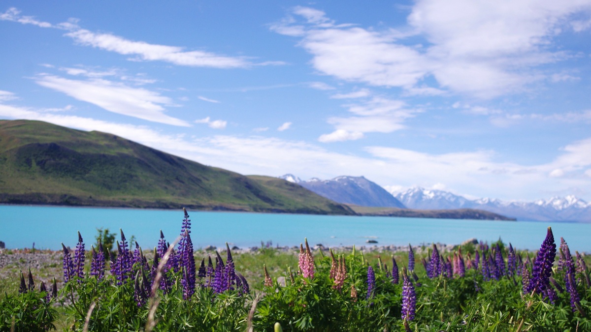
New Zealand’s major lakes occupy volcanic calderas, glacial troughs, landslide-blocked valleys and coastal lowlands. The 12 below were selected for geographic scale, distinctive origin or national and regional importance. They are not presented as one objective ranking because surface area, depth and cultural significance answer different questions.
The list represents both main islands and uses macrons in current names where well established. A 2024 national lake-database review identifies thousands of natural and artificial lakes, including hybrid basins that formed naturally and were later raised for hydropower. Argo’s world lake map places this diversity within a global pattern.
Origin alone does not determine present condition. The Ministry for the Environment’s national freshwater assessment tracks nutrient enrichment and other pressures across lakes with very different geology. The entries therefore separate how a basin formed from later regulation, catchment land use and water quality.
1. Lake Taupō
Lake Taupō lies near the center of the North Island within a large volcanic caldera. It is New Zealand’s largest lake by surface area, about 616 to 620 square kilometers in modern government and research summaries. Its only surface outlet is the Waikato River.
Earth Sciences New Zealand describes a maximum depth of about 184 meters in a recent Taupō profile, while older national summaries list 163 meters. The difference reflects datasets and bathymetric values retained from different periods. Both figures should be labeled maximum depth rather than average depth.
2. Lake Te Anau
Lake Te Anau occupies a glacial basin in Fiordland on the South Island. Long western arms reach into steep mountain valleys, while the main body lies beside the town of Te Anau. Water exits through the Waiau River toward Lake Manapōuri and the sea.
A Ministry for the Environment overview gives an area around 350 square kilometers and a maximum depth of 417 meters. Those dimensions make Te Anau the South Island’s largest lake by area, not the country’s deepest.
3. Lake Wakatipu
Lake Wakatipu is a long, bent glacial lake in Otago. Queenstown stands on its shore and the surrounding Southern Alps create steep catchments. The Kawarau River drains the lake eastward into the Clutha/Mata-Au system.
The national overview reports roughly 290 square kilometers and a maximum depth near 380 meters. A modern map should preserve the official lake name while recognizing the wider Indigenous place-name history recorded by New Zealand’s Geographic Board.
4. Lake Wānaka
Lake Wānaka fills another large glacial trough north of the town that shares its name. The Makarora and Matukituki rivers enter from mountain catchments. Its outlet becomes the Clutha/Mata-Au, connecting the lake to one of the South Island’s largest river systems.
National lake datasets put its area near 200 square kilometers and maximum depth above 300 meters. The lake is natural, though river regulation farther downstream affects the larger basin. Wānaka illustrates the environmental and human benefits of lakes without implying that recreation is its only value.
5. Te Waihora / Lake Ellesmere
Te Waihora / Lake Ellesmere lies behind a gravel barrier on the Canterbury coast. It is shallow and broad, with water levels managed partly through periodic openings to the sea. Its lagoon-like origin differs from the deep glacial lakes west of the Canterbury Plains.
The Ministry for the Environment’s older national summary lists an area near 180 square kilometers and a maximum depth below three meters. Area changes with water level and managed openings, so a map date matters. The official dual name also carries cultural meaning that the English label alone does not convey.
6. Lake Pūkaki
Lake Pūkaki occupies a glacial basin in the Mackenzie region. Meltwater from the Tasman River supplies its distinctive suspended rock flour. The lake now forms part of the Waitaki hydroelectric system, with its natural level raised by engineering.
The 2024 lake-database review classifies Pūkaki as a glacial-artificial hybrid rather than forcing it into a purely natural or artificial category. Published surface area varies with operating level. The origin of its basin remains glacial even though dams and canals altered the modern water body.
7. Lake Tekapo / Takapō
Lake Tekapo / Takapō lies east of Pūkaki in another glacier-carved Mackenzie basin. The Tekapo River is part of the Waitaki drainage, while hydroelectric canals connect water management across neighboring lakes. Government place-name material notes Takapō as the traditional form associated with the lake.
An official bathymetric survey mapped an approximately 83-square-kilometer lake floor and documented extensive underwater landslide deposits. The lake formed naturally behind glacial sediment, then its level was raised for power generation. It is another hybrid rather than a reservoir excavated from scratch.
8. Lake Rotorua
Lake Rotorua occupies a volcanic caldera on the North Island. The city of Rotorua sits on its southern shore and Mokoia Island rises near the center. Water drains through the Ohau Channel toward Lake Rotoiti and ultimately the Kaituna River.
Rotorua is much shallower than Taupō even though both have volcanic origins. Geothermal activity in the wider region does not mean the whole lake has a uniform temperature. Catchment nutrients and shallow mixing are more relevant to its present water-quality behavior.
9. Lake Manapōuri
Lake Manapōuri is a deep glacial lake in Fiordland, downstream from Te Anau through the Waiau system. Mountain arms branch westward from the main body, creating a complex shoreline. Natural outflow once continued down the Lower Waiau River.
Hydroelectric development diverts much of the lake’s water through a power station and tunnels to Doubtful Sound. The basin is natural, while the current water route is substantially engineered. A national lake dataset lists a maximum depth above 440 meters, placing Manapōuri among the country’s deepest lakes.
10. Lake Hāwea
Lake Hāwea is a natural glacial lake northeast of Wānaka. Its outlet flows into the Clutha/Mata-Au system through the Hāwea River. Steep mountain catchments occupy the north, while a dam controls the modern southern outlet.
Raising the lake for hydroelectric storage enlarged its surface beyond the original natural level. The database therefore treats such lakes as modified or hybrid water bodies. A national lake dataset gives a maximum depth near 384 meters, but operating level changes the precise water-column depth on a given date.
11. Lake Benmore
Lake Benmore is an artificial reservoir on the South Island’s Waitaki River. Benmore Dam created it as part of a chain of hydroelectric lakes and canals. Its arms extend into the former valleys of the Ōhau and Pūkaki-Tekapo river systems.
Unlike Pūkaki or Tekapo, Benmore did not begin as a major natural lake later raised by a dam. Its basin footprint was created by impounding a river valley. The difference is central to the 2024 database classification, which separates constructed reservoirs from natural lakes modified by control structures.
Benmore’s operating level and shoreline respond to hydroelectric management. Its mapped area is therefore a managed value rather than an immutable natural boundary. The reservoir still develops lake processes such as waves and thermal layering even though its origin is entirely artificial.
12. Lake Waikaremoana
Lake Waikaremoana lies in Te Urewera on the eastern North Island. A massive landslide blocked the Waikaretaheke River valley and created the natural lake. Its outlet continues toward the Wairoa River and Hawke Bay, although power development now uses part of the drop.
The Ministry for the Environment identifies Waikaremoana as the North Island’s deepest lake, with a maximum near 248 meters. Its landslide origin differs from North Island volcanic lakes and South Island glacial troughs. Argo’s lake-versus-pond guide explains why origin and depth are more informative than relying on a name alone.





