
Reno sits between high Sierra lakes and the desert basins of northwestern Nevada. Within roughly two hours of downtown, visitors can reach Lake Tahoe’s clear alpine water, the saline expanse of Pyramid Lake and several reservoirs built along the Truckee River system. The best choice depends on whether the day is for swimming, paddling, fishing or a quiet shoreline walk.
The ten destinations below are ordered by general usefulness rather than strict distance. Drive times change with the starting point, mountain weather and weekend traffic. California and Nevada manage different waters, while Pyramid Lake lies within the Pyramid Lake Paiute Reservation and requires tribal permits for many activities.
Conditions also change quickly. Reservoir levels respond to snowpack and water operations. Harmful algal bloom advisories or fire restrictions can close particular activities, so check the linked managing agency before leaving Reno.
1. Lake Tahoe
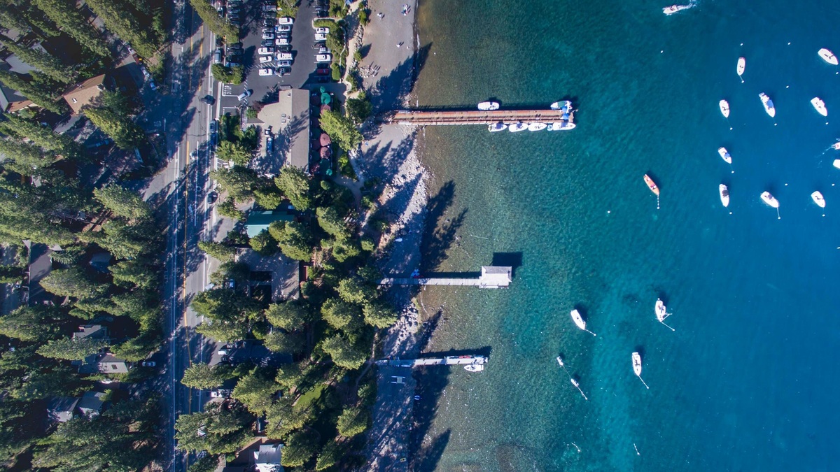
Lake Tahoe is the region’s largest and best-known lake, about 35 miles southwest of central Reno at the nearest northern shore. The state line divides it between Nevada and California. Beaches, marinas and trailheads ring the basin, but public access varies from developed parks to stretches of private shoreline.
Nevada’s Sand Harbor is a popular place for clear-water swimming and kayaking, while Cave Rock offers a boat launch farther south. Summer reservations and parking controls may apply. Cold water persists well into the warm season and afternoon wind can make a calm morning paddle much harder on the return.
2. Pyramid Lake
Pyramid Lake lies about 35 miles northeast of Reno and receives the Truckee River after it leaves Lake Tahoe. It has no surface outlet, so salts remain as water evaporates. Pale tufa formations and a broad desert shoreline make the lake look very different from the forested Tahoe basin.
The lake is within the sovereign Pyramid Lake Paiute Reservation. Visitors need tribal permits for fishing, boating, camping and day use where required. The tribe’s current permit page also lists closures, including areas near the Pyramid formation that are closed to the public. A Nevada fishing licence does not replace a tribal fishing permit.
3. Washoe Lake
Washoe Lake sits between Reno and Carson City beneath the Carson Range. It is a shallow natural lake surrounded by wetlands, open sage country and mountain views. The drive from downtown Reno is commonly around 30 to 40 minutes, depending on the entrance used.
Washoe Lake State Park supports camping, picnicking and water sports, with trails and equestrian facilities on land. Wind is a defining feature of Washoe Valley and can rise abruptly. Shallow water also makes the lake responsive to drought and algal blooms, so boaters should check current advisories.
4. Boca Reservoir
Boca Reservoir lies northeast of Truckee on the California side of the state line, generally less than an hour from Reno in good conditions. The reservoir stores water on the Little Truckee River system and has broad shore access where water levels permit.
Visitors use Boca for boating, fishing and dispersed shoreline recreation, with developed camping nearby in Tahoe National Forest. Seasonal fire restrictions can change what is allowed at campsites. Winter snow and muddy shoulder-season roads can also affect access even when the main highway remains open.
5. Stampede Reservoir
Stampede Reservoir is farther north on the Little Truckee River, beyond Boca. Its forested coves offer boating and fishing, while Logger Campground provides a large developed base on the south side. The drive from Reno is usually around an hour without difficult weather.
The reservoir is known for kokanee salmon as well as trout fishing. Water level influences launch access and the character of shoreline sites. The U.S. Forest Service lists current recreation destinations around Stampede and Prosser, which should be checked before towing a boat.
6. Prosser Creek Reservoir
Prosser Creek Reservoir is just north of Truckee and close enough for an easy half-day trip from Reno. Sage-covered slopes meet pine forest around the water, giving the shoreline a mix of open sun and sheltered coves. It is quieter than Lake Tahoe on many weekdays.
Campgrounds sit above the western shore and visitors fish or paddle when conditions allow. Reservoir drawdown can expose long stretches of bank late in a dry season. The relative shelter does not remove the need for a personal flotation device because Sierra winds can arrive quickly.
7. Spooner Lake
Spooner Lake is a small mountain lake near Spooner Summit on Tahoe’s Nevada side. Its value lies as much in the surrounding backcountry as in the water itself. A mostly level two-mile path circles the lake, while longer routes climb toward Marlette Lake and the Flume Trail.
Spooner Lake and Backcountry State Park lists fishing rules and seasonal trail conditions. Swimming and motorized boating are not its central attractions. Choose Spooner for hiking, wildlife watching and a forested picnic rather than a beach day.
8. Donner Lake
Donner Lake sits beside Truckee, roughly 40 miles west of Reno. It is much smaller than Tahoe but offers public beaches, paddling and fishing with steep granite ridges nearby. Interstate 80 provides direct access, though holiday traffic and winter storms can greatly extend the trip.
Donner Memorial State Park occupies the east end and interprets the region’s Indigenous history, emigrant travel and the Donner Party. The lake has public and private shoreline segments, so use designated access. Boats must follow California requirements, including any current inspection rules intended to prevent aquatic invasive species.
9. Lahontan Reservoir
Lahontan Reservoir lies east of Reno near Silver Springs. The drive commonly takes about an hour, exchanging Sierra forest for open desert. The reservoir stores water from the Carson and Truckee basins as part of the Newlands Project and can have 69 miles of shoreline when full.
Lahontan State Recreation Area supports camping, boating and fishing. Water level varies substantially, so a beach or launch remembered from a previous year may look different. Cottonwoods and willows support birds, while wild horses are sometimes seen in the surrounding country.
10. Frenchman Lake
Frenchman Lake is northwest of Reno in California’s Plumas National Forest, usually about 75 to 90 minutes away. The reservoir sits in a broad mountain valley with campgrounds and shoreline access around several arms. It is a practical alternative when travelers want forest water without Tahoe’s busiest corridors.
Fishing, kayaking and camping are common, with access changing after snow or wildfire. Mobile service can be limited. Bring a map and check Forest Service alerts before the drive, especially outside midsummer.
These lakes span several management systems rather than one Reno recreation district. Nevada state parks, California parks, federal forests and the Pyramid Lake Paiute Tribe set their own fees and rules. A permit valid at one destination may have no force at the next.
Before a summer outing, check water-quality advisories and launch status on the morning of travel. A reservoir can be open while one ramp is unusable and a park can allow shore visits while warning against contact with algae. Winter trips need a separate road and avalanche check because interstate access does not guarantee that a lakeside road or trailhead has been cleared.
For broader lake comparisons, Argo’s famous lakes in the United States places Tahoe among nationally recognized waters, while the formation of saltwater lakes helps explain Pyramid Lake’s chemistry. Near Reno, that variety is the main attraction: alpine clarity, desert salt and working reservoirs all fit within a day’s drive.





