
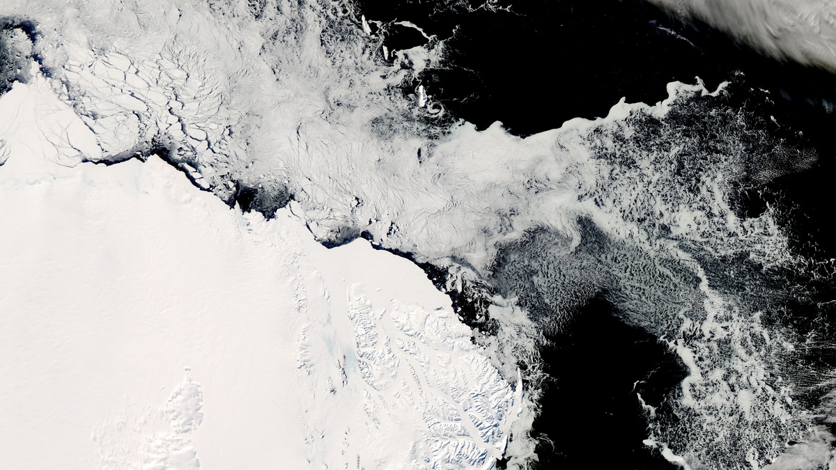
Heat escapes from the sea most efficiently near the poles, where long winter darkness, ice and frigid air keep the water close to its freezing point. The answer most people expect is the Southern Ocean, the ring of water around Antarctica. It contains enormous reaches of water that stay exceptionally cold and the U.S. National Science Foundation has described it as the planet’s coldest ocean water.
The comparison requires a clear definition. “Coldest” can mean a basin-wide average, a seasonal surface reading, a deep-water measurement, or the lowest temperature found in one place. The Southern Ocean is the usual answer when the five named oceans are compared broadly. Yet the Arctic Ocean also holds near-freezing water beneath its ice, so a single thermometer reading cannot settle every version of the question.
The short answer depends on the measurement
Ocean temperatures change with location, season and depth. A sea-surface temperature measures the upper skin of the ocean, which responds quickly to sunlight, winds and melting ice. A measurement near the seafloor describes a different layer. One bay may also be colder than the average water in a much larger basin. For that reason, rankings need to say what was measured and over what time period.
For the familiar five-ocean list, the Southern Ocean is widely called the coldest because it surrounds Antarctica and spans a huge polar belt. Its cold water is part of the ocean system rather than a small sheltered corner. The Arctic is smaller and almost enclosed by land. NOAA says its average temperature seldom rises above freezing for much of the year, a reminder that Arctic Ocean conditions are also intensely cold.
Air temperature adds another possible mix-up. Antarctica is the coldest continent, but air over ice and the water below it are different measurements. Under Arctic sea ice, the ocean remains limited by the freezing point of salt water even while the air above can plunge far lower. A clear answer therefore names the water, the basin and the comparison being made.
Scientists build temperature records from ships, drifting floats, moorings and satellites. Each method has strengths and gaps. Satellites give wide coverage of the surface, while instruments lowered from ships reveal layers beneath it. Polar observations are especially challenging because sea ice, storms and winter darkness limit access. A careful comparison uses long-term measurements where possible and avoids treating a single season or expedition as the permanent temperature of an entire ocean.
Why the Southern Ocean is the usual answer
The Southern Ocean circles Antarctica without a continental barrier across its path. During the austral winter, sunlight fades for months and sea ice spreads outward from the continent. Cold winds, limited solar heating and contact with Antarctic ice help keep broad regions of seawater close to freezing. Salt lowers the freezing point, so ordinary ocean water freezes at about minus 1.9 degrees Celsius, or 28.4 degrees Fahrenheit, according to NOAA’s explanation.
Its geography also makes the label meaningful. The ocean is commonly bounded near 60 degrees south for mapping and education, while oceanographers also track fronts where water masses meet. Ocean boundaries are useful conventions, not a wall in the water. Cold Antarctic waters mix with water from the Atlantic, Indian and Pacific, which makes a precise whole-basin average sensitive to the chosen boundary and dataset.
Still, the waters closest to Antarctica give the basin its defining character. In the Ross and Weddell seas, winter cooling and sea-ice growth can produce seawater near the saltwater freezing point. NASA’s overview of Antarctic sea ice shows why seasons matter: the ice fringe expands around the continent in winter and contracts sharply in summer. A summer map can therefore look very different from a winter map without changing the Southern Ocean’s polar identity.
Wind helps shape this cold region too. Strong westerlies sweep around Antarctica with few land barriers to interrupt them. They stir the surface and help drive the current system that separates many Antarctic waters from warmer water farther north. The basin label does not make every part of the Southern Ocean equally cold at every depth or every month. It does explain why its coldest conditions cover such a large, connected area instead of appearing only in isolated coves.
The Arctic can be just as cold in key places
The Arctic deserves equal care in any cold-ocean comparison. It is an ocean basin surrounded by land and its sea ice often persists over a large area through the year. Near the ice, surface water can sit close to the saltwater freezing point. The observations are genuine examples of the planet’s coldest seawater, even when a broad five-basin description gives the Southern Ocean the top label.
Summer changes the picture. Open patches of Arctic water can absorb solar energy for weeks, especially where ice has retreated early. Atlantic water also flows into parts of the Arctic and can bring heat from lower latitudes. In the Southern Hemisphere, the wide, wind-swept ocean around Antarctica has a different layout and much Antarctic sea ice melts back during summer. The two polar oceans share freezing conditions while following different seasonal patterns.
Depth matters as well. Below the sunlit surface, much of the deep ocean is cold everywhere. NOAA Ocean Exploration notes that water below about 200 meters averages roughly 4 degrees Celsius globally, though local layers vary. A claim about the coldest water therefore needs a location and depth. A deep measurement from another ocean may be colder than a surface measurement taken during an Antarctic summer.
The Arctic also receives water from the Atlantic and that inflow can be warmer than the water near the surface ice. Layers can therefore carry different temperatures only a short distance apart. In either polar ocean, a profile from surface to seafloor tells a fuller story than a single number. The ocean’s vertical structure is one reason oceanographers compare observations with care.
Cold water powers global circulation
The Southern Ocean is more than a cold backdrop for Antarctica. Its Antarctic Circumpolar Current flows all the way around the globe and connects the Atlantic, Indian and Pacific oceans. It is the only current that completely circles Earth. The current helps move water, heat, nutrients and dissolved gases among basins. Deep-water formation gives the cold polar belt an influence far beyond the Antarctic coast.
Winter sea-ice formation also changes the water left behind. As ice forms, much of the salt stays in the surrounding liquid. The colder, saltier water becomes denser and can sink, a process often called brine rejection. NOAA’s account of deep circulation explains how polar cooling and rising density help drive currents far below the surface.
Some of this dense water contributes to Antarctic Bottom Water, one of the water masses that ventilates the deep ocean. The process moves oxygen and other properties into deep layers over long timescales. Cold, dense water is a major part of global ocean circulation. Temperature, salt, ice and wind work together. Seafloor shape also contributes to the process.
The same cold setting supports distinctive food webs. Microscopic algae bloom when light returns and help feed Antarctic krill. Krill in turn support fish, seabirds, seals and whales. Polar ecosystems are adapted to a strong annual cycle of darkness, ice, open water and productivity. As ocean temperatures and sea ice patterns change, researchers watch both polar regions closely because even small shifts can travel through habitats and currents.





