
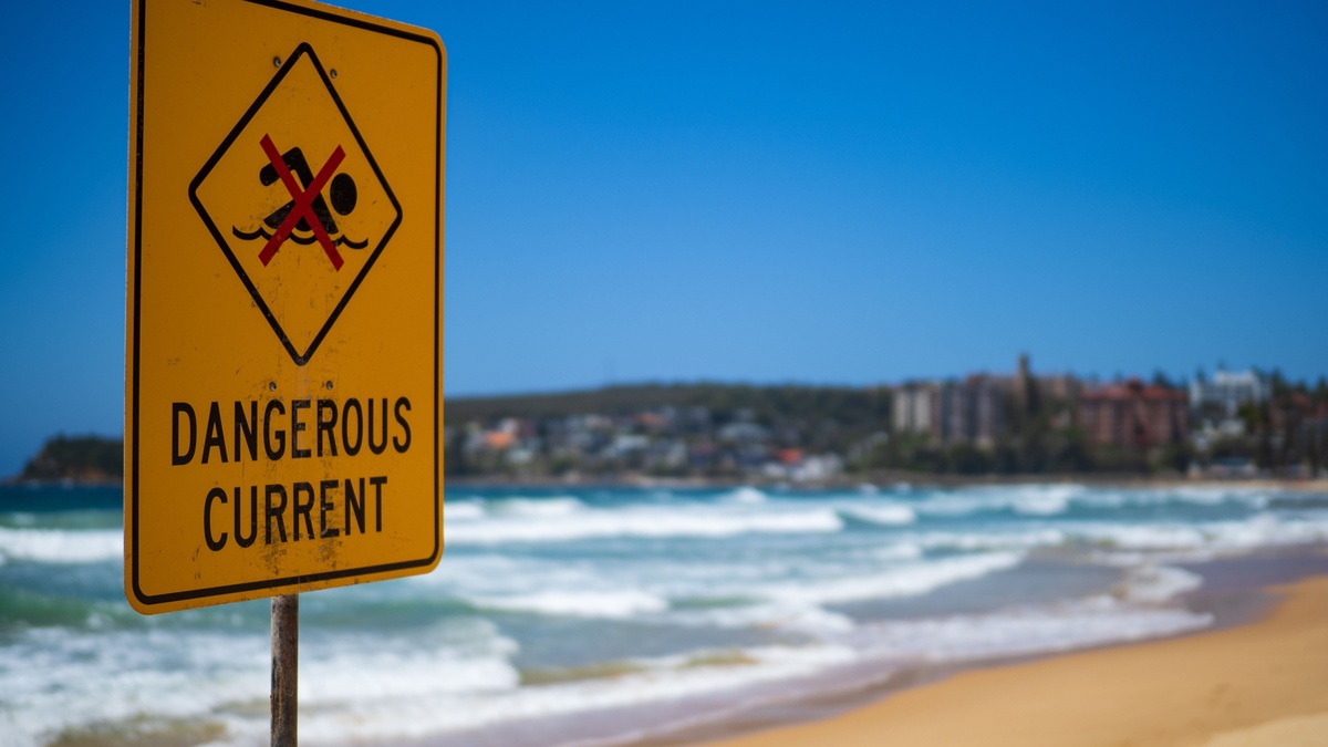
A rip current is a concentrated flow of water moving away from shore through the surf zone. “Rip tide” is an inconsistent term that scientists and safety agencies generally avoid. It may be used informally for a rip current or for a strong tidal flow through an inlet, but those are different processes.
Calling the beach hazard a rip current keeps the mechanism clear. Breaking waves push water toward shore and some of that water returns seaward in a channelized flow. The current can carry a swimmer beyond the breaking waves, yet it does not pull a person under the water.
Breaking waves create rip currents
Waves raise the average water level near shore through a process called wave setup. If waves break more strongly on two sides of a deeper channel, the setup is greater there than within the gap. Water flows alongshore toward the lower-water region, converges and moves seaward.
The National Weather Service’s rip-current science guide explains that rips form where wave breaking varies along the beach. They can develop at gaps in sandbars, beside jetties or piers and along apparently featureless shores when the wave pattern creates uneven setup.
Rip currents occur on ocean and sea coasts and they can also occur along Great Lakes beaches. Tides are absent or very small in many of those settings. Their presence on lakes is direct evidence that a rip current does not require an astronomical tide.
Why “rip tide” causes confusion
A tide is the predictable, long-period rise and fall of water driven mainly by the gravitational effects of the Moon and Sun. A tidal current is the horizontal flow associated with that changing water level. Strong tidal currents often develop where water is squeezed through an inlet, harbor entrance or estuary.
Some communities have historically called an especially strong inlet current a rip tide or tidal rip. The same words are also widely used for surf-zone rip currents. Because one label can point to two hazards with different causes, NOAA and the U.S. Lifesaving Association use rip current for the beach process.
Argo’s explanation of tides and coastal water levels tracks vertical water-level change. Rip-current forecasts instead focus on surf conditions, wave direction and beach shape. The tide can influence a rip current by changing where waves break, but it is not the current’s basic cause.
The word “undertow” introduces another misconception. Backwash can knock a wader off balance and wave motion produces near-bed return flow. The National Weather Service notes that these processes are distinct from the narrow offshore jet that carries swimmers through the surf zone.
Rip currents are difficult to see from the water
A rip may appear as a darker gap between lines of breaking waves. Foam or floating debris may move steadily seaward and the water can look choppier or unusually smooth compared with the surrounding surf. None of these clues is guaranteed to be visible.
The quiet-looking gap can be deceptive because fewer waves are breaking over a deeper channel. People may choose it as an easy place to enter the water even though the return flow is concentrated there. An elevated view from a lifeguard stand or dune can make the pattern easier to recognize.
Rip currents change with waves and shifting sandbars. A channel may persist for days, while a flash rip can form briefly after a group of larger waves. Fixed structures can anchor recurring currents, but their strength still responds to the incoming wave field.
The hazard is exhaustion rather than submersion
A strong rip can move faster than a swimmer can overcome directly. Fighting the flow toward shore wastes energy and can lead to panic. The current usually narrows and weakens beyond the surf zone, though its exact circulation varies by beach.
The National Weather Service rip-current FAQ reports that dangerous rips have exceeded 5 mph and in some cases reached 8 feet per second. Speed can change quickly, so a calm-looking beach does not guarantee safe swimming.
A rip carries people away from the beach rather than beneath the surface. Drowning risk rises when a swimmer becomes exhausted or frightened, cannot float comfortably or is injured by waves. Children and weak swimmers can be displaced before they understand what is happening.
Beach warning flags and lifeguard instructions should take priority over visual judgment. Local surf-zone forecasts combine wave and weather information into a rip-current risk assessment. Conditions can be dangerous under clear skies when distant storms send long-period swell toward the coast.
How to respond if caught
First, conserve energy and stay afloat. Avoid swimming directly against the current. If possible, move out of the narrow flow in a direction following the shoreline or toward breaking waves, then angle back to the beach. The safest direction depends on the current’s shape and nearby hazards.
If escape is difficult, float or tread water and signal for help by waving and calling. A person on shore should alert a lifeguard, call emergency services and throw a flotation device if one is available. Untrained rescuers can become additional victims when they enter a rip without flotation.
The National Weather Service’s dangerous-current safety guidance emphasizes swimming near a lifeguard and following local warnings. Prevention offers far more protection than relying on escape technique after a current has already carried someone offshore.
Use the precise term for the precise hazard
“Rip current” identifies the wave-driven, channelized seaward flow found at surf beaches. “Tidal current” identifies horizontal motion linked to the astronomical tide, particularly in coastal channels. “Rip tide” leaves the reader unsure which one is meant.
The distinction supports better forecasts and safer decisions. Beachgoers need wave and rip-risk information, while boaters navigating an inlet need tidal-current predictions. Both flows can be powerful, but their timing, location and escape strategies are not interchangeable.
Argo’s overview of current ocean conditions can help frame a broader check before visiting the coast. At the beach, posted flags and lifeguards remain the most immediate sources of local safety information.
Tide level can still change rip behavior
Although tides do not create the basic rip-current mechanism, changing water depth alters where waves break. A sandbar that focuses a rip at low tide may be too deeply submerged at high tide, while another beach develops its strongest flow around mid-tide. Local research is needed before assigning one rule to a coast.
Wave angle matters as well. Oblique waves create longshore currents that feed water toward a rip channel. A shift in swell direction can strengthen one channel and weaken another even if wave height remains similar.
Beach shape changes after storms as sandbars migrate or channels fill. A safe-looking entry used the previous day may contain a new current. This mobility is another reason safety agencies base risk on current conditions rather than a permanent map of rip locations.
People can reduce exposure by choosing a lifeguarded beach, entering only when local flags allow swimming and keeping children within immediate reach. These precautions address the uncertainty that remains even after a visitor learns how to identify common visual clues.
Safety advice reflects different rip shapes
Education campaigns have changed their advice as research improved. Older slogans sometimes told every swimmer to move parallel to shore, while modern guidance offers several options because rips can circulate or run at an angle. Floating and signaling may be safer when a person cannot identify the edge of the flow.
Rescuers face the same uncertainty with greater stakes. Lifeguards use flotation and knowledge of local current patterns. A bystander who swims out without equipment risks being caught, so calling trained help and throwing something buoyant are the preferred first actions.





