
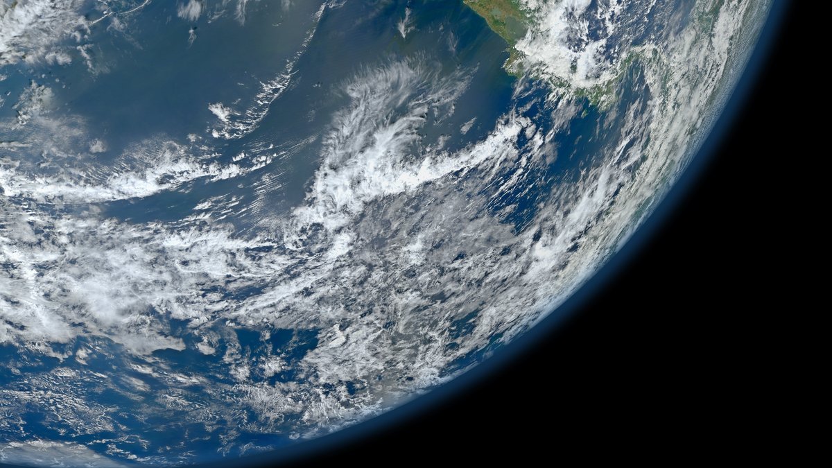
The Pacific Ocean covers more of Earth than any other ocean basin and its scale changes how the planet works. It holds huge stores of heat, links polar and tropical waters and contains the deepest known point in the sea. A map makes it look like open blue space. It is a restless system with ridges, trenches, islands, currents and living communities. Its waters touch nations with very different climates, economies and coastal risks.
One useful starting number is more than 155 million square kilometers, or more than 60 million square miles. NOAA Ocean Exploration describes the Pacific as Earth’s largest and deepest ocean basin. That broad reach runs from Arctic waters through the tropics toward Antarctica, with Asia and Australia on one side and the Americas on the other. It also contains marginal seas, island chains and seamounts that make any simple boundary line a scientific choice.
A basin larger than all continents
NOAA’s National Centers for Environmental Information gives a more detailed illustration of the scale. Its ETOPO1-based compilation lists the Pacific at 161.76 million square kilometers of area and about 660 million cubic kilometers of volume. Those figures amount to 44.7 percent of ocean area and 49.4 percent of ocean volume in that dataset. The Pacific therefore holds nearly half of the ocean water represented there. The basin is wider than the Moon’s diameter at its broadest east-to-west span. It crosses many time zones and joins high-latitude waters with the warm tropical belt.
Large ocean numbers need labels. A coastline is irregular and scientists must decide where one ocean ends and a marginal sea begins. The NCEI compilation reports values calculated from a particular global seafloor model. A rounded basin estimate, a mapped area that includes selected seas and a percentage of Earth’s surface answer related questions. Differences in their values reflect those distinct definitions. Volume adds another choice because it depends on the mapped bottom and the sea-level reference used in the calculation.
Depth depends on the measurement
The same care applies below the waves. NCEI’s table gives the Pacific an average depth of 4,080 meters, while NOAA Ocean Exploration uses an approximate 4,000 meters. Both convey a basin that is extraordinarily deep on average. Average depth comes from dividing a defined water volume by a defined area, so the chosen boundary and underlying bathymetry matter. Bathymetry means the shape and depth of the seafloor, mapped by soundings, satellites and other measurements.
At the other extreme lies Challenger Deep in the Mariana Trench. NOAA’s ocean-depth reference calls it approximately 10,935 meters below sea level, or 35,876 feet. NCEI’s gridded Pacific table reports a 10,803-meter maximum. Survey coverage, processing methods, reference surfaces and the exact spot selected can produce different published depths. Each value should travel with its method rather than being treated as a conflict. NOAA’s depth overview places Challenger Deep in the southern end of the trench. Pressure there is extreme because a towering column of seawater rests above it. Reaching this environment requires specially designed instruments and vehicles.
Currents move heat across the planet
Over the tropical Pacific, steady trade winds usually push surface water westward. Warm water piles up toward Indonesia and Papua New Guinea, while colder nutrient-rich water can rise nearer the eastern equatorial Pacific. That exchange helps shape rain, fisheries, clouds and the distribution of heat between ocean and air. Along coasts, currents can also steer fog, carry larvae and set the temperatures experienced by marine species. Farther north and south, rotating wind systems and Earth’s spin organize broad current loops called gyres.
The pattern can shift during the El Niño-Southern Oscillation, often shortened to ENSO. When easterly trade winds weaken or reverse, warm surface water spreads eastward and upwelling can ease. NOAA’s Pacific Marine Environmental Laboratory has tracked how these changes alter carbon dioxide exchange and circulation in the equatorial Pacific. Its equatorial observations show why one ocean region can influence weather far beyond its shores. These events develop over months and their effects vary by season, place and event strength.
Why the Pacific has a Ring of Fire
The Pacific’s dramatic hazards are concentrated around many parts of its rim, where tectonic plates meet. In several arcs, dense oceanic crust bends downward beneath another plate. These subduction zones generate earthquakes and feed volcanoes as rocks and fluids move into hotter depths. The connected belts are commonly called the Pacific Ring of Fire. Underwater earthquakes can also displace seawater and generate tsunamis, making coastal warnings especially important around some basins.
That name is a useful map label that needs local detail. Subduction dominates some Pacific margins. It shapes parts of Japan, Alaska, the Andes, Tonga and the Marianas. Other sections include transform faults, spreading centers, passive continental edges, or broad areas far from a boundary. The U.S. Geological Survey describes the Ring of Fire as the area where the Pacific Plate meets many surrounding plates. Plate boundaries organize much of the seismic and volcanic activity. Hawaii sits within the plate, where hot-spot volcanism follows a different process.
Islands and life across changing waters
Thousands of islands rise from this basin, although they formed by different routes. New Guinea and New Zealand include continental fragments. Hawaii records a chain of volcanoes built as the Pacific Plate moved over a long-lived hot spot. Elsewhere, volcanic islands and low coral atolls create small land areas separated by immense stretches of water. Many island societies have built navigation traditions suited to these distances. Their coastal waters are vital for food, transport and cultural practice.
Life follows the physical setting. Sunlit surface waters support microscopic algae that begin many food webs. Upwelling can bring nutrients toward the surface. Coastal forests, seagrass beds and coral reefs shelter young fish and invertebrates, while the open ocean supports animals adapted to travel or drift. Conditions can change sharply with latitude, depth, currents and distance from land. The Pacific is one name for many connected habitats. Deep areas support communities that live without sunlight, including animals around some hydrothermal vents. Migration links these regions when whales, tuna, seabirds and turtles cross national boundaries during their life cycles.
A vast ocean under pressure
The Pacific supports food systems, shipping, island communities and climate monitoring. It also receives pollution from land and sea. Plastic items break into smaller pieces, move with winds and currents and can be swallowed by wildlife or entangle animals. The Great Pacific Garbage Patch is a well-known accumulation zone in the North Pacific, yet plastic pollution extends across coasts, water columns and seafloor habitats. Cleanup, prevention, waste collection and product design all matter because currents can carry debris long distances from its point of release.
Warming water, marine heatwaves, acidification, deoxygenation and overfishing add further stress in different places. Coastal development can add pressure close to shore. The size of the Pacific can hide local damage from a distant view. Measurements from ships, buoys and satellites help scientists track change. Seafloor maps and community observations add vital local evidence. They reveal why careful definitions matter: a single ocean can be a planetary basin, a local fishery, a deep trench and a moving climate engine at the same time. Good observations turn that huge, changing system into evidence communities can use. They can support safer navigation, disaster preparation, fisheries management and reef protection. The Pacific’s future will be shaped by local actions that reflect its basin-wide connections. They help communities connect distant changes in wind, temperature, pollution and seafloor conditions to choices that protect coastal ecosystems and livelihoods. That knowledge gives a vast ocean a human scale.





