
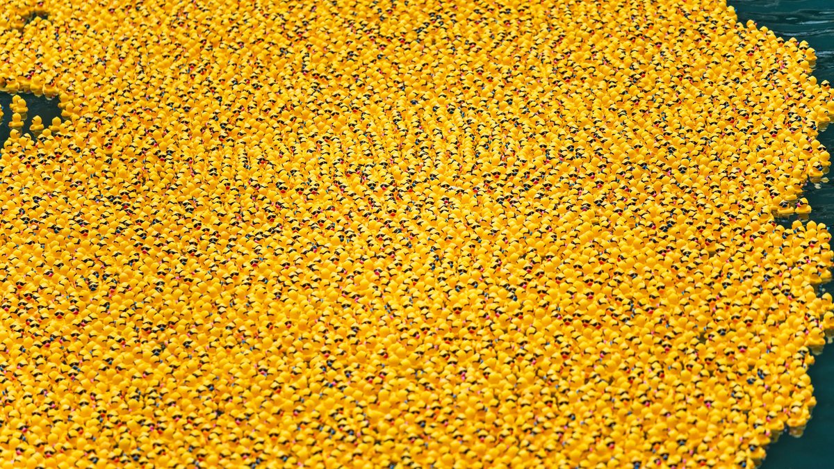
NOAA‘s Mapping Friendly Floatees lesson turns a 1992 cargo accident into a map of moving water. A container of almost 29,000 plastic bath toys went overboard in the North Pacific during a storm. Reports of toys reaching shore later gave oceanographers real dates and places to compare with their ideas about how the ocean moves.
The objects became known as the Friendly Floatees. Their story is memorable because the cargo was made for bathtubs, yet the useful part of the record was much plainer: an accidental release had a known starting time, an approximate location and later recoveries. That combination offered a rare public view of the forces that steer floating material across the sea.
A container opened in the North Pacific
On January 10, 1992, severe weather caused a ship near the International Date Line to lose containers. NOAA’s ocean-circulation overview says the ship was traveling from Hong Kong toward Tacoma, Washington. One container held plastic ducks and other bath toys. The objects entered the sea near 45 degrees north and 178 degrees east.
The cargo included ducks, frogs, turtles and beavers. Media accounts often reduce the event to rubber ducks, but the source describes a mixed shipment. That detail matters because each floating object had its own shape above the waterline. Wind, waves and the part of an object below the surface can all affect where it goes.
Beach finds supplied the first clues
About ten months later, some toys began washing ashore in Alaska. NOAA’s recovery handout lists Sitka in November 1992, Chichagof Island in February 1993 and Cordova in May 1993. It also lists later finds on Washington’s Olympic Peninsula, Kure Island and Lānaʻi.
Those dates are more useful than a colorful beachcombing tale. Each reported recovery gives a model a test point. A calculation that sends every object far from the observed coast is missing something important. A calculation that reaches the right region at a plausible time has captured at least part of the water’s large-scale motion.
Location and date work together in this kind of mapping. A beach report without a date gives less information about speed. A date without a location cannot identify the current system involved. The Friendly Floatees record is valuable because NOAA’s teaching materials preserve both pieces for several reported recoveries.
The toys were imperfect but revealing drifters
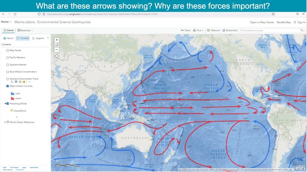
Oceanographers call the broad, directed movement of seawater a surface current when it occurs near the top of the ocean. Winds transfer momentum to the water and help form many of these currents. Earth’s rotation alters the path. Coastlines, seafloor shape, water density and tides also influence where floating material goes.
The bath toys behaved differently from precision instruments. They rode partly above the water, so wind could push them differently from a purpose-built scientific drifter. Some may have become trapped in ice, damaged, lost, or picked up before anyone reported them. For that reason, a recovered toy gives a valuable clue rather than a complete record of its own path.
Still, a large accidental release can show patterns that one lone object might hide. Many items began in roughly the same area. Their scattered discoveries revealed how quickly a wind-driven drift can spread material across a basin and how nearby objects can take different routes as currents bend and split.
Models turned sightings into testable routes
Scientists already had tools for estimating North Pacific movement. NOAA researcher W. James Ingraham Jr. helped develop OSCURS, short for Ocean Surface Current Simulations. The model was built to simulate surface transport in the North Pacific and Bering Sea using information about winds and currents.
Models in this family calculate many small steps rather than drawing one straight line from a spill to a beach. The estimated wind and current conditions at one step affect the next. When a predicted track misses a reported recovery, researchers can test the timing and release location. They can also revisit the wind field and other model assumptions.
A chance release has one unusual advantage for this kind of comparison. The ocean receives many objects at nearly the same time, then the first recoveries arrive without an investigator choosing the endpoint. The spill remains an uncontrolled event, yet it gives researchers an independent pattern against which to compare a simulation. The lesson is especially useful for showing why a good forecast needs observations from the real ocean, including observations that reveal where a model has limits.
A later NOAA description of OSCURS shows a trajectory adjusted to the first beach recoveries and then followed over several years. The picture is a calculated route, based on the model’s inputs and the recovery pattern. It is most useful for asking whether known releases and later recoveries can be connected by a physically reasonable path.
That distinction keeps the story grounded. The toys helped check and refine ideas about ocean circulation. Each reported landfall was an occasional checkpoint. A GPS buoy would produce continuous position reports. Ocean models combine the checkpoints with weather and current information to estimate the routes between them.
The North Pacific route had branches
Some of the material traveled toward Alaska and the Bering Sea. NOAA’s marine-debris report says the toys traveled through the Bering Strait and into the Arctic. The NOAA education handout separately lists later discoveries on the Maine coast, the Isle of Skye and Devon.
These locations describe reported recoveries, not a simple parade of the same object around the world. The exact history of any individual toy is often unknown. What the wider pattern shows is that a release in the North Pacific can feed into connected current systems over years, especially when ice, winds and coastal encounters alter its course.
Why a small accident became an ocean lesson
The subarctic gyre is one of the broad circulation patterns that can move floating material around the North Pacific. NOAA’s OSCURS material depicts a trajectory circling this system more than once after the 1992 release. Such routes are shaped by changing winds and seasons, so a single clean loop would oversimplify the ocean.
The event also makes an uncomfortable point about marine debris. Floating plastic can travel far beyond the place where it enters the water. In this case, the same observations that helped explain currents also showed why lost cargo and other drifting debris can create a problem across borders and decades.
Modern science uses better tracers and the same logic
Today, researchers deploy instruments designed for the job. Surface drifters and profiling floats can send locations and measurements while they move. Their data support forecasts and navigation. They also aid search and rescue, fisheries research and studies of climate-related ocean change.
The basic reasoning remains familiar. Scientists start with a release or deployment point, measure later positions and compare those observations with a model. The Friendly Floatees episode gave the public a striking version of that process. It also showed why reliable observations, careful dates and clear uncertainty make oceanographic models stronger.
The limits of the Floatees record
The known spill date and reported beach finds make the incident useful for teaching and for testing broad current pathways. The evidence is strongest for the overall pattern of movement. Individual toys reported years later need separate provenance and unreported toys leave gaps in the record. Their later course, sinking date and wind exposure often remain unknown.
That uncertainty is part of the science rather than a flaw in the story. A model earns confidence when it is compared with observations and revised as evidence improves. The Friendly Floatees became a memorable case because a very ordinary object helped make the hidden movement of the ocean easier to see.





