
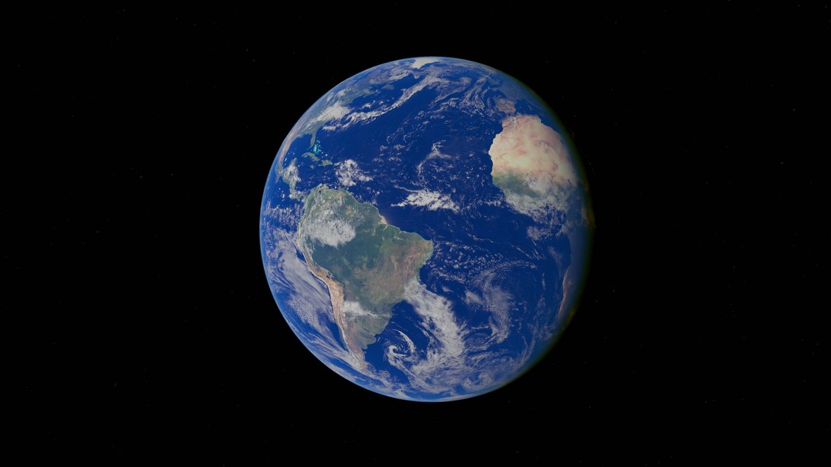
NOAA’s Ocean Service describes Earth as one connected global ocean that is usually divided into five named ocean basins. Their names are Pacific, Atlantic, Indian, Arctic and Southern. That answer gives maps, classrooms, scientists and navigators a practical shared language. It also carries an important reminder. The lines between oceans help people describe a complex planet, while seawater itself moves across those lines every day.
The count can sound simple until a globe comes into view. The Pacific meets the Arctic in the north and reaches toward the Southern Ocean in the south. The Atlantic and Indian connect with their neighbors as well. Five is the common modern answer, yet it sits alongside the larger scientific idea of a single circulating ocean.
Five named ocean basins
The familiar list starts with the Pacific Ocean, Atlantic Ocean and Indian Ocean. It also includes the Arctic Ocean and Southern Ocean. Each name refers to a vast region of saltwater with its own shape and currents. Weather patterns, seafloor features and nearby continents give each basin a recognizable character. The names make it easier to discuss a storm in the Atlantic, a monsoon over the Indian Ocean, or sea ice in the Arctic without describing the whole planet at once.
For a long time, many maps taught a four-ocean model. It included the Pacific, Atlantic, Indian and Arctic. The waters around Antarctica were often treated as southern portions of the Atlantic, Pacific and Indian Oceans. Today, the five-ocean model appears widely in U.S. government material, maps, education and ocean science communication.
Ocean names come from a blend of geography, history, culture and science. They are useful regional labels, much like naming mountain ranges or deserts. A boundary can follow a coast, a latitude, a current, or a convention set by mapmakers. That is why asking for a number opens a larger question about how people organize an interconnected natural system.
Maps are especially good at making the regional view feel natural. A classroom globe shows blue areas broken up by land, labels and colored boundaries. Researchers also need those labels when they compare sea temperature records, track fish populations, issue marine forecasts, or organize seafloor surveys. The names make large data sets easier to use. They also let people describe local conditions while keeping the full planetary system in mind.
One ocean links every basin
Earth’s global ocean covers about 71 percent of the planet’s surface. NASA notes that it holds about 97 percent of Earth’s water. The sheer scale matters because ocean water stores heat, absorbs carbon dioxide, supports food webs and supplies much of the moisture that later falls as rain or snow over land.
Currents keep the named basins in contact. Winds push surface water, while differences in temperature and saltiness affect how dense water is. Colder or saltier water can sink in some places. Water from below rises elsewhere. Over long periods, this linked movement carries heat and oxygen through the world’s ocean. It also transports nutrients and dissolved carbon.
The U.S. Geological Survey describes the named oceans, seas, bays and estuaries as interdependent parts of one global ocean. That connection helps explain why a change in one basin can matter far away. A warming pattern, an El Niño event, or a large amount of pollution may begin in one region, then influence ecosystems and communities across many shores.
A line printed between two basins doesn’t block water or stop a current. It gives researchers a consistent place to organize observations. Oceanographers can compare conditions on either side while still tracing water as it crosses the mapped boundary. This is especially useful when they study heat moving between regions or follow nutrients through marine food webs. It also helps forecast agencies describe where waves, storms and unusual temperatures are developing. The regional names provide precision, while measurements reveal the continuous physical connections underneath them.
The Pacific, Atlantic and Indian
The Pacific is the largest and deepest named basin. NOAA reports that the Pacific covers roughly 162 million square kilometers and contains more than half of Earth’s free water. It reaches from the Arctic region toward Antarctica and lies between Asia and Australia on one side and the Americas on the other.
The Atlantic is the second-largest basin. Its long, narrow shape separates the Americas from Europe and Africa. It includes the Gulf Stream and other currents that help redistribute heat. In the North Atlantic, cold and salty water can become dense enough to sink, a process that helps drive parts of the larger ocean circulation system.
The Indian Ocean is the third-largest basin and the warmest overall. It lies between Africa, Asia, Australia and Antarctica. Seasonal monsoon winds strongly affect its surface currents and rainfall patterns. Busy shipping routes cross its waters. Coral reefs, fisheries, islands and coastal populations make this basin important to daily life for people across several continents.
Why the Southern Ocean stands apart
The Southern Ocean circles Antarctica and is commonly mapped south of 60 degrees south latitude. NOAA says the United States recognizes this region as the fifth ocean. The latitude offers a clean, easy-to-draw boundary. Its use also supports consistent naming in maps, data records and educational materials.
Nature gives the region a strong identity too. The Antarctic Circumpolar Current flows around Antarctica without a continental barrier. It connects the southern parts of the Pacific, Atlantic and Indian basins. Strong westerly winds help power this current, which moves an enormous amount of water and plays a major role in global climate and the exchange of heat and carbon.
International agreement on exact limits has developed gradually. The International Hydrographic Organization received a proposal for a Southern Ocean boundary in 2000, while member countries have differed on final details. The practical five-ocean answer remains useful because the water around Antarctica has distinctive currents, weather, sea ice and ecosystems. It also highlights a region central to climate research.
The Arctic and the meaning of sea
The Arctic is the smallest named ocean basin. NOAA estimates its area at about 15.6 million square kilometers. It is bordered by North America, Greenland, Europe and Asia. Sea ice covers much of its surface for much of the year and rivers add large amounts of freshwater that help give Arctic surface waters relatively low salinity.
Names can also become confusing when people use oceans, seas, gulfs and bays in the same conversation. A sea is usually a smaller part of the ocean, often partly enclosed by land or defined by a regional coastline. The Mediterranean Sea, Caribbean Sea and Bering Sea are all connected to the global ocean. Their names describe regional settings rather than separate planetary oceans.
The phrase Seven Seas adds another historical layer. Its meaning changed between cultures and eras. It has never served as a fixed scientific count of Earth’s oceans. For modern geography, five named ocean basins is the clearest answer. For ocean science, the deeper answer is one living, moving system whose regions are connected from the sea surface to the seafloor.
A useful way to remember the answer is to keep both scales in view. On a map, Earth has five named ocean basins. In motion, it has one connected ocean system. Both statements describe the same planet from different angles. The first supports clear communication. The second explains why ocean currents, climate, marine life and pollution can link distant places that appear far apart on a map.





