The stakes of a century-old expedition story have come into focus on the floor of the Labrador Sea. A July 8 announcement from the Royal Canadian Geographical Society and Woods Hole Oceanographic Institution reports the first close-up images of Quest, the final ship of polar explorer Ernest Shackleton. Cameras on the human-occupied submersible DSV Alvin and WHOI’s Falcon ROV recorded the wreck in detail for the first time.
The images open a new chapter for a ship already familiar to exploration history. Quest’s wreck was discovered in 2024 by the RCGS-led Shackleton Quest Expedition using side-scan sonar. This 2026 voyage produced the first close look at the wreck, along with a three-day survey intended to map the site and build a lasting digital record.
A ship seen at close range
For the team, the view was immediate and personal. The bow, deck and some portholes remain visible on the seafloor, although the main mast is down. John Geiger, the RCGS chief executive and expedition leader, rode Alvin on its first dive to Quest. He called the encounter a moving experience and said, “To see Shackleton’s ship and to think that Shackleton was standing on that deck a century ago.”
Light from the vehicles revealed an active marine setting around the vessel. The expedition reported pink corals across the wreck, as well as cod, redfish and wolffish. Those observations give the images a second value beyond history. Quest has become part of a living seafloor habitat, where a damaged wooden ship now offers surfaces and shelter within the cold Labrador Sea.
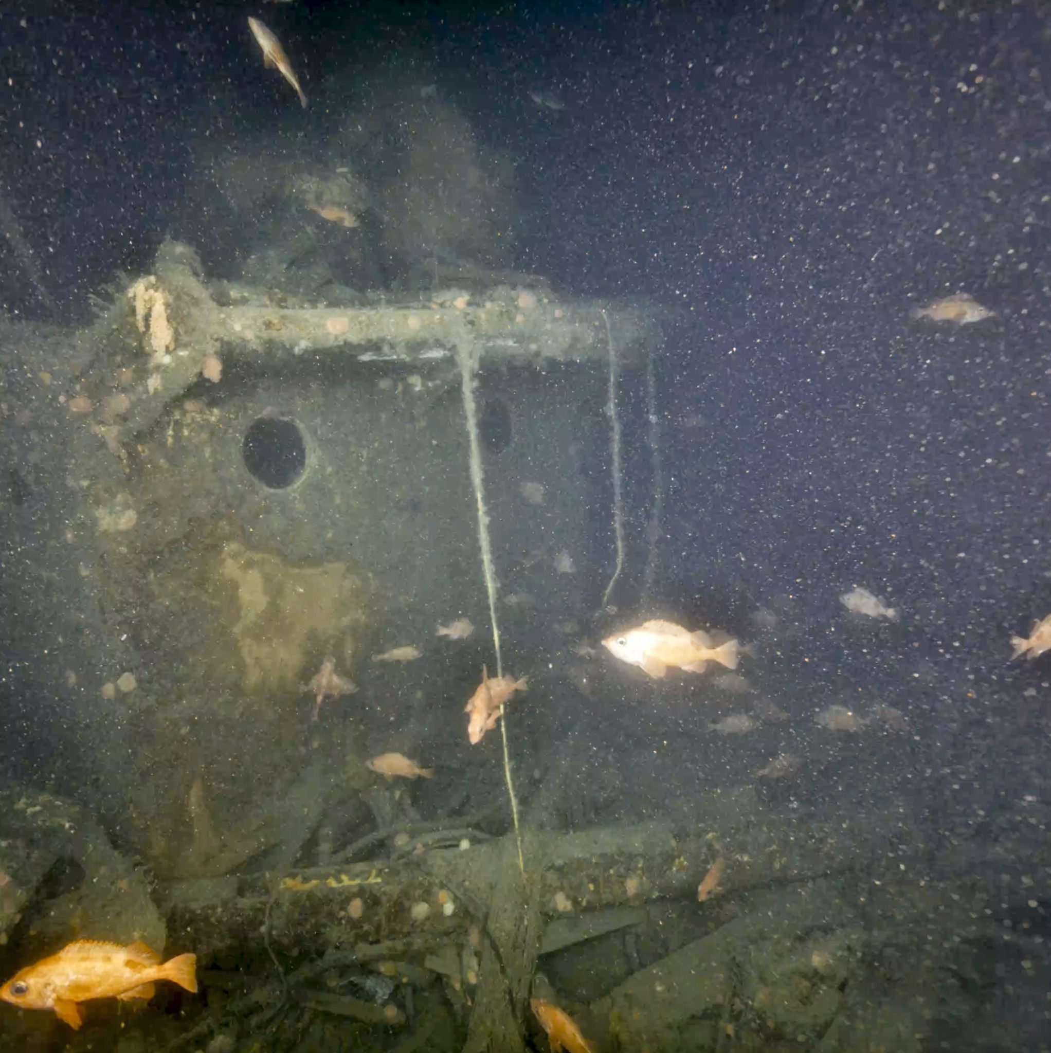
Close-range imagery also makes condition easier to judge than a sonar outline alone. A side-scan sonar survey sends sound toward the seabed and reads the returning signal, producing a useful picture of shape and position. Cameras can show details such as portholes, broken structures, marine growth and gear lying across the hull. Together, the older sonar result and the new observations give researchers a more useful record of Quest’s present state.
That difference matters when a ship has a complicated past and a delicate future. An image can preserve the relation between a porthole, a broken mast and the surrounding seafloor at the moment of the visit. Later teams can compare a fresh image with this baseline. They can also share the scene with people who will never descend to the wreck, while the vessel remains where it sank.
From a sonar find to a digital twin
The 2024 expedition located Quest after more than six decades on the seafloor, following its loss in 1962. The ship had been sold to a Norwegian family after Shackleton’s era and spent about 40 years sealing in Arctic waters. It was finishing a Labrador Sea season when ice floes crushed it on May 5, 1962.
This year’s crew is using underwater photogrammetry from the Canadian company Voyis to document the wreck. The method combines many overlapping photographs into a measured three-dimensional model. Each image supplies part of the scene. When matching features appear in several photographs, software can estimate their positions and build the shape of the structure. The planned result is a digital twin, a virtual version of Quest that can be examined after the shipboard work ends.
A digital model does more than make a dramatic wreck easier to view on a screen. It holds the results of one careful survey in a form that can be studied without sending another vehicle down immediately. Researchers can use it to orient themselves around the hull, locate features visible in the photographs and frame new questions for later work. The expedition says the model is intended for both further study and public engagement.
That record can help specialists study a difficult site without repeated visits. Dwight Coleman, WHOI co-chief scientist for the expedition, said the team would use Alvin “to put the first human eyes on Quest in more than 60 years.” The same effort pairs a human view with systematic photography, so historians, archaeologists and the public can inspect more than a single dramatic frame.
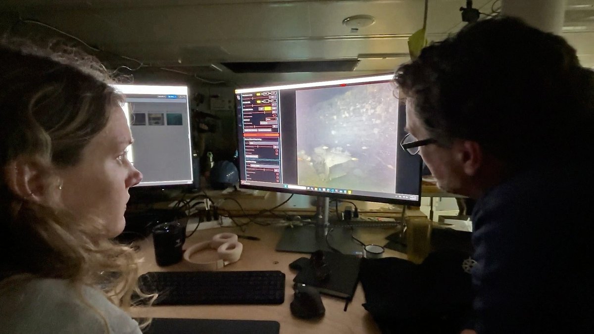
Alvin is built for precisely this kind of close work. WHOI describes the vehicle as a human-occupied submersible for deep-ocean research, where pilots and observers can inspect the seafloor directly while using cameras and scientific tools. The expedition also used WHOI’s remotely operated Falcon vehicle. Its video and imaging systems can work while operators remain aboard the research vessel. Using both kinds of vehicle gave the team direct observation and camera coverage from a safe working platform above.
A fragile site in a working ocean
The first visits also brought a warning. Large fishing nets obscured parts of Quest when the team reached the wreck. Geiger said, “The nets are a sad story, limiting our ability to look at the wreck.” His observation points to a practical problem for the survey. Nets can block cameras and conceal details that photogrammetry needs to see.
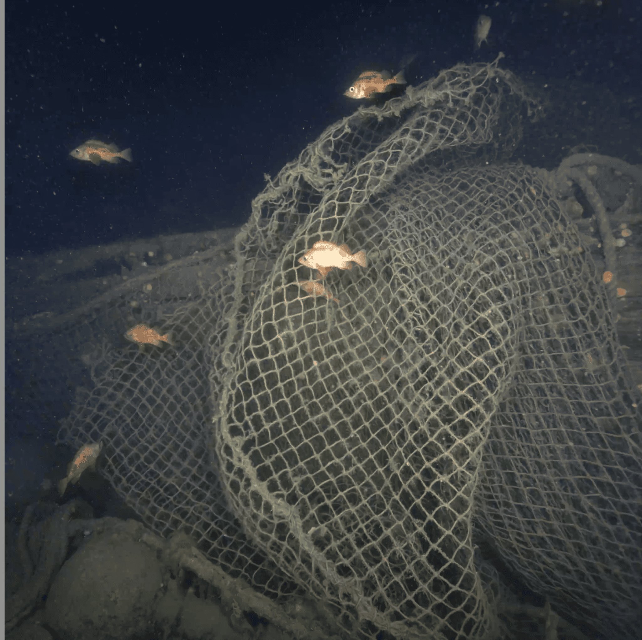
Wrecks can be valuable historical places and busy pieces of ocean habitat at the same time. Coral and fish found around Quest show why a careful visual record matters. The announced survey is designed to map the vessel while leaving it undisturbed. It offers a baseline for future comparisons if researchers return to assess changes to the structure, marine life, or fishing gear.
The origin and arrival date of the nets remain unresolved in the announcement. That gap is important. The expedition documented what it saw and described an obstruction that affected the survey. A detailed map and image set can make the extent of the visible gear clearer for future discussions about protecting the site and understanding its changing condition.
Several systems made the visit possible. Alvin and the research vessel Atlantis are owned by the U.S. Navy Office of Naval Research and operated by WHOI with support from the U.S. National Science Foundation. The Falcon vehicle came through the NSF-supported Ocean Observatories Initiative at WHOI. These tools turn a remote shipwreck into a place that can be mapped, revisited and shared without moving it from the seafloor.
Quest’s final voyage still carries a larger story
Quest is linked closely to Shackleton’s final years. He died aboard the ship in 1922 at age 47 while traveling toward Antarctica on what was meant to be his last expedition. His name was already tied to the survival of the Endurance crew, after their ship was lost in the ice of the Weddell Sea. Quest carried that legacy into a later and very different life in Arctic sealing waters.
The Heroic Age Expedition brought together ocean engineers, pilots, a marine archaeologist, a benthic ecologist, historians and shipwreck hunter David Mearns. Their roles reflect the many questions around a historic wreck. The photographs can show its physical condition. The model can preserve its form. Biological observations can record what now lives there. Historical research can connect those findings to the people who sailed it.
The announcement said the expedition would then travel northeast toward Greenland to survey Terra Nova, the final ship associated with Robert Falcon Scott. Both vessels later worked as sealers in Canadian waters, which gives the two wrecks a shared regional history beyond their better-known Antarctic connections. Shackleton had originally planned to take Quest to the Canadian Arctic before changing course toward Antarctica.
For now, the sharpest result is a set of images that joins exploration history to modern ocean science. As the first close-up survey of Quest develops, the wreck can be studied as a historic vessel, a deep-sea habitat and a record of what happens when ships, ice, fisheries and time meet on the ocean floor. The work also shows how a 2024 sonar discovery can grow into a richer survey when human observers, remote cameras and three-dimensional imaging reach the same place.