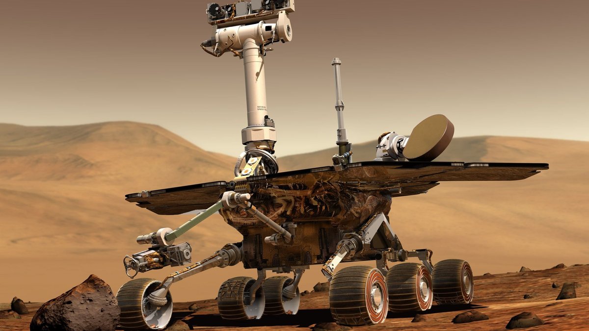
NASA’s Curiosity mission is surveying a puzzling sequence of exposed rock bands as the rover climbs Mount Sharp, using close-up imaging, chemistry measurements and long-distance views to track how the Martian landscape changes from one layer to the next.
The June 12, 2026 planning update describes NASA’s Curiosity rover crossing a dark, rough-textured band of bedrock and preparing to examine a smoother, lighter-toned unit ahead. Each band gives the Mars Science Laboratory team another chance to compare textures, colors, chemistry and layering along the rover’s route through Gale Crater.
William Farrand, a senior research scientist at the Space Science Institute, described the work as Curiosity moving through “physical bands of exposed rocks with textural and tonal differences.” That simple phrase captures the science value of the climb. On Mars, a change in rock tone or texture can point to a change in material, erosion, dust cover, or ancient environmental conditions.
Curiosity is still doing what it was built to do. It stops, looks closely, tests chemistry, takes wide mosaics and then drives onward. The latest plan shows the careful rhythm behind a rover campaign, where even a delayed data downlink can reshape the next several Martian days of science.
Curiosity Reaches a Dark, Rough Band
A rough, dark band on Mount Sharp became Curiosity’s main workspace during the sols 4920 and 4921 plan. The rover was positioned in the middle of a unit with darker bedrock and a rougher surface texture. That texture mattered immediately because the team could examine the rocks only as they were found.
The rover often uses a brushing tool to clear dust from selected rock targets before contact science. In this workspace, the surface was too rough for brushing. The team still had usable targets, so they planned observations on “as is” bedrock. That kept the campaign moving while preserving the chance to measure the rocks inside the band.
Targets named Salto La Cascada and Puerto de Rosas were selected for contact science. Curiosity’s arm-mounted instruments could collect chemical and close-up imaging data at those spots. The names come from the mission’s target-naming practice, which helps the team track many observations across complex terrain.
The dark tone and rough texture make this band useful as a comparison point. If the rover later measures a smoother or brighter band, scientists can ask whether the change is mainly physical, chemical, or tied to how wind and dust have shaped the surface. Curiosity’s path across these boundaries gives the team a natural transect through Martian geology.
Chemistry Tests on Unbrushed Martian Rock
Chemistry work continued even with the rocks left unbrushed. Curiosity planned measurements with APXS, the Alpha Particle X-ray Spectrometer, on the bedrock targets Salto La Cascada and Puerto de Rosas. APXS helps identify the chemical elements present in rocks and soils by placing the instrument close to the surface.
Close-up imaging was also planned with MAHLI, the Mars Hand Lens Imager. MAHLI gives the science team a detailed view of textures that are hard to interpret from navigation images alone. Tiny grains, coatings, layers and rough surfaces can all help scientists decide how a rock may have formed or changed over time.
Curiosity’s ChemCam instrument added another layer of analysis. The plan included LIBS spectroscopy on a bedrock target named Kishuara and on a small, layered float rock named La Rosita. LIBS stands for laser-induced breakdown spectroscopy, a technique that can read chemical clues from a small spot at a distance.
The float rock La Rosita is especially useful because it may have traveled from a nearby outcrop or slope. Its layered appearance gives the team another texture to compare with the bedrock under the rover. Even small rocks can carry clues about the surrounding landscape when a rover has the tools to inspect them.
Together, APXS, MAHLI and ChemCam let the team connect chemistry with appearance. A dark rough rock can be described visually, but chemistry can show whether it differs from nearby materials in composition. That combination is central to Curiosity’s work as it climbs through changing terrain.
Layered Buttes, Troughs and Tonal Dunes
The rover’s cameras widened the story beyond the rocks at its wheels. ChemCam’s Remote Micro-Imager collected views of the Mishe Mokwa butte and another view looking toward dunes with tonal differences. These distant images help the team place local observations into the larger landscape.
Curiosity also used Mastcam mosaics to document several surrounding features. The plan included mosaics of the Valle Grande channel, Kimsa Chata butte, nearby troughs and a rock called El Matir. Farrand described El Matir as aircraft carrier shaped, a reminder that rover teams often rely on memorable visual descriptions when navigating unfamiliar terrain.
After another drive, Curiosity moved closer to the upper border of the dark-toned band. The next workspace still had rock surfaces that could be examined, although brushing remained unavailable. The team planned APXS and MAHLI observations of Santa Gracia and Laguna San Rafael. ChemCam LIBS also targeted the bedrock there.
Nearby features received attention as well. Mastcam mosaics were planned for a layered rock, nearby troughs and the smaller butte Miraflores. According to the mission update, Miraflores shows an interesting layered structure with ragged dark-toned rocks on one side and a stack of dust on top. That mix of layered rock and dust cover may help the team separate bedrock structure from surface deposits.
Long-distance imaging extended the survey again. ChemCam’s RMI was assigned a mosaic of a bright unit on Mishe Mokwa, while Navcam dust-devil surveys were included on both sols. The rock record and the active atmosphere are both part of the same Martian scene. Dust can hide, soften, or exaggerate contrasts between units, so environmental monitoring helps the team read the surface more carefully.
A Delayed Downlink Changes the Mars Plan
On Mars, even a strong plan depends on data arriving at the right time. The Curiosity team expected images from the drive planned for sol 4923, but the downlink did not arrive in time for Friday planning. Without those images, the team could not safely plan another drive, targeted remote sensing, or detailed in situ work at a newly confirmed location.
That kind of delay shows how much rover science depends on communication between worlds. Curiosity sends information back to Earth through relay and mission systems. Once the images arrive, scientists and engineers use them to decide where the rover can drive and which rocks can be targeted. A late downlink compresses or changes that process.
Farrand wrote, “There are always interesting things to be done on Mars.” The team proved that point by building a three-sol plan for sols 4924 to 4926 around activities that could be done without the missing drive images.
The revised plan included a 360-degree Mastcam mosaic. That kind of panorama can provide broad context while the rover waits for enough information to resume more targeted work. A full sweep of the surrounding terrain can reveal layers, slopes, troughs and distant features that deserve closer inspection later.
Curiosity also planned automatic AEGIS targeting of LIBS measurements on each sol. AEGIS lets the rover select targets for ChemCam analysis with onboard autonomy. That capability is valuable when the team wants science data during a period with limited targeting information from Earth.
Curiosity Prepares for a Smooth, Light-Toned Band
The delayed downlink was expected to guide the next step after the weekend plan. On Monday, the team planned to use those images for the first investigation of the next band of surface materials. This upcoming unit was described as smooth-textured and light-toned.
That transition is the heart of the current survey. Curiosity has been moving from a dark, rough band toward light-toned surface materials. A smoother, brighter unit may behave differently under the rover’s instruments. It may also show different layering, dust cover, erosion patterns, or chemistry.
Every new band adds a comparison. The rover can examine whether rough dark bedrock and smooth light-toned material share similar chemical signatures. If they differ, scientists can study how that difference fits into Mount Sharp’s larger story. If they match in some ways, texture and color may reflect later surface processes as well as original rock formation.
Curiosity’s climb up Mount Sharp has always been a layered investigation. The mountain preserves a long sequence of exposed materials inside Gale Crater. As the rover ascends, it gives researchers a ground-level view of changes that orbiters can see from above but cannot touch.
The latest plan shows a rover still working with patience and flexibility. It can test rough bedrock when brushing is unavailable. It can image distant buttes while preparing for a drive. It can pivot to panoramas, atmospheric measurements and autonomous laser targeting when a data delay interrupts the original plan. That adaptability is why Curiosity remains a powerful field geologist on Mars, one band at a time.