A study in Antiquity has identified a previously undocumented Maya city called Valeriana in Campeche, Mexico, after researchers reexamined environmental lidar data collected for forest monitoring. The discovery shows how a dataset built for one scientific purpose can reveal an ancient urban world beneath dense tropical vegetation.
The city came into view when Luke Auld-Thomas, then a Tulane University anthropology doctoral student, found a lidar survey while searching online. The scans had been gathered in 2013 for a forest and carbon project tied to Mexico REDD+. Years later, the same laser data helped archaeologists map pyramids, plazas, a ball court, causeways, reservoirs and thousands of smaller features across a busy Maya landscape.
Valeriana makes the story feel almost impossibly modern. A city that had been hidden under forest for centuries was also sitting inside a public digital trail. The first clue came from search results rather than a jungle expedition, yet the result belongs firmly to archaeology. It adds another piece to a fast-changing picture of the ancient Maya lowlands.
The Search That Revealed Valeriana
The most striking number in the story may be 16. Auld-Thomas has said he was deep in Google results when he found a laser survey that had been collected for environmental monitoring. The file had scientific value from the start, since it recorded forest structure and carbon-related information. Its archaeological value emerged when a different question was asked.
That shift matters. Archaeologists often work with fresh field surveys, excavations and carefully planned mapping campaigns. Here, the first step was recognizing that an existing scan could be read in a new way. The laser pulses had already recorded the terrain beneath the trees. Researchers needed to process and interpret the shapes that survived in the ground surface.
The study focused on an area of Campeche in southern Mexico. Within that landscape, the team identified Valeriana, a settlement with two major zones of monumental architecture. The site’s scale and layout suggest a major Maya center rather than a small scatter of buildings.
The discovery also highlights an increasingly important skill in modern science, finding useful data that already exists. Satellites, aircraft, climate surveys and environmental projects are producing enormous archives. In some cases, their second life begins when another field notices what the measurements can show.
How Lidar Sees Through Forest
Lidar stands for light detection and ranging. The technique sends laser pulses from an aircraft toward the ground. By measuring how long the pulses take to return, scientists can build a precise three-dimensional map of the surface below.
Forest makes ordinary archaeological survey difficult. Leaves, branches and trunks block the view from above. On foot, small rises and stone platforms can blend into roots, soil and vegetation. Lidar helps by collecting huge numbers of elevation points. Researchers can then filter out much of the vegetation and examine the shape of the land underneath.
For Maya archaeology, that ability has been transformative. A pyramid may appear as a low wooded hill. A causeway may look like a subtle ridge. House platforms, terraces, reservoirs and plaza edges can leave traces that are hard to see at ground level. In a lidar model, those traces can form patterns that point to ancient construction.
The method still depends on archaeological judgment. A computer image can show a rectangular platform, a raised road, or a basin. Researchers then compare those shapes with known Maya sites and regional architecture. The map becomes a guide to interpretation, field checking and future preservation work.
A City of Pyramids, Plazas and Waterworks
Valeriana covers about 6.4 square miles, according to descriptions of the site. Its form points to the Classic Maya period, a span that ran roughly from AD 250 to AD 900. That era saw the growth of powerful cities, elaborate architecture, written monuments, long-distance exchange and dense settlement across parts of Mesoamerica.
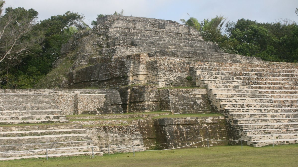
The larger architectural zone at Valeriana contains several features associated with major Maya centers. Researchers identified enclosed plazas, temple pyramids, a ball court, a broad causeway and a reservoir made by damming a seasonal stream. These features suggest planning, public gathering, ritual activity, movement through the city and water control.
The reservoir is especially important. In seasonal tropical environments, water management can shape where people live and how large settlements grow. A dammed seasonal watercourse suggests that residents were altering the landscape to store or control water. That kind of infrastructure points to organized labor and long-term planning.
The ball court also carries cultural weight. Across the Maya world, ball courts were tied to public life, politics, ritual and competition. Finding one at Valeriana strengthens the case that this was a significant center in its region. It adds to the sense of a city with civic and ceremonial spaces rather than a simple residential cluster.
A Crowded Maya Landscape in Campeche
Across about 47 square miles of lidar coverage in Campeche, researchers and officials reported thousands of pre-Hispanic structures. Public accounts describe more than 6,500 features in the broader survey area. That density changes the way the forested landscape reads to modern eyes.
The point is bigger than one city. Valeriana appears within a region filled with settlements, agricultural traces, roads, reservoirs and architecture. Some areas were rural. Others were more densely built. Together, they suggest a landscape shaped heavily by ancient people.
Marcello Canuto, a co-author of the research, described lidar’s emerging picture of the Maya lowlands as “a diverse tapestry of towns and communities.” That phrase captures the importance of the finding. The forested spaces between famous ruins may hold many layers of human activity.
For a long time, the best-known Maya sites dominated the public imagination. Names like Tikal, Calakmul, Palenque and Chichén Itzá became shorthand for the ancient civilization. Lidar is widening that frame. It shows how smaller settlements and large centers could be woven together across broad terrain.
In Campeche, the pattern suggests an ancient landscape with fewer empty spaces than a modern forest map might imply. The study’s title, “Running out of empty space,” points to that realization. Archaeologists are finding that many apparently quiet zones contain traces of houses, farms, civic centers and modified terrain.
Why Old Data Can Change Archaeology
The Valeriana discovery began with data collected for forest monitoring. That origin is part of what makes the case so useful for science. The lidar survey was tied to environmental questions about forests and carbon. Archaeologists later used the same measurements to study human history.
This kind of reuse is becoming more powerful as scientific archives grow. A dataset can outlive its first project. Climate researchers, ecologists, geologists, archaeologists and urban planners may all find different signals in the same measurements. The value depends on the questions researchers bring to it.
In archaeology, this approach can save time and open regions that have received less attention. Fieldwork remains essential, but old lidar data can help researchers choose where to look. It can reveal possible site cores, roads, reservoirs, terraces and residential zones before a team enters the forest.
Valeriana also shows the importance of public access and careful searching. A dataset that sits unseen in an archive has limited reach. When researchers can locate and process such data, discoveries can come from material that has been available for years. The city was hidden under forest and it was also waiting inside an overlooked digital record.
What Researchers Need To Confirm on the Ground
Laser mapping can reveal form with remarkable detail, yet archaeology still needs ground confirmation. A lidar image can show the shape of a mound or platform. It cannot always establish the exact age, function, sequence, or cultural meaning of every feature.
Field reconnaissance can answer questions that a map raises. Researchers may look for ceramics, construction materials, carved stones, soil changes, or architectural details. Those clues can help determine when a structure was built, how long it was used and how it related to nearby features.
Chronology is especially important. A lidar map captures a landscape as it exists today. Ancient places can accumulate over centuries. A city may have grown, shifted, shrunk, or changed function through time. Excavation and surface collection help build a timeline from the visible shapes.
Conservation adds another reason for caution. Once a site becomes widely known, it can attract attention from researchers, visitors, looters, developers, or local authorities. Mexican officials have emphasized the need for field reconnaissance to guide research, conservation and public communication. A discovery of this scale carries responsibility as well as excitement.
More Hidden Cities May Be Waiting
The broader lesson from Valeriana is that the Maya lowlands still have many stories to tell. Recent lidar projects have already transformed views of settlement in Guatemala, Mexico, Belize and beyond. They have revealed dense networks of structures, causeways, canals, terraces and reservoirs in places where forest now dominates the surface.
Campeche is especially important because it includes known major centers and large areas where mapping remains incomplete. The discovery of Valeriana suggests that other significant sites may be present in regions that appear familiar from roads, farms and nearby communities. The modern landscape can sit above a much older one.
The finding also changes how discovery itself feels. Earlier generations of archaeologists made breakthroughs through slow ground survey, excavation, aerial photography and local knowledge. Those methods still matter deeply. Today, they are being joined by data mining, remote sensing and digital mapping.
That combination gives archaeologists a wider toolkit. A student’s online search can lead to an old environmental scan. A forest dataset can become an archaeological map. A faint pattern in elevation data can guide field teams toward a city with plazas, pyramids, waterworks and roads.
Valeriana’s larger meaning comes from that chain of connections. Old data, patient searching and careful interpretation can still revise the map of the ancient world. In Campeche, they have brought a Maya city back into view and strengthened the case for “how crowded tropical antiquity may have been,” as the Antiquity study puts it.