A study in Nature Communications found that atmospheric rivers, long bands of moisture that stream across the sky, can help shape marine heatwaves in the North Pacific and North Atlantic. The work, led by Suqiong Hu and Shineng Hu at Duke University, points to an overlooked link between weather in the air and dangerous warmth in the ocean.
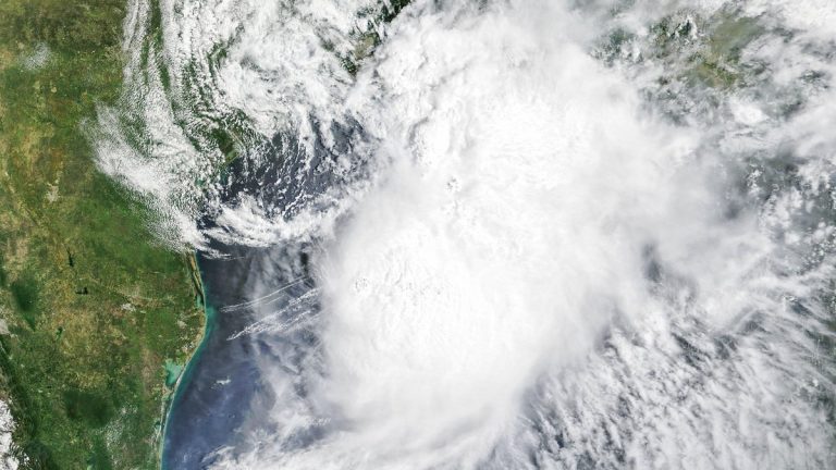
Atmospheric rivers are already famous for the rain and flooding they can bring when they hit land. Over the ocean, they spend most of their lives moving warm air, humidity, clouds and winds across vast distances. That open-water stage may matter more than scientists had recognized.
The Duke researchers examined decades of ocean and atmospheric data to ask a focused question. When a marine heatwave forms, was an atmospheric river nearby in the days before it peaked? Their answer was yes often enough to reveal a broad pattern across two major ocean basins.
The finding matters because marine heatwaves can devastate ecosystems, disrupt fisheries and stress coastal economies. They can last for weeks or months, creating heat stress beneath the surface where much of the damage unfolds out of sight.
Atmospheric Rivers Over Open Water
Atmospheric rivers are narrow corridors of concentrated water vapor. They can stretch for thousands of miles and carry enormous amounts of moisture from warmer regions toward cooler latitudes. When they meet mountains or coastlines, that moisture can fall as intense rain or snow.
Far offshore, the same systems move above the ocean surface for days. They carry warm, moist air and often bring thick cloud cover. They also change the way heat moves between the sea and the lower atmosphere.
That open-ocean behavior has received less attention because the most visible damage usually happens on land. Flooded streets, swollen rivers and landslides make atmospheric rivers hard to miss. A warm patch of open ocean is easier to overlook until it affects fisheries, coral reefs, seabirds, or coastal weather.
The Duke study brings those offshore hours into focus. According to the paper’s abstract, atmospheric rivers “play a previously overlooked role in the development of MHWs in the North Pacific and North Atlantic.” That short sentence captures the main shift in the research. The sky-rivers are part of the ocean heatwave story.
For general readers, the key idea is simple. A passing atmospheric river changes the ocean’s energy balance. Sometimes it helps the sea surface cool. Sometimes it helps the sea surface hold heat. The season and region decide which effect wins.
How Marine Heatwaves Build
Marine heatwaves are periods when sea-surface temperatures stay unusually high for a region and season. They can cover large areas and last long enough to alter food webs. In some places, they have been linked to coral bleaching, seabird die-offs, harmful algal blooms and fishery disruptions.
Several forces can help them develop. A persistent high-pressure system can reduce winds and allow the surface ocean to warm. Ocean currents can move warm water into a region. Changes in mixing can keep heat trapped near the surface.
The new Duke work adds atmospheric rivers to that list. These vapor-rich systems can arrive before a marine heatwave reaches full strength. Their timing suggests they may help prepare the surface ocean for warming or cooling in ways that become visible days later.
The mechanism comes down to heat exchange. The ocean constantly trades energy with the air above it. Sunlight adds heat. Evaporation and turbulent exchange can remove heat. Clouds, humidity, wind and air temperature all influence the final balance.
An atmospheric river changes several of those controls at once. Its clouds can shade the sea. Its warm, humid air can reduce the ocean’s ability to release heat. Those effects pull in different directions, which helps explain why the link varies by season.
A Four-Decade Ocean Pattern
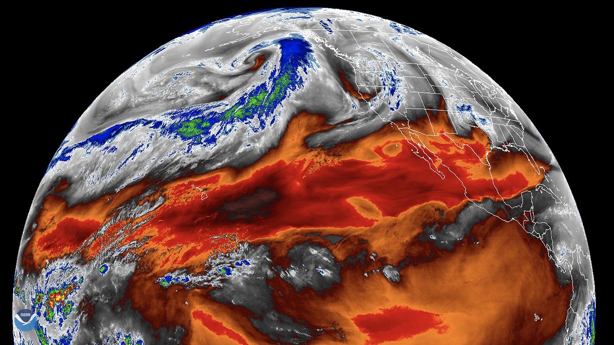
Four decades of records gave the researchers a long view. They compared satellite-based sea-surface temperature data with weather and ocean information that tracks atmospheric rivers. Then they searched for overlap between atmospheric river events and marine heatwaves in the North Pacific and North Atlantic.
The pattern stood out in the timing. Atmospheric rivers tended to appear more than a week before marine heatwaves peaked. Their influence was strongest roughly two days before the peak. That sequence gave the team a way to study how the events build.
To check whether the relationship was robust, the researchers also used 15 climate models. Eleven of those models reproduced the seasonal patterns seen in the observed data. That agreement strengthened the case that the relationship reflects a real air-sea process.
The team also removed the long-term warming trend from the analysis. The connection between atmospheric rivers and marine heatwaves still remained. That step is important because the background ocean is already warming as the climate changes. The study focused on how shorter-term events can push the ocean surface around that warming baseline.
This makes the finding useful for forecasts. Atmospheric rivers are tracked by weather systems days in advance. If their ocean effects can be represented better, forecasters may gain another clue about where marine heatwaves are likely to intensify.
Cloud Shade Versus Trapped Heat
At the heart of the study is a tug-of-war. Atmospheric rivers bring clouds that block some incoming sunlight. Less sunlight means less shortwave radiation reaches the sea surface, which can cool the upper ocean.
At the same time, these systems often carry warm and humid air. That air can sit above the sea like a damp blanket. The ocean then releases less heat through evaporation and turbulent exchange. In plain terms, the surface holds on to more warmth.
The paper’s heat-budget analysis points to these two effects as dominant. Cloud shading cools the ocean by limiting solar input. Trapped ocean heat builds when humid air reduces heat loss from the sea surface.
Those competing effects help explain why atmospheric rivers have a mixed role. The same type of weather system can encourage warming in one season and cooling in another. Local climate conditions also matter because the ocean and atmosphere begin each event with different temperatures, winds and sunlight levels.
This air-sea exchange is subtle compared with a storm crashing into shore. Still, it can reshape the temperature of the upper ocean. Over days, small changes in heat flow can help determine whether the sea surface crosses into heatwave territory.
Why Winter and Summer Split
Seasonal sunlight changes the outcome. In summer, the sun is high and strong over the North Pacific and North Atlantic. Clouds associated with atmospheric rivers can block a meaningful amount of energy from entering the ocean.
That shade often gives summer atmospheric rivers a cooling influence. Fewer marine heatwaves form under those conditions in many regions. The cooling effect comes from reduced solar radiation at the sea surface.
Winter produces a different balance. Sunlight is weaker, so cloud shade has less power to change the heat budget. Warm and humid air then plays a larger role because it reduces the ocean’s ability to release heat into the atmosphere.
As a result, winter atmospheric rivers can help nudge the ocean toward heatwave conditions. The season creates a wider gap between the cool ocean surface and the warm moist air overhead. That setup favors reduced heat loss from the sea.
The pattern still has regional texture. Some areas do not follow the broad seasonal average exactly. The study indicates that background climate state can shift the balance between cooling and warming, which is why ocean-basin maps matter for prediction.
What This Means for Forecasts
Marine heatwaves remain difficult to predict because they grow from several interacting processes. Winds, clouds, ocean currents, mixing and background climate all matter. The Duke study suggests that ocean-atmosphere extremes should be treated together when scientists assess heatwave risk.
Weather agencies and research groups already monitor atmospheric rivers because of their flood potential. That tracking could also support ocean heatwave warnings. If a strong atmospheric river crosses a vulnerable ocean region in winter, forecasters may look for a higher chance of surface warming in the days that follow.
For fisheries and coastal communities, even a few extra days of warning can help. Marine managers can watch sensitive areas more closely. Aquaculture operators can prepare for oxygen stress or harmful algae risk. Conservation teams can focus attention on reefs, kelp forests, or habitats that are already near thermal limits.
The study also points toward future climate questions. Atmospheric rivers are expected to change as the planet warms, including shifts in intensity and location. Marine heatwaves are also expected to remain a growing concern as oceans absorb heat from rising greenhouse gas concentrations.
The next challenge is to understand how those changes interact. Stronger or shifting atmospheric rivers could alter where marine heatwaves begin, how long they last and which ecosystems face the greatest stress. The new research gives scientists a sharper lens for watching that connection develop.