A study in Communications Earth & Environment has found that China’s most severe water erosion clusters along the Hu Line, a famous 1935 boundary that still captures one of the country’s deepest geographic divides. The study used national soil-loss modeling from 2000 to 2020 to show where land is washing away fastest and why the pattern follows a line first drawn to describe population.
Researchers associated with Yunnan University and colleagues mapped water-driven soil loss across China using rainfall, terrain, land use and soil properties. Their results point to a narrow diagonal belt where steep slopes, heavy rain, intensive farming and fragile soils overlap. That belt follows the Hu Line, which runs from Heihe in the northeast to Tengchong in the southwest.
The finding matters because soil loss is slow until it becomes costly. Water erosion strips away the fertile top layer that crops depend on. Once that layer is gone, nature rebuilds it over long timescales. Farmers, cities, reservoirs and river systems can all feel the effects.
The study also found that the center of China’s soil loss shifted southwest over the two-decade study period. That movement points toward rugged terrain around Yunnan and nearby regions, where steep valleys and intense downpours make soil especially vulnerable.
A National Map of Vanishing Soil
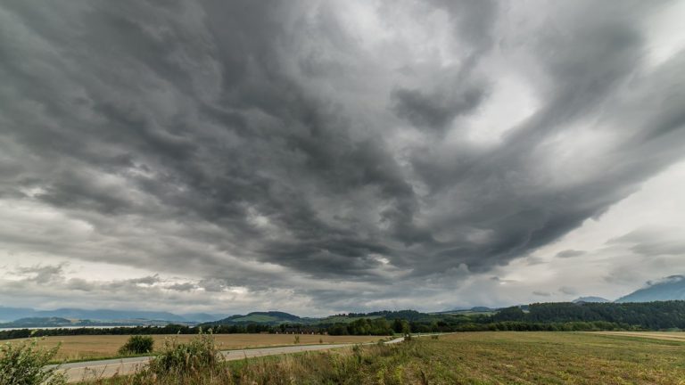
China’s landscape makes soil erosion a national problem with very local causes. Rainfall can loosen exposed ground. Runoff can carry particles downhill. Rivers then move that sediment away from the fields and slopes where it formed.
To map that loss, the researchers used the Chinese soil loss equation, a model designed to estimate erosion from water. The model draws on environmental conditions that control how easily soil moves. Rainfall gives water its force. Slope decides how fast runoff travels. Land use determines how much of the ground is protected by plants or disturbed by farming.
The team examined the period from 2000 to 2020. That span allowed them to look beyond a single wet year or one major storm season. It also gave them enough time to detect whether China’s erosion patterns stayed in place or moved across the map.
The national view is important because China contains very different erosion settings. The southeast is wetter and more heavily farmed. The northwest is drier and more sparsely populated. Between those zones lies a complicated belt of mountains, plateaus, cropland and monsoon-driven rain.
By turning those conditions into a countrywide erosion map, the researchers could compare regions on the same scale. That made the study useful for soil conservation planning, especially in places where local erosion data can be scattered or uneven.
The Hu Line Reappears
The most striking pattern came from a line drawn almost a century earlier. In 1935, geographer Hu Huanyong described a diagonal divide across China from Heihe to Tengchong. The line became famous because it separated the densely populated southeast from the much emptier northwest.
That demographic split has lasted for generations. The southeast side contains the overwhelming share of China’s people, cities and intensive farming. The northwest side contains far more land per person, along with drier basins, plateaus, deserts and high mountains.
In the erosion study, the Hu Line appeared for a different reason. The worst water erosion zones gathered along the same diagonal. As the paper’s summary states, “Severe water erosion regions in China are concentrated along the Hu Line.”
The overlap makes sense once the geography is unpacked. Along this boundary, humid and rugged environments meet heavily used land. Rainfall is strong enough to drive runoff. Slopes are steep enough to speed it up. Farms and settlements have altered the surface in ways that can leave soil exposed at vulnerable times.
The Hu Line therefore becomes more than a population marker in this research. It becomes a physical clue. It shows where people, terrain and climate combine to create a high-risk erosion belt.
Where Erosion Hits Hardest
The study divided China into erosion regions by intensity. The severe zones formed a chain along the Hu Line rather than spreading randomly across the country. That pattern gave the researchers a way to describe water erosion as a regional system.
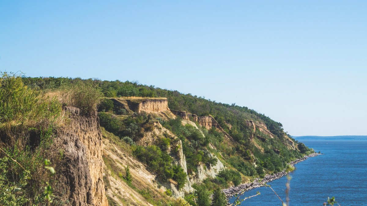
Water erosion begins when raindrops strike the ground and break apart soil aggregates. On a protected field, leaves and stems soften that impact. On bare or disturbed soil, the drops hit directly. Fine particles can then be swept into thin sheets of runoff.
As runoff gathers, the damage can intensify. Small channels may form on slopes. Those channels concentrate water and increase its cutting power. In hilly farmland, this process can remove the most fertile surface soil before the loss is obvious from a distance.
The severe regions identified in the study reflect places where several risk factors meet. Steep land gives gravity a stronger role. Heavy rainfall provides repeated pulses of energy. Cropland can expose soil during planting or after harvest. Erodible soils break apart more easily under the same rainfall.
This kind of mapping helps identify where prevention has the greatest value. A broad national program can miss the local nature of erosion. A map that separates high-risk belts from lower-risk terrain can guide terraces, replanting and crop choices toward the areas where they matter most.
The Southwest Drift
One of the study’s key findings was movement over time. The center of China’s water erosion shifted toward the southwest between 2000 and 2020. That trend suggests the country’s erosion burden has been leaning toward a more rugged part of the map.
The southwest contains steep terrain, deep valleys and strong seasonal rainfall in many places. In and around Yunnan, slopes can be abrupt and soils can be thin. When intense rain falls on disturbed ground, runoff can gain force quickly.
This drift gives planners a moving target. Soil conservation strategies based only on older maps may understate the importance of southwestern terrain. The two-decade movement suggests that future monitoring should pay close attention to how erosion centers shift as rainfall, land use and restoration policies change.
The study stays careful about cause. A model can reveal where erosion is likely to be severe and how patterns change. Assigning exact responsibility to each driver in every local landscape requires more field-level work. Even so, the southwestward shift is a clear signal in the national analysis.
For a country with limited farmland relative to its population, that signal has practical weight. The soil that moves from a hillside today becomes sediment downstream tomorrow. Keeping it in place protects fields first, then rivers, reservoirs and flood-control systems.
Why the Soil Washes Away
Several forces work together along the Hu Line. The study highlights steep terrain, concentrated rainfall, intensive agriculture and soils that erode easily. Each factor changes how water behaves on the land.
Steep terrain turns runoff into a faster-moving flow. Water on a gentle plain spreads out and slows down. Water on a hillside accelerates. As it gains speed, it can detach and carry more soil.
Concentrated rainfall adds another layer of risk. A landscape may handle light rain with little damage. Strong storms can exceed the soil’s ability to absorb water. Once the surface is saturated or sealed by impact, more rain becomes runoff.
Intensive agriculture can increase exposure during sensitive periods. Tilling loosens soil. Planting schedules leave some fields with little cover. Harvested land may sit open before the next crop develops roots and leaves. On slopes, those windows can be costly.
Highly erodible soils complete the pattern. Some soils hold together under rainfall. Others break apart more readily. Texture, organic matter, structure and depth all influence how much soil can withstand water before it starts to move.
Terraces, Trees and Smarter Crops
The study points toward familiar tools that can still matter at national scale. Terraces, vegetation restoration and better crop management all reduce the chance that rainfall will turn into soil loss.
Terraced farmland changes the shape of a slope. Instead of allowing water to race downhill, terraces create flatter steps that slow runoff. Slower water has less power to detach soil. It also has more time to soak into the ground.
China has a long history of using terraces in mountain agriculture. Modern erosion mapping can help decide where new terraces or repairs would bring the greatest benefit. The source material notes that recent research found existing terraces can sharply reduce erosion from Chinese cropland.
Vegetation restoration works in a different way. Roots bind soil. Leaves intercept raindrops before they strike the surface. Stems and litter slow the flow of water across the ground. Forests, shrubs, grasses and mixed cover can all protect exposed slopes.
Crop choices and timing can also help. Keeping soil covered during rainy seasons reduces risk. Planting along contours slows water on slopes. Rotations that improve soil structure can make fields more resistant to detachment. These measures are especially useful where farming remains necessary on hilly land.
A New Target for Soil Protection
The study gives China’s soil conservation effort a sharper geographic focus. Severe water erosion clusters along the Hu Line and the center of that erosion moved southwest during the 2000 to 2020 study period. Together, those findings turn a familiar demographic boundary into a new environmental warning line.
That matters because soil protection is easier to plan when risk is mapped clearly. A countrywide average can hide the places where land is losing its surface fastest. Regionalization shows where the danger is concentrated and which conditions are driving it.
The findings also connect human geography with physical geography. The Hu Line has always reflected climate, terrain and settlement patterns. This study shows that those same forces help explain where soil washes away. Dense land use on vulnerable slopes can amplify the natural power of rain and gravity.
Future work can refine the picture with more local measurements. Field studies can test how specific crops, slopes, soils and rainfall patterns interact. Long-term monitoring can show whether restoration and farming changes slow the southwestward drift.
For now, the main message is clear. China’s worst soil loss follows a well-known line across the map. Protecting that belt with targeted terraces, restored vegetation and soil-conscious farming could help keep fertile ground where future harvests need it.